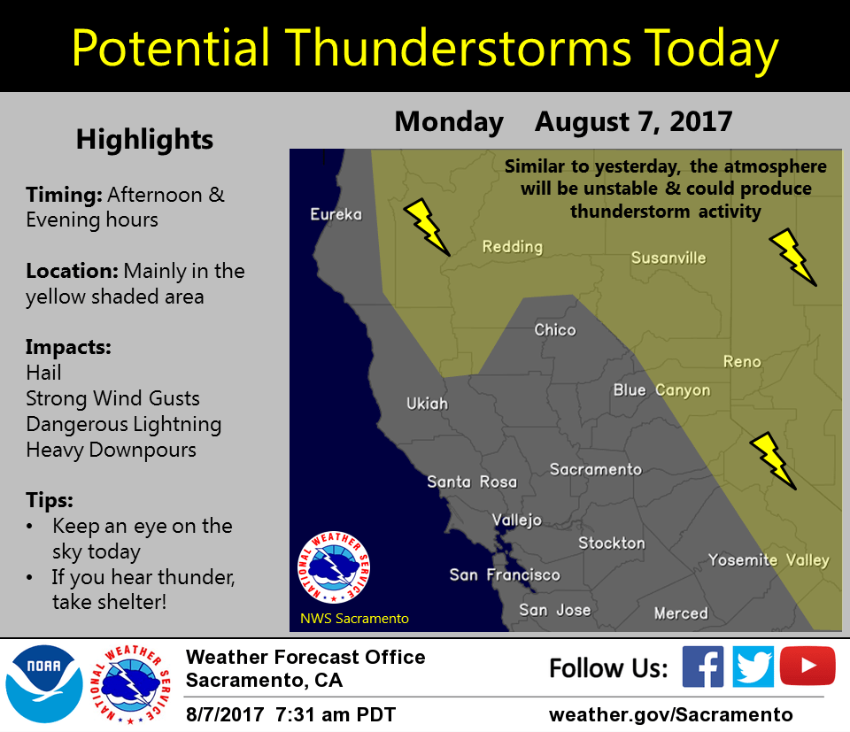
August 7, 2017 – Showers and thunderstorms are possible over the next several days, mainly over the mountains. Temperatures around average expected through the week.
Discussion
A few showers linger across far northeast California early this morning in the vicinity of the upper low. Elsewhere across interior NorCal, skies are clear and temperatures are slightly cooler compared to 24 hours ago.
Little change expected today as the upper low lingers across the region then retrogress slightly back off the coast Tuesday into Wednesday. This will keep a threat of mainly late-day showers and thunderstorms primarily over the mountains, though portions of the northern Sacramento Valley won’t be immune. Slight warming into mid-week as upper low and associated synoptic cooling weaken.
Extended discussion (Friday through Monday)
An upper low in the Gulf of Alaska will impact the West Coast on Friday and continue moving inland (Canada/Pacific NW) over the weekend. For our CWA, conditions will stay fairly consistent as that low moves eastward. Moisture is expected to stay north so the extended forecast for interior NorCal should be dry. Valley highs will range from the mid 90s to low 100s while higher terrain ranges 70s to mid 90s and the Delta will generally be in the 80s to low 90s.