Late day mountain thunderstorm chances expected through the week. Above normal temperatures are expected through Friday with a slight cooling trend for the weekend and early next week.
Discussion
GOES-West infrared imagery reveals some mid/high clouds propagating over central and northern interior California this early Thursday morning. Infrared imagery also shows the Dixie Fire continuing to burn hot in some areas of Butte and Plumas Counties. After a hot day yesterday, most communities are running at least several degrees warmer compared to 24 hours ago — if not more. As of 1 AM PDT, Chico and Oroville are both at 16 degrees above compared to this time yesterday night. Onshore San Francisco to Sacramento gradient is a tad stronger resulting in wind gusts around 25 to 30 kt at Travis Air Force Base. By sunrise, temperatures will bottom out in the 60s to low 70s in the Valley with the adjacent thermal belts in the 70s.

An expansive upper level ridge centered over the Great Plains will continue to promote south/southeasterly flow aloft over the Southwestern United States. Surface temperatures again this afternoon will be around 5 to 8 deg F above late July normals with most Valley locations forecast to reach the triple digits. Exception to this would be around the Delta in Solano County. Another potential twist that will have to be closely monitored would be wildfire smoke and its influence on temperatures. Corresponding heat risk for this afternoon generally lands in the moderate (orange) risk with a few isolated pockets of high (red) risk.
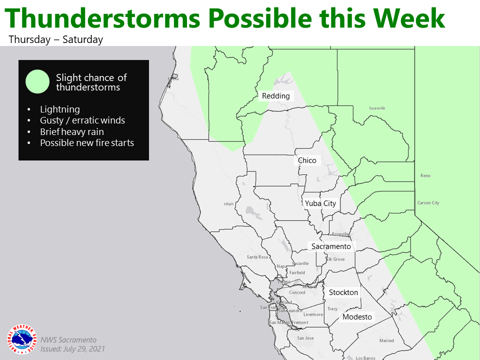
Reoccurring opportunities for afternoon/evening showers/ thunderstorms will continue over the next several afternoons as the south/southwest flow draws moisture into portions of central and northern California.
For this afternoon, slight chance of showers and thunderstorms extend along and east of the Sierra crest with the best chance generally along/south of Interstate 80. Better chances develop on Friday with 15 to 30 percent chance of showers/thunderstorms expanding through the mountains of Shasta County. Storms may be accompanied by gusty/erratic winds, brief downpours, and lightning.
Temperatures are forecast to moderate over the weekend as an upper level trough develops along the 140th meridian. Most pronounced cooling will occur in/around the Delta where temperatures will fall back by 10 or more deg F. Sacramento Metro Area will likely fall to the 90s for both Saturday and Sunday.
Extended Discussion (Monday through Thursday)
Cluster analysis in the extended favors troughing along the West Coast with weak ridging over the Rockies. The resulting onshore flow for northern California will keep temperatures in-check early next week with highs generally landing within several degrees of early August normals.