Dry and near normal temperatures through mid-week. Isolated mountain and foothill thunderstorms possible Thursday and Friday, otherwise dry. High pressure strengthens bringing a return of very hot weather by the weekend into next week.

Discussion
Upper low just west of the Bay Area will slowly move east and weaken through Friday, as strong high pressure system develops over the Pacific Northwest. Onshore flow will continue in association with the upper low helping keep temperatures near normal, albeit with a gradual warming trend through the end of the week.
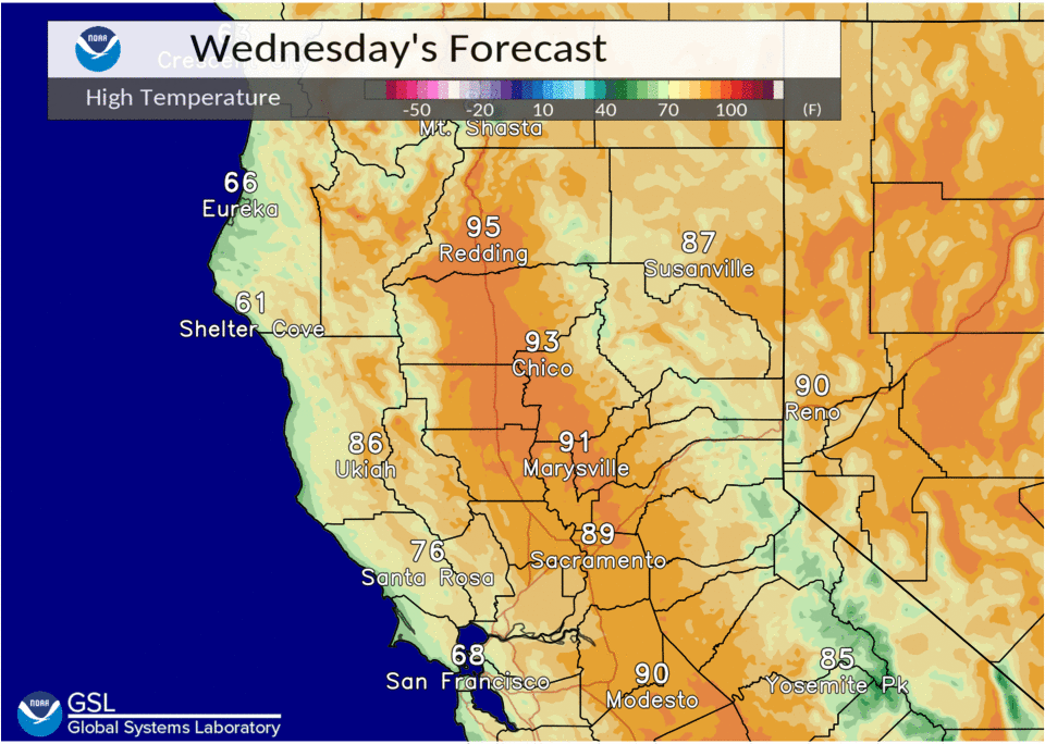
High temperatures will generally be in the upper 80’s and low 90’s today and Thursday, although warming into the upper 90’s over the Northern Sacramento Valley. Then low to mid 90’s, except 100 to 105 over the Northern Sacramento Valley Friday. Upper high will become firmly in place Saturday with Valley high temperatures from 100 to 110 degrees. Excessive heat and high heat risk will be possible over the Central and Northern Sacramento Valley during the weekend starting Saturday.
Increasing elevated instability ahead of the upper low will lead to mountain and foothill thunderstorm chances through Friday. Only expecting an isolated storm or two near the crest or Lassen park this afternoon.


The best thunderstorm chances will be Thursday afternoon, as instability spreads west from Nevada with widespread MUCape in the 200-600 J/KG range over the mountains and even spreading into the foothills. Coverage may even be in the scattered category, unfortunately precip amounts look to be light with generally less than 0.10 inches except in isolated heavier cells.
Extended discussion (Sunday through Wednesday)
Strong upper high moves into the Western U.S. Sunday resulting in very hot temperatures for interior NorCal. Potential for record breaking heat Sunday as 850 mb temps rise into the 30-35 Deg C. Triple digit heat continues in the Central Valley Monday through Wednesday.