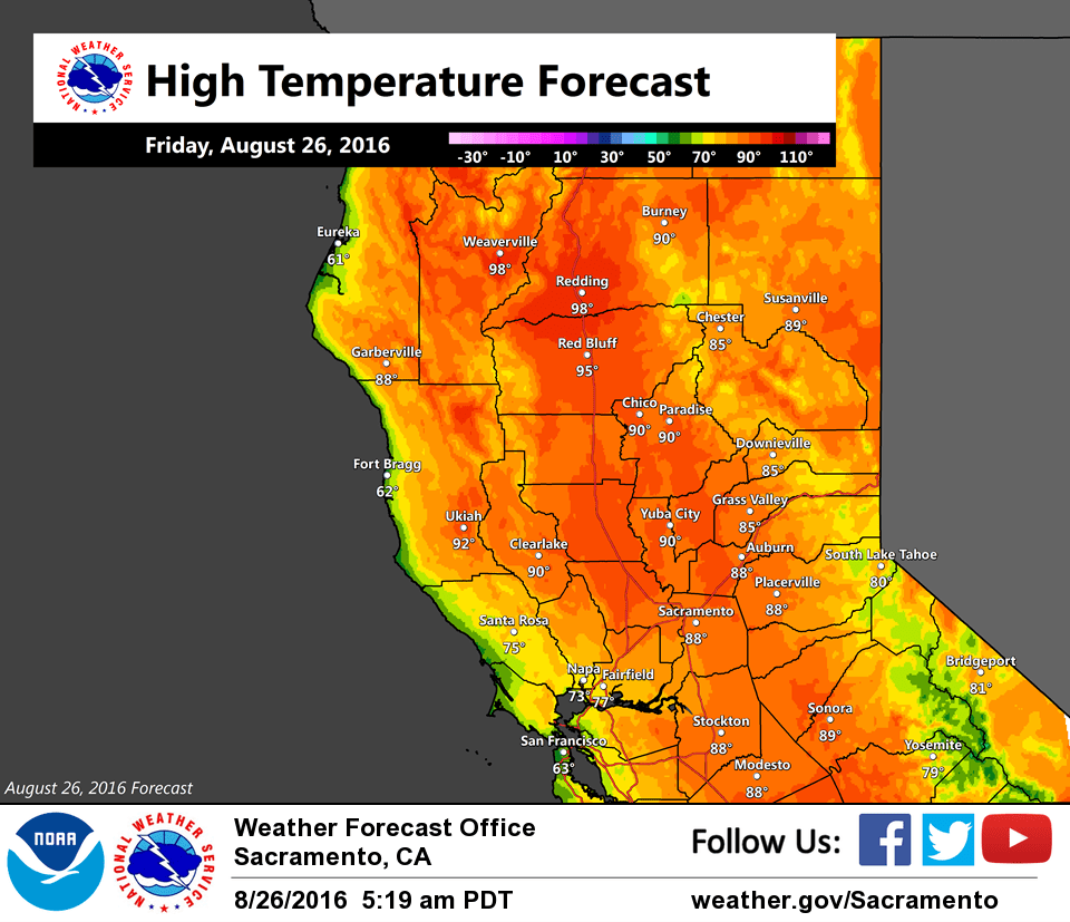
August 26, 2016 – Dry weather pattern with near normal temperatures for the rest of the week.
Discussion
Quiet weather pattern continues for interior NorCal the next several days other than the Sierra south of Tahoe possibly seeing an isolated storm or two pop late today.
Currently, the marine layer is around 2500 ft deep which is trending deeper. This, combined with the onshore gradient will continue to bring slightly below average temperatures today and Saturday for the Delta and adjacent areas.
A weak longwave ridge will build in early next week but will have relatively little influence on our temperatures.
Extended discussion (Tuesday through Friday)
A short wave trough should approach interior northern California early next week. Model differences still exist regarding the progression of the approaching trough, with the GFS being the fastest solution.
A deeper wave will move along the West Coast by midweek, resulting in synoptic cooling during the extended period. Temperatures will be near to below normal temperatures next week. Precipitation chances are low at this point, given that the air mass looks to be dry for convection.