October 23, 2017 – Dry and warm weather this week. Locally breezy northerly winds into Tuesday.
Discussion
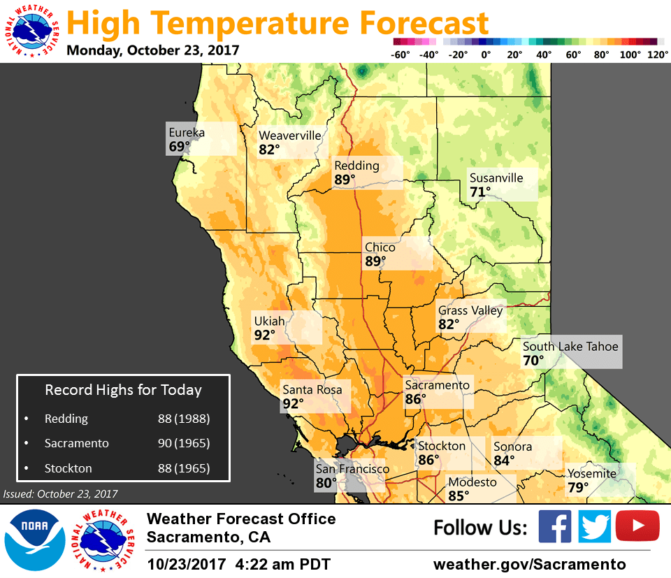
Clear skies across interior NorCal under strengthening high pressure. Surface pressure gradients have continued to increase since Sunday (MFR-SAC now nearly 9 mbs and RNO-SAC around 6.5 mbs) resulting in some locally breezy north to east winds across the northern Sacramento Valley and surrounding terrain, and across the northern Sierra. Current temperatures are running around 5-10 degrees milder compared to 24 hours ago with breezier locales in the Sacramento Valley running 15-25 degrees warmer!
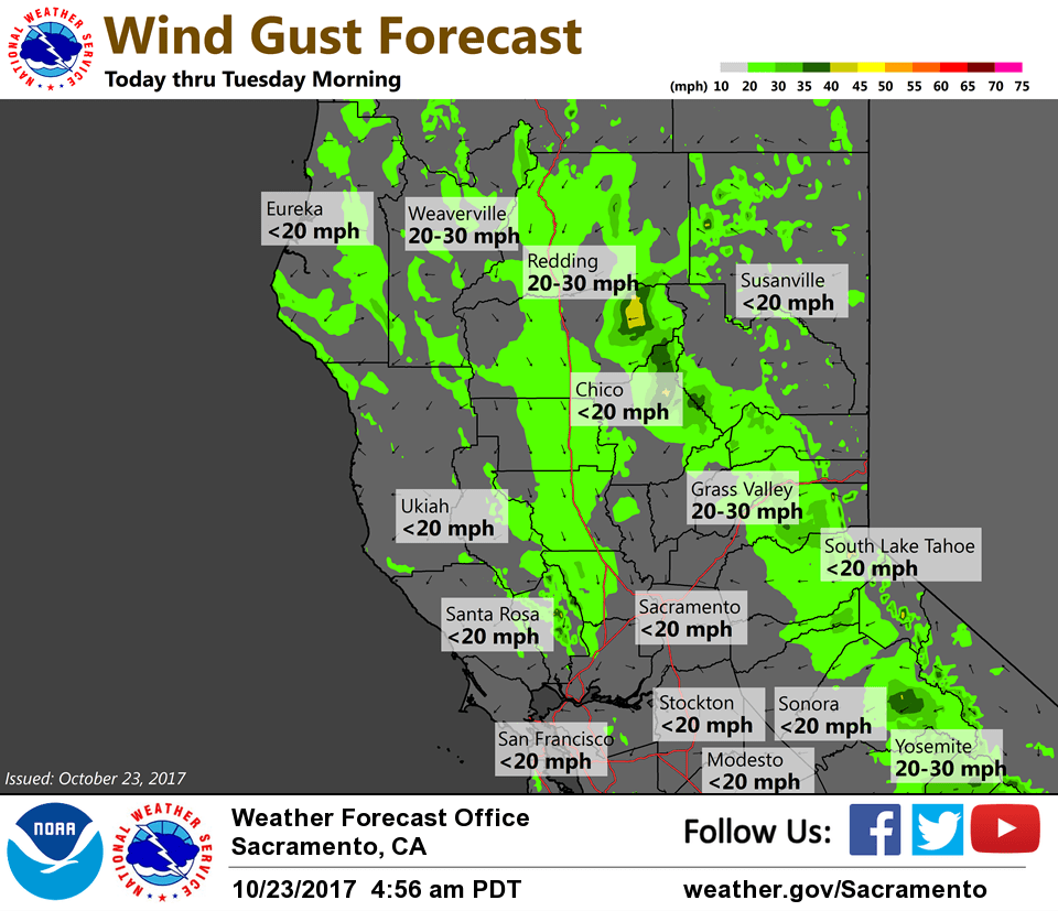
Northerly breezes spread south and are expected to peak in the Central Valley today (likely below wind advisory criteria), but remain breezy on Tuesday. Gusty northeast winds across the foothills and northern Sierra are expected to peak tonight and early Tuesday with some local gusts around 40 mph possible. Lighter winds expected by mid-week.
Record or near record warm temperatures will be possible across the Central Valley the next few days as highs top out in the mid 80s to lower 90s (around 15 degrees above average for late October). Some minor cooling will be possible after mid-week as the ridge retrogrades slightly in response to a system moving through the PacNW into the Rockies.
Extended discussion (Friday through Monday)
Strong upper high centered over the area Friday will gradually weaken to ridge and shift over the Great Basin through the weekend into early next week. This will result in continued dry weather with above normal temperatures. High temperatures on Friday will be around 10 degrees above normal, trending down to about 3 to 5 degrees above normal by next Monday.