September 9, 2016 – Dry with above normal temperatures today and Saturday. Temperatures cooling to below normal early to middle of next week. A slight threat of Sierra crest thunderstorms Monday and Tuesday.
Discussion
Building high pressure over the eastern Pacific and west coast bringing fair skies to the CWA this morning. Satellite fog product showing coastal stratus moving locally into the bay and inland as far as western Solano county at this time. Fort Ord profiler showing marine layer has been suppressed a bit since mid day Thursday by building upper ridge and currently around 1200 feet. Strong delta breeze gusting to over 30 mph making good use of this marine air with temperatures in the valley several degrees below 24 hours ago.
Overall airmass warms by several degrees today so most locations should see a modest warm up in high temperatures over Thursday. Even delta influenced areas will see a little warming as the delta breeze diminishes during the day. Only minor changes are expected on Saturday as the upper ridge axis moves across the west coast and into the Great Basin.
An upper low dropping into the Pacific Northwest will bring a drop in temperatures on Sunday with daytime highs expected to come in right around normal for this time of year.
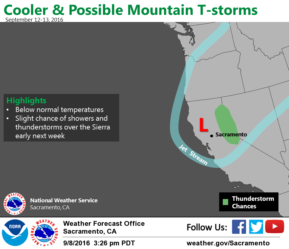
Weather gets a bit more interesting on Monday as this upper low drops southward into northern California. This low should provide enough instability for some isolated afternoon thunderstorms but exact position of low and therefore likely location of these thunderstorms varies from model to model. GFS farthest west with track with GEM the farthest east. Did a general average keeping afternoon thunderstorm threat over the Cascades Monday afternoon and evening. Any solution will bring significant cooling with daytime highs dropping another 5 to 10 degrees.
Extended discussion (Tuesday through Friday)
A trough of low pressure will deepen over northern California early next week. Main impacts from this system will be cooler temperatures and a chance of showers or thunderstorms over the mountains. Precipitation coverage will be dependent upon the position of the upper trough and how fast it shifts to the east. The ECMWF remains faster in kicking the system out. Temperatures will be well below average early in the week, then return to average by late week.