Unsettled weather will bring cooler temperatures, chances for showers and breezy winds at times over Northern California through the start of the weekend. Early next week dry and breezy winds are forecast through the Valley leading to elevated fire weather concerns.
Discussion
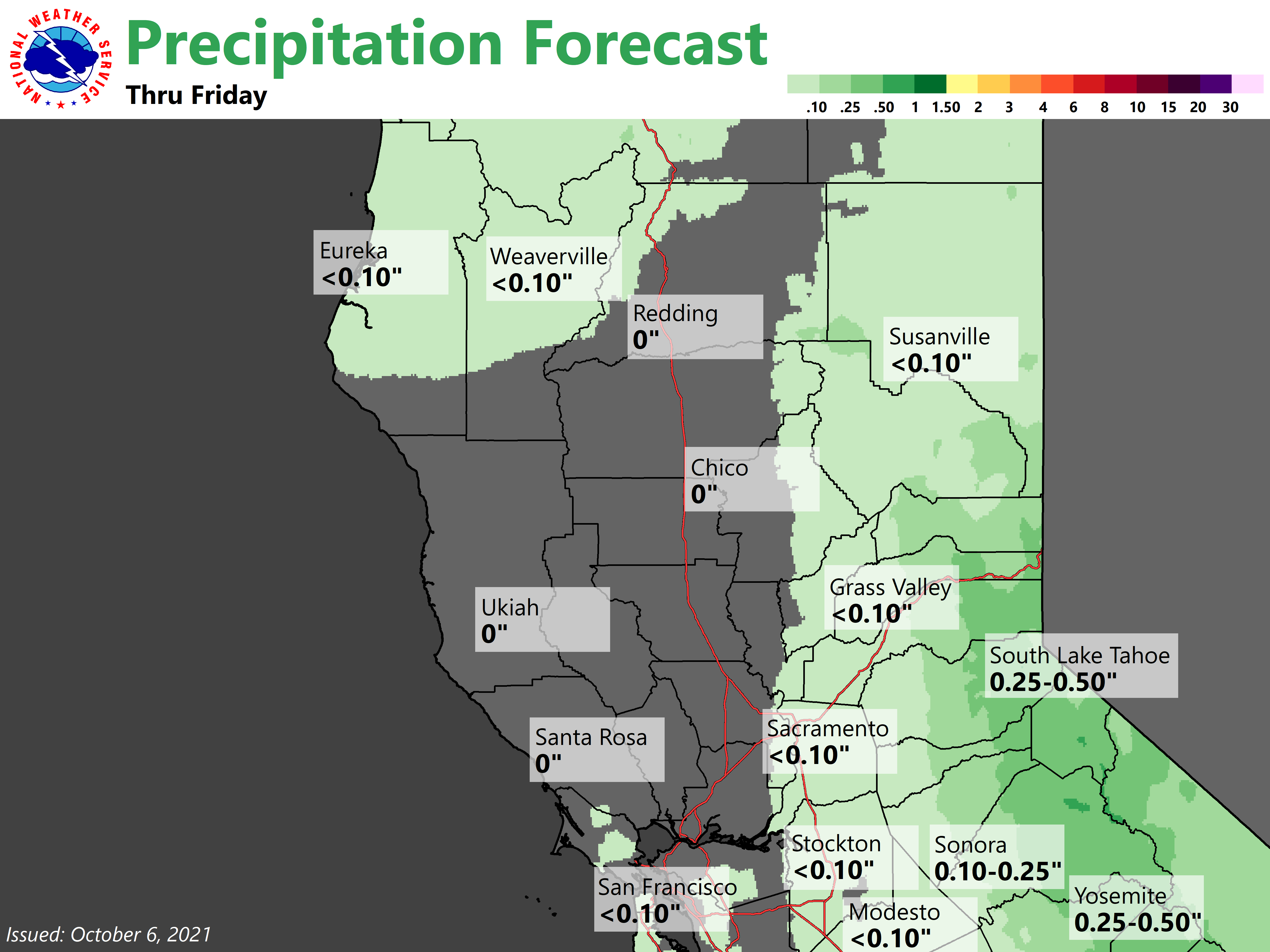
Some very light radar returns have reached far northwestern Shasta county early this morning implying some moisture has made its way to interior northern California. High resolution models are hinting at the possibility of this first narrow band of light rain showers to bring some sprinkles to the northern Sacramento Valley and the surrounding foothills into the morning hours. Thereafter, models have started to come into better agreement about very scattered and light showers possible mainly over the mountains through the next few days. Not much in the way of accumulations are expected in the Valley with this unsettled and cooler pattern.
Better chances for precip will likely be Thursday evening into Friday morning, particularly in the Motherlode region as well as the Sierra with precip totaling about one third of an inch or less.
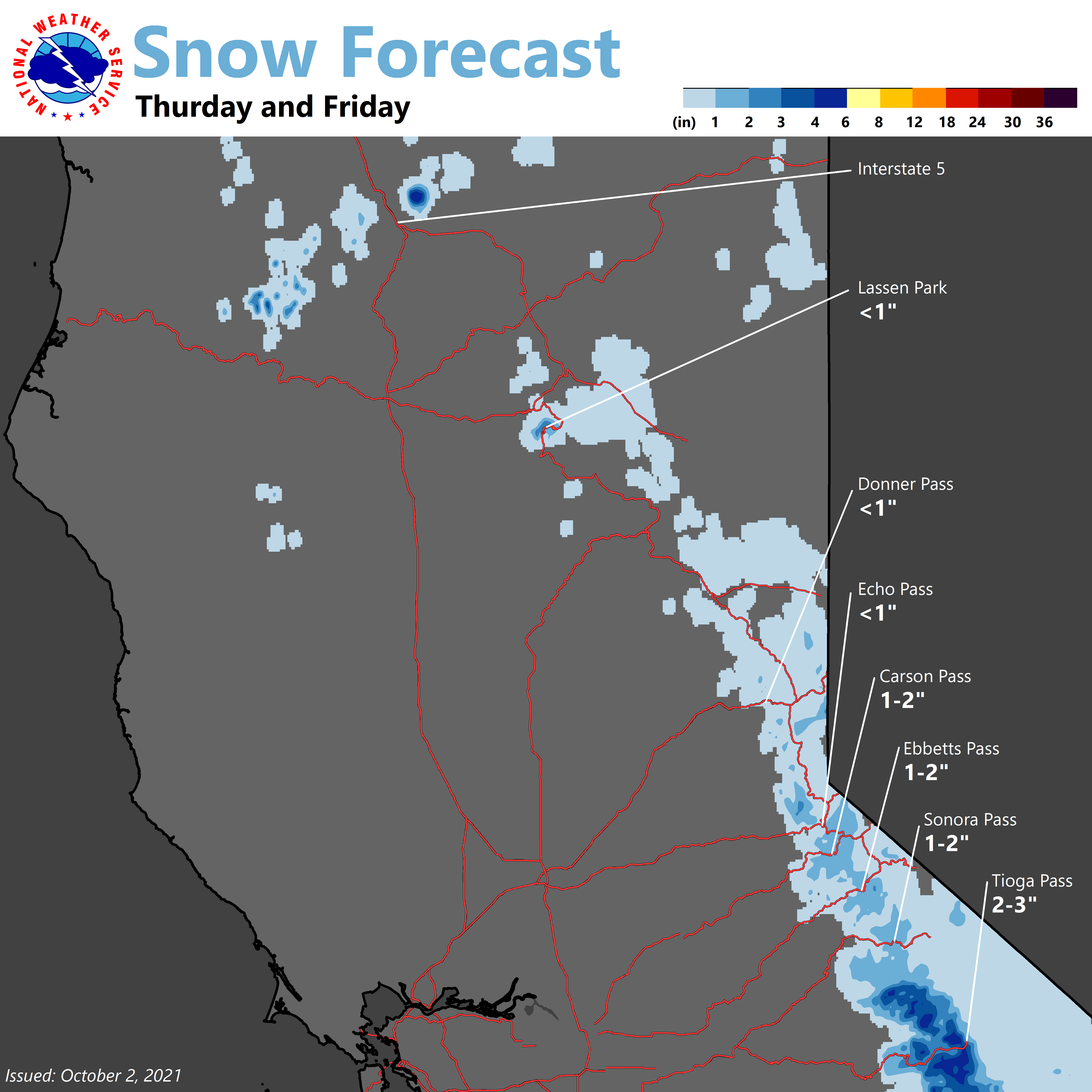
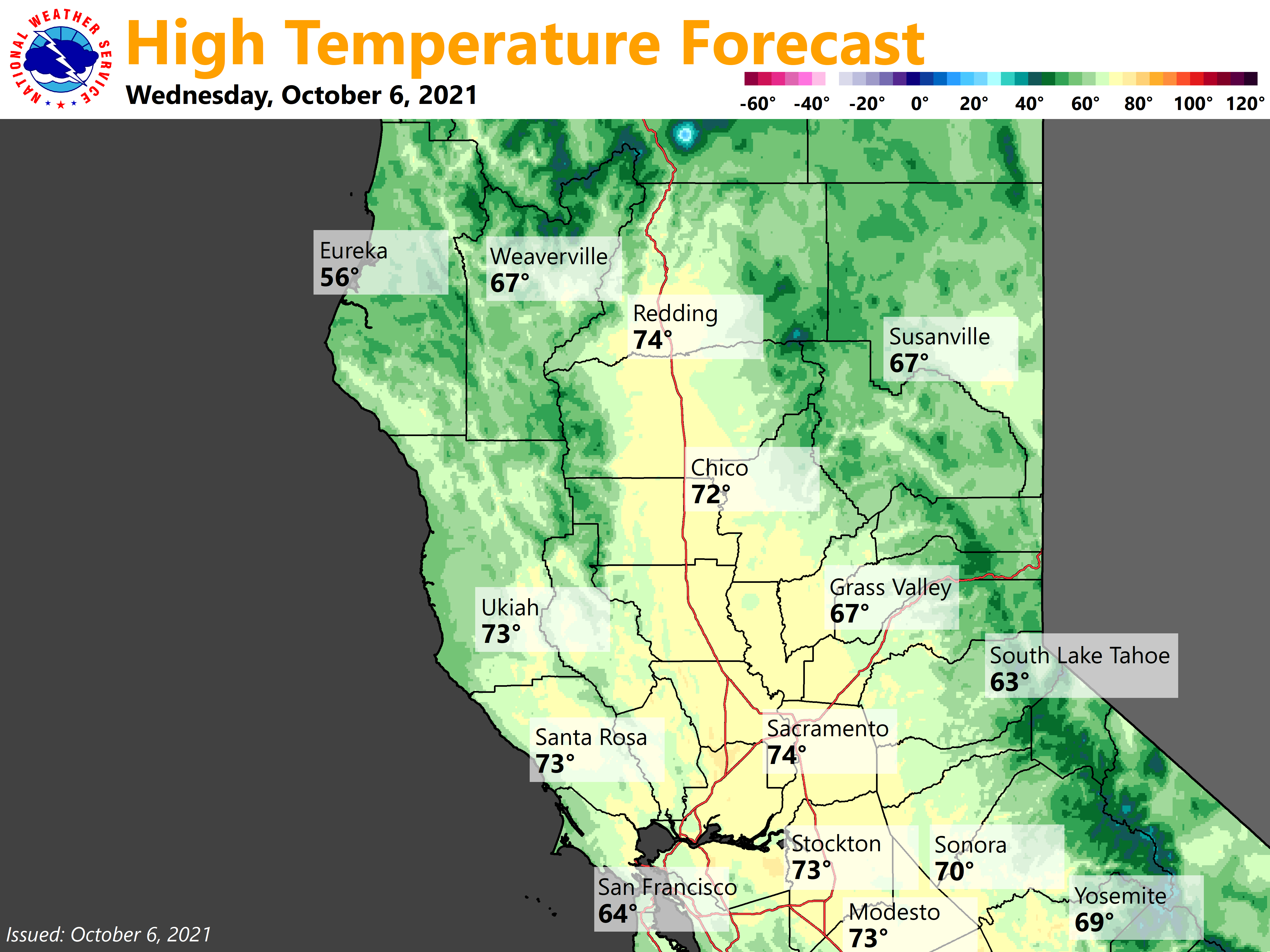
Some of these showers could fall as snow showers generally above 7500 feet. Any snow will likely not stick around for long with temperatures forecast to quickly warm into the later part of the weekend. This is due to shortwave ridging forecast to build over northern California leading to temperatures in the 50s to 60s in the Sierra and upper 70s to low 80s across the Valley on Sunday.
Extended Discussion (Sunday through Wednesday)
Ensemble guidance keeps the region dry on Sunday under shortwave ridging. Ensembles and cluster analysis are gaining increasing agreement about a cold and relatively dry trough digging into the region early next week. Minimal shower chances are possible over the mountains.
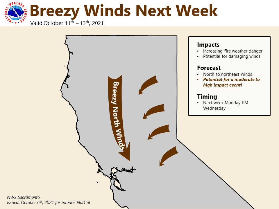
However, the most impactful feature of this next system could be dry and breezy northerly to easterly winds with strongest gusts anticipated through the Valley. Uncertainty is present with exact location of the trough and has yet to come into good agreement in dynamic cluster analysis. The depth and track of this trough will greatly influence potential impacts for Northern California.
Some clusters would produce fire weather concerns for the Valley while other scenarios would likely lead to more moderate impacts. It is also worth noting the EFI continues to have a fairly strong signal for gusty north winds through the Valley early next week. Stay tuned for potential fire weather concerns!