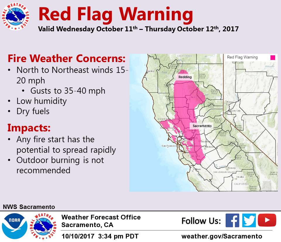
October 11, 2017 – Dry with temperatures around average for the remainder of the week. Storm systems passing north of the area will keep winds gusty at times through the week, bringing critical fire weather conditions through Thursday.
Discussion
A band of high clouds is moving slowly south across NorCal ahead of the upper trough moving into the PacNW. Areas of smoke, mainly from the wildfires burning across the northern Bay Area, continues to impact the region. Temperatures are milder across much of the area as dew points and humidities recover.
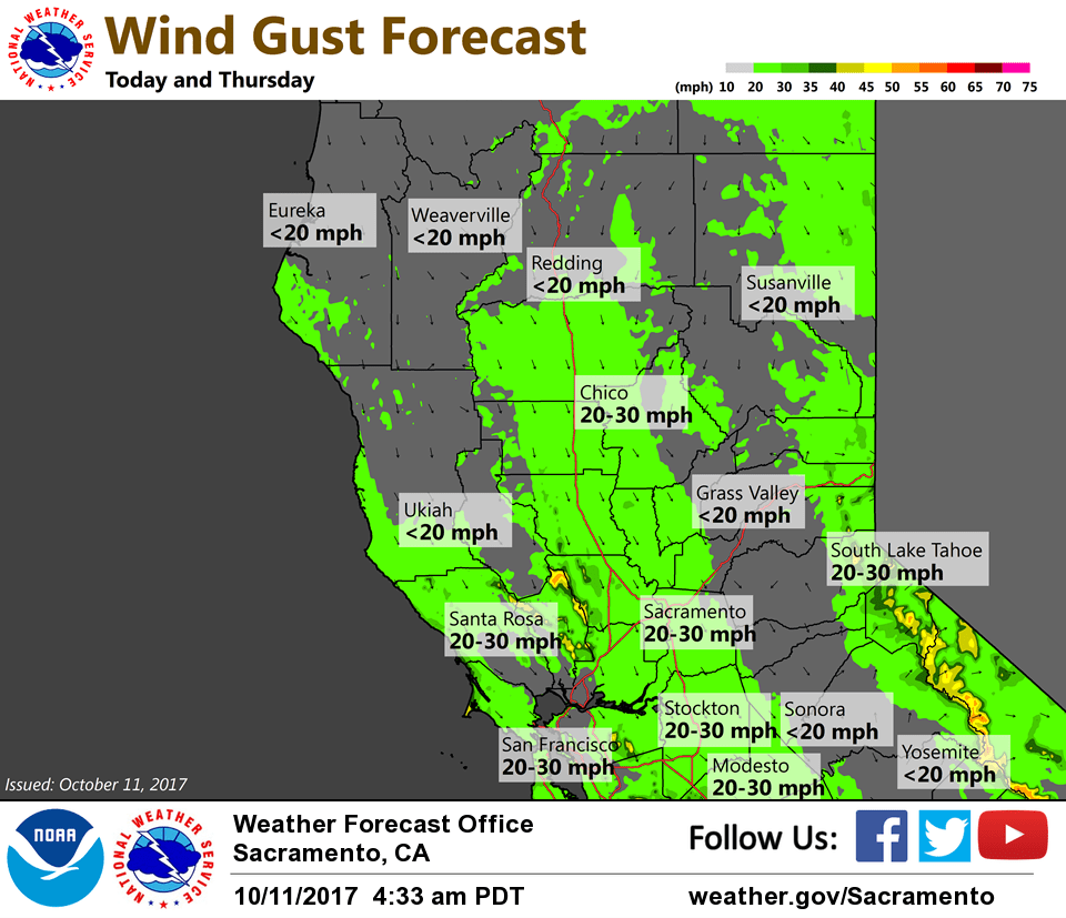
North winds will return to the Sacramento Valley today and Thursday bringing critical fire weather conditions. Winds are not expected to be as strong as those experienced Sunday night, though 10-20 mph with gusts 30-40 mph look possible. A Red Flag Warning is in effect from midday through Thursday afternoon.
Temperatures will trend down the next several days with highs in the 70s through the Central Valley. Increasing north winds possible again Friday night into Saturday.
Extended discussion (Sunday through Wednesday)
Model differences exist through the extended forecast period, but overall forecast between them is similar. Upper ridging breaks down over the weekend as short wave troughing tracks across the PacNW early next week. Any associated precipitation looks to remain well north of the forecast area. Near normal high temperatures expected over the weekend with cooling to slightly below by Wed.