October 21, 2017 – Warming temperatures through early next week. Breezy north winds and possible fire weather concerns return Monday into Tuesday.
Discussion
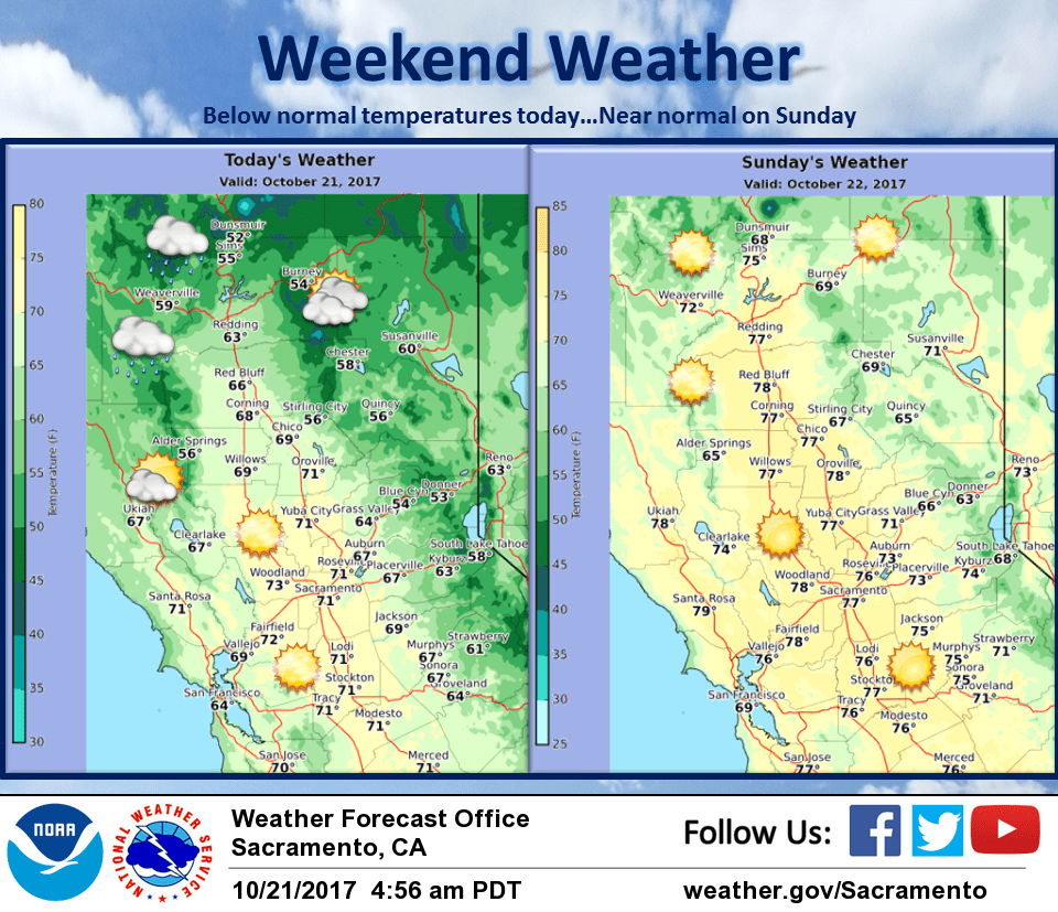
Heights/thicknesses trend up over the weekend into early next week as broad upper ridging strengthens over California. Overrunning warm frontal precip extends into N/NW portions of California today bringing a threat of some light precip. Bulk of precip looks to remain outside of our forecast area, with slight chances over our Coastal range and Shasta mountains today.
Upper ridging strengthens tonight into Sunday shifting storm track farther north and providing warming of AMS over CWA. Surface high builds through Oregon into Great Basin tomorrow into Monday as thermal troughing deepens along the coast. Pressure gradient increases leading to breezy conditions over Interior NorCal beginning Sunday night and continuing into Tuesday. At this time wind speeds do not look like they will reach advisory criteria, but strong enough when combined with warming temperatures and lowering RH to increase fire weather concerns. Near normal temperatures expected Sunday, then temps warm to upwards of 10 to 15 degrees above normal Mon/Tue.
Extended discussion (Wednesday through Saturday)
Amplified upper air pattern forecast to continue across the eastern Pacific and western North America with a strong blocking ridge centered over the Gulf of Alaska during the second half of next week. Slider system clipping the area on Thursday may cool temperatures slightly, but readings will remain well above average for late October. Breezy north winds possible in the Sacramento Valley behind the system on Thursday.