September 22, 2017 – Unseasonably cool weather system will bring mountain rain and snow showers this afternoon. A few inches of snow are possible at high elevations south of highway 50. Turning warmer and drier from this weekend into next week.
Discussion
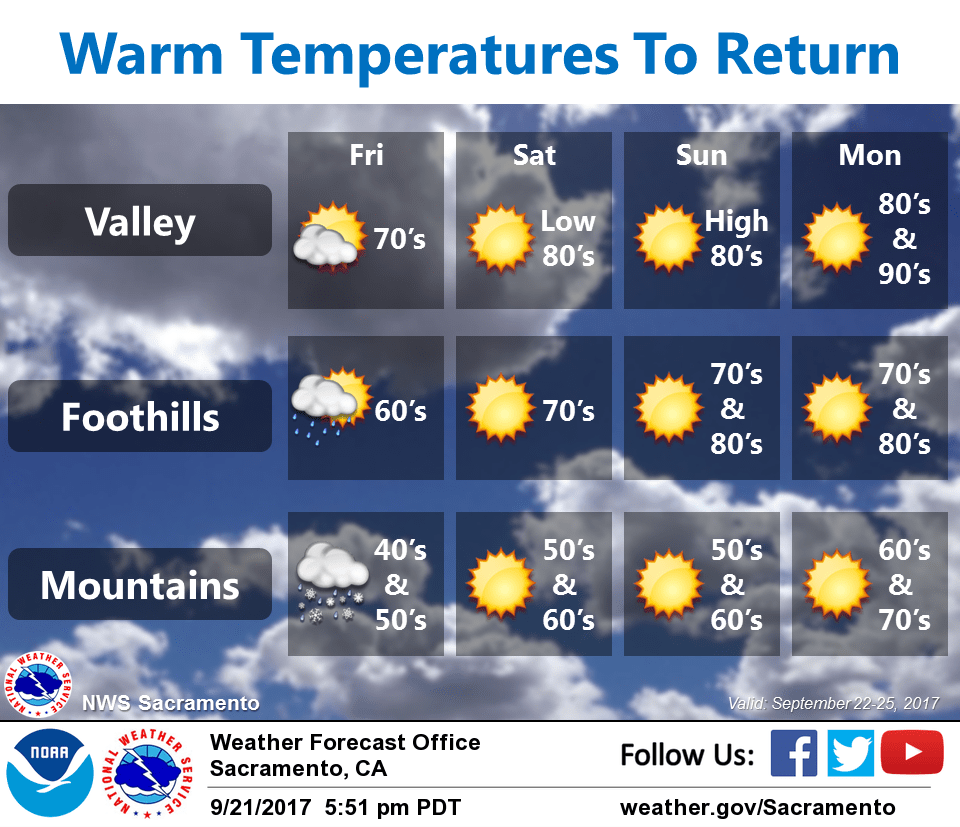
Unseasonably cold trough has shifted east into the Great Basin with upper low developing over northern Nevada. Disturbance will drop south behind low along the Sierra late today with another quick shot of snow above 6500 feet. Expect 2 to 3 inches for areas south of highway 50 and around an inch northward over interstate 80.
Instability will also increase over the central Sierra and have added isolated thunderstorm chances south of highway 50, best chances look to be over eastern Calaveras and Tuolumne counties. Liquid precip amounts should be 0.20-0.40 central Sierra with 0.10 or less northward. Valley locations will remain dry, although high temperatures will be about 10 degrees below normal in the mid 70’s.
Upper low will shift west into Utah Saturday leaving NorCal in a much drier…but breezy north flow. This will cause temps to warm back into the 80’s at valley locations Saturday and Sunday. North wind gusts from 20 to 25 mph will be possible over the northern and central Sacramento valley. The warm-up will continue into Monday with reading at or near 90 degrees for many locations as Pacific ridge builds eastward.
Extended discussion (Tuesday through Friday)
While recent cool temperatures and even mountain snow might make it seem like summer is over(and the calendar too), above normal temperatures and dry weather are expected next week. High confidence continues in this pattern to continue through the week, and possibly into even into next weekend. Valley high temperatures are forecast to be in the lower 90s for Tuesday through Thursday, extending into the mid 90s for Friday. While these temperatures are 5 to 10 degrees above normal, record highs for those dates are not expected. Triple digit highs would required for records, and this kind of heat is not anticipated.
Breezy north winds are forecast to continue through Thursday next week, particularly early in the week. These winds will act to warm and dry the area, creating an elevated fire risk. No precipitation is expected, even in the mountains.