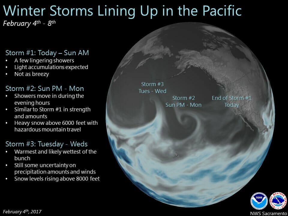
February 4, 2017 – Showers possible this weekend then the next Pacific storm moves through Sunday night and Monday followed by additional storms Tuesday into Friday.
Discussion
Moist westerly flow with embedded vort maxes will keep a threat of showers over Interior NorCal over the weekend. Best chances look to be today into tonight and over the mountains.
Additional snow accumulations of 4 to 8 inches possible today into tonight above 6000 feet over the Western Plumas and Sierra Nevada mountains. Thus have replaced the expiring Winter Storm Warning with a Winter Weather Advisory in effect through 06z Sun for elevations above 6000 feet.
Breezy southerly wind continues over portions of Interior NorCal today but speeds look to remain below advisory criteria at most areas, and thus have dropped the advisory.
Models suggesting decreasing showers overnight and Sunday ahead of next approaching Pacific frontal system. Progs spread associated precipitation into western portions of the forecast area after 00z Monday, and across all of Interior NorCal Sunday night into Monday morning.
Heavy snow possible in the mountains and additional winter storm warnings likely to be issued. In addition, strong surface winds look likely Sunday night with speeds well into wind advisory criteria for the Central Valley after about 03z Monday til around 18z Monday.
Precip turns showery in the Central Valley Monday afternoon behind front while more steady widespread precip continues in the Sierra Nevada through Monday evening. Post frontal model instability looks limited attm so will hold off on mention of possible isolated thunderstorm development Monday afternoon.
Decreasing showers expected Monday night into early Tuesday then models point to a wetter and warmer system as warm conveyor belt moisture plume impacts Interior NorCal.
Extended discussion (Wednesday through Saturday)
Warm advection precipitation is expected to spill over west coast upper ridging on Wednesday. Moderate precipitation accumulations will be possible with very high snow levels above pass levels.
Extended models fairly consistent in bringing a Pacific frontal system onshore on Thursday for increasing precipitation. Snow levels will start out high but drop rapidly in the cold air behind the front on Friday. There will probably be enough lingering snowfall at pass levels Friday to have at least some impact on Sierra travel. Breezy winds will accompany the passage of this system.
Upper ridge amplifies over the west coast on Saturday and by Saturday afternoon, precipitation threat should be over interior northern California. Most of next weekend should see a period of dry conditions, fair skies and breezy north winds.