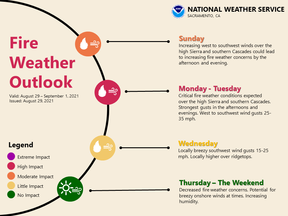
Hot and very dry today and Monday turning cooler through the rest of the week. Gusty southwest to west winds early this week could bring critical fire weather concerns to the northern Sierra and southern Cascades. Red Flag Warning Monday through Tuesday Evening for the Sierra Nevada and Southern Cascades
Discussion
Flat ridge pattern over Northern California will begin to erode as upper trough starts to form off the West Coast this afternoon. Ensembles and clusters indicate that the trough will gradually deepen into mid-week. This will switch the wind pattern to more onshore, which will thin out the smoke today, especially for the Delta/Srn Sacramento Valley.

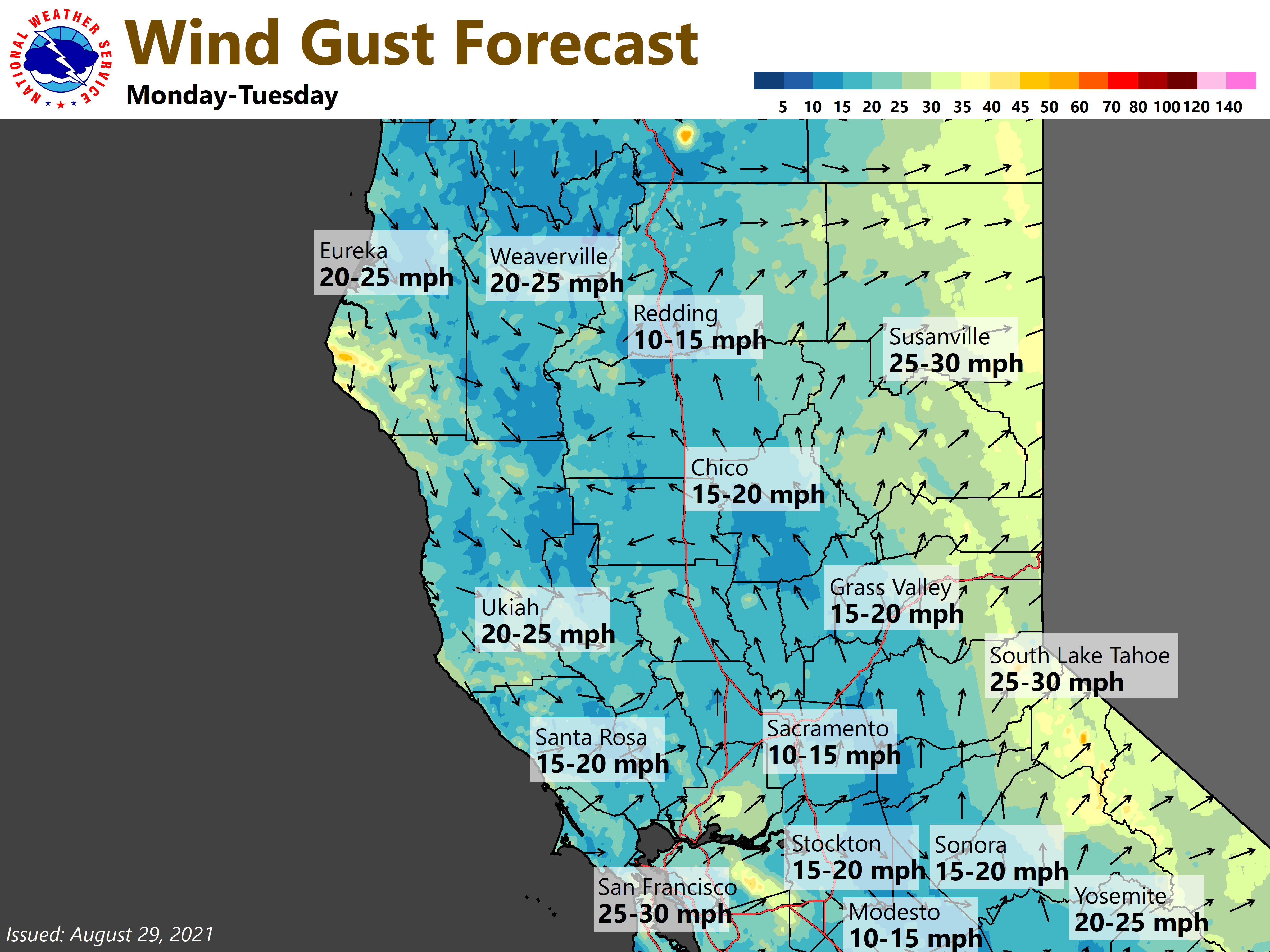
A stronger onshore flow/southwest winds will get going Monday, which should push the smoke eastward out of the Valley and much of the foothills. However, the deepening trough will enhance southwest ridgetop winds and could bring critical fire weather conditions to ongoing wildfires. West to southwest wind gusts of 20 to 35 mph, strongest over the higher elevations with minimum humidity of 8 to 25 percent and moderate to poor overnight recoveries are expected.
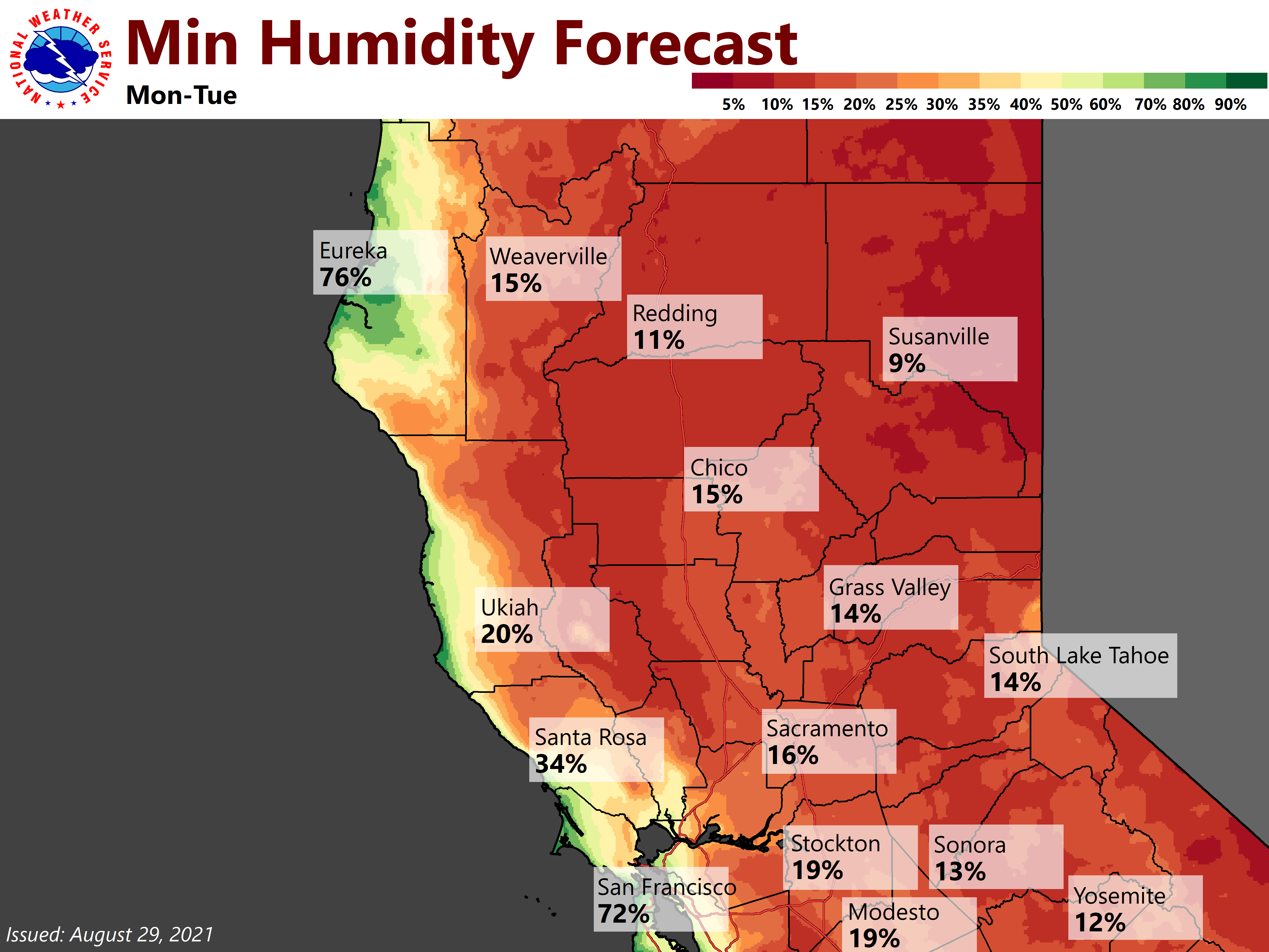
A Red Flag Warning has been issued for the higher elevations of the northern Sierra and southern Cascades from 11 AM Monday through 11 PM Tuesday, given the potential for rapid spread of new or existing wildfires. A brief period of critical fire weather conditions may also occur late this afternoon over ridgetops, as trough forms off the Coast.

Despite the developing trough higher heights will remain over the area keeping temperatures on the hot side today, with widespread readings from 100 to 105 at Valley locations. These readings are 10 to 15 degrees above normal and will likely result in moderate heat risk, especially for sensitive individuals. Temperatures will cool back into the mid 80’s/mid 90’s during the Tuesday-Wednesday timeframe.
Extended Discussion (Thursday through Sunday)
Upper troughing off the CA coast Thursday forms closed low that lingers offshore through the weekend. This will keep high temperatures near to slightly below normal. Locally breezy westerly wind possible at times through the Delta and over higher terrain, mainly afternoons into evenings.