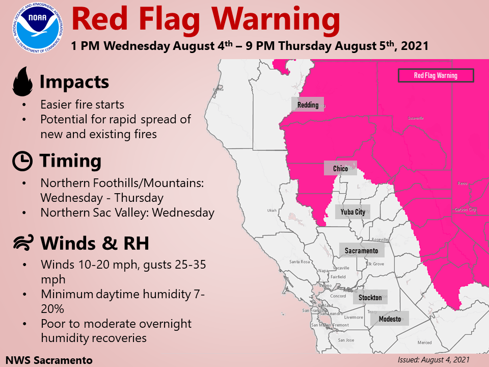
Periods of critical fire weather conditions Wednesday afternoon through early Thursday evening. Mainly dry weather and near normal temperatures expected through the week. Breezy onshore winds at times through the weekend.
Discussion
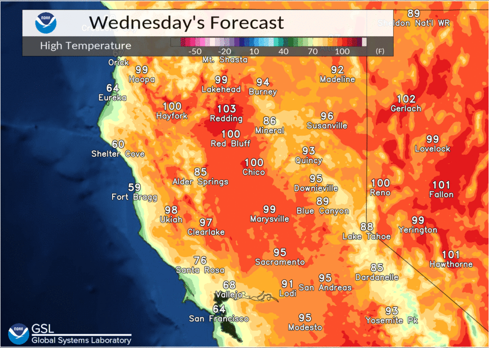
NorCal remains between high pressure centered over the Desert Southwest and trough approaching from the eastern Pacific. This continues a southwest flow pattern over the area. Onshore flow will begin to influence the Southern Sacramento and Northern San Joaquin Valleys today with temperatures falling back to near normal levels from the upper 80’s to mid 90’s. Readings will remain slightly above normal over the cent/nrn Sacramento Valley from the upper 90’s to low 100’s. Temperatures will drop to slightly below normal levels Thursday with trough passing through and onshore strengthening, then warming back to normal and slightly above levels Friday and Saturday.
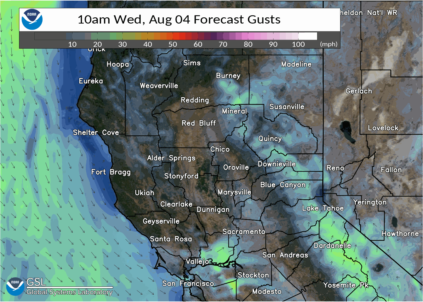
Surface and ridgetop south to southwest winds will strengthen Wednesday afternoon into Thursday as gradient tightens with approaching trough, with local gusts up to 25 to 35 mph causing fire weather concerns.
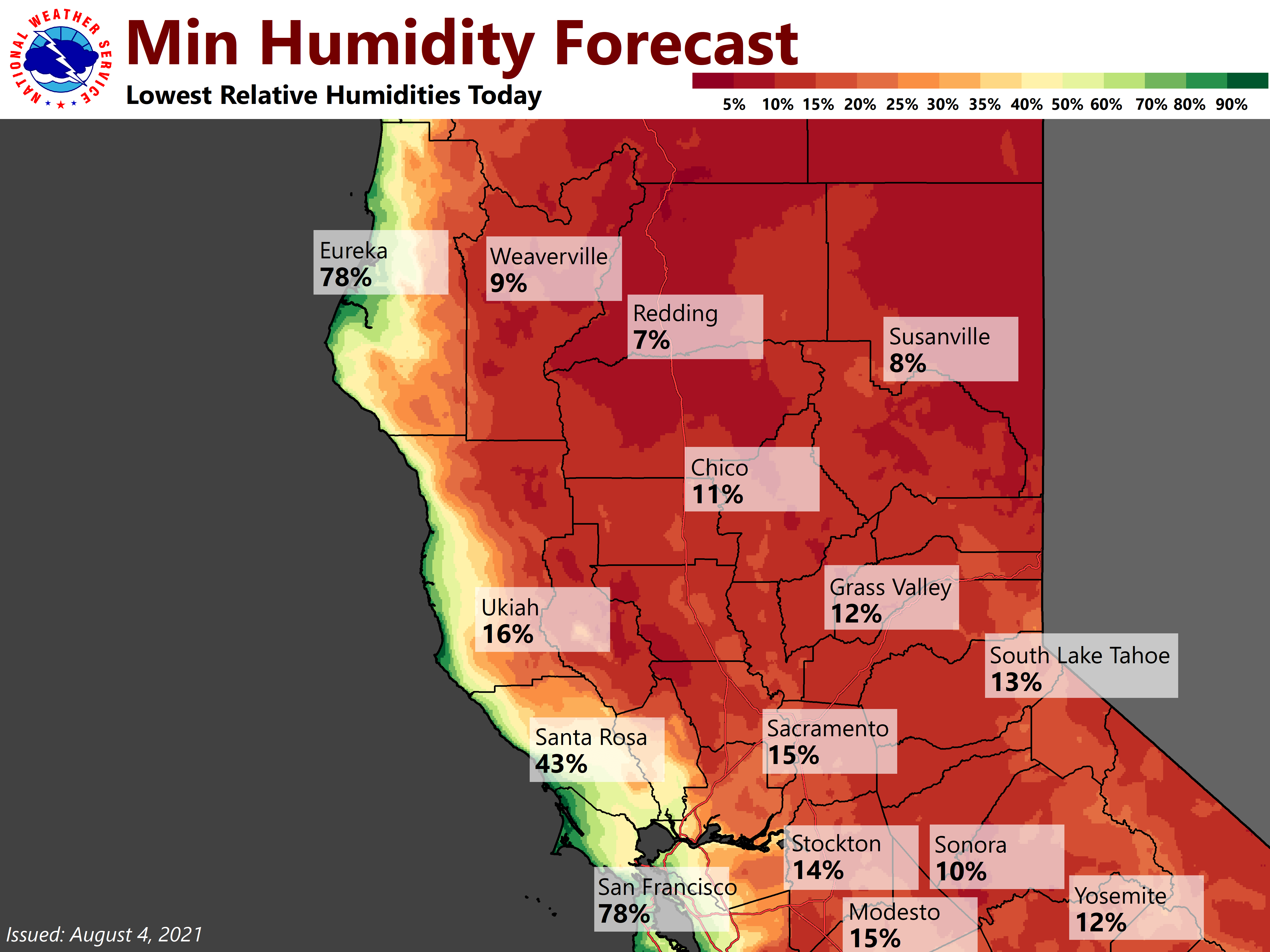
The combination of very low humidity, gusty winds and extremely dry fuels will bring periods of critical fire weather conditions to the northern Sacramento Valley Wednesday afternoon into early Wednesday evening and for the mountains of Shasta and western Plumas counties, and the northeast foothills through early Thursday evening. A Red Flag Warning is in effect for these areas. Please practice fire safety.
Increased instability with a brief period of cooling aloft and steepening lapse rates near upper low passing through Shasta and Siskiyou counties may lead to a few isolated thunderstorms Thursday afternoon over northern and western Shasta county. Dry weather with lighter winds Friday and Saturday, as upper low quickly moves northeast into the Northern Plains.
Extended Discussion (Sunday through Wednesday)
Models differ through the extended forecast period with EC showing a slower and deeper low over the PacNW early next week. Ensembles support weaker troughing aloft similar to the operational GFS. Forecast remains dry at the moment with high temperatures near to slightly below normal.