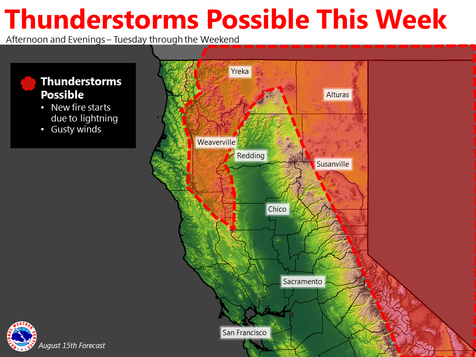
August 15, 2016 – Beginning Tuesday afternoon and lasting through the weekend, thunderstorms elevate the potential for new fire starts in northern California. The National Weather Service in Sacramento released an updated forecast, confirmed by NorthOps’ seven day fire weather narrative.
Review your emergency preparedness plan now, have your Go bag ready and make sure all family members are aware and ready too.
Hot weather will continue through Thursday before a cool-down is expected for the weekend. Monsoonal moisture may surge north, beginning Tuesday and continuing into the weekend. This may allow for isolated thunderstorms to develop over mountainous terrain each afternoon and evening, with the highest potential Wednesday – Friday. There is the potential for new fire starts due to lightning and gusty winds with any storm that forms.
Fire weather forecast: Isolated Afternoon/Evening Thunderstorms Northern and Eastern Areas Tuesday- Wednesday, Spreading to More Areas Thursday-Sunday. Isolated thunderstorms are possible over the northern and eastern mountains Tuesday and Wednesday. Any storms that develop will be capable of producing brief rainfall, but dry strikes and new ignitions will also be possible. The low pressure troughs are allowing the marine layer to deepen to 1500-2000 ft. The cool moist marine air will move farther inland with stronger sea breeze winds in the Bay Area and into the Delta, but farther north the surface pressure pattern is producing offshore flow conditions and causing the mid and upper slopes of the mountains of far NW CA to dry out. Northeast winds in far NW CA will peak early Wednesday with gusts to near 30 mph. This pattern produces very dry conditions in far NW CA and fire potential will be elevated for just the mid and upper slopes of the mountains in far NW CA.