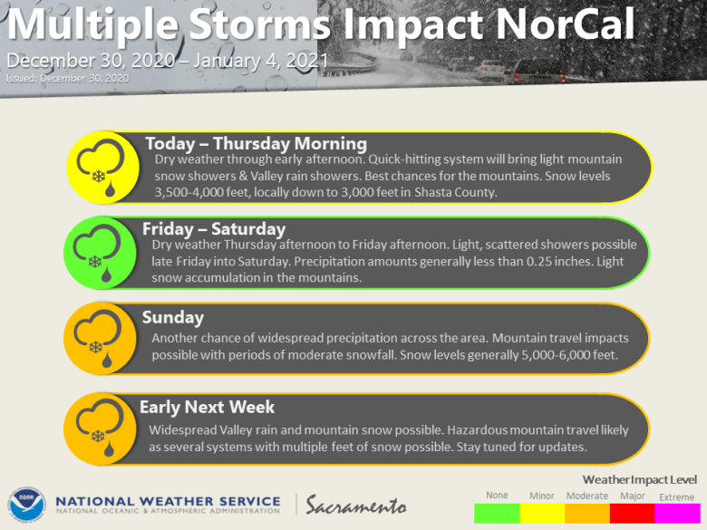
December 30, 2020 – Dry weather most of day with possible morning valley fog. A weak system will bring light precipitation late today into Thursday morning. Mainly dry through Saturday with isolated showers before the pattern becomes active Saturday night and remains active for the first half of next week.
Discussion
Patches of light fog trying to form this early AM so will keep an eye out for fog formation mainly from around Marysville southward and from the Sacramento river eastward. High clouds moving over the area has been limiting fog formation but is thinning along with light winds. Cold this morning with lows in the upper 20s to mid 30s for most of the valley to the teens to lower 20s for the mountain valleys.
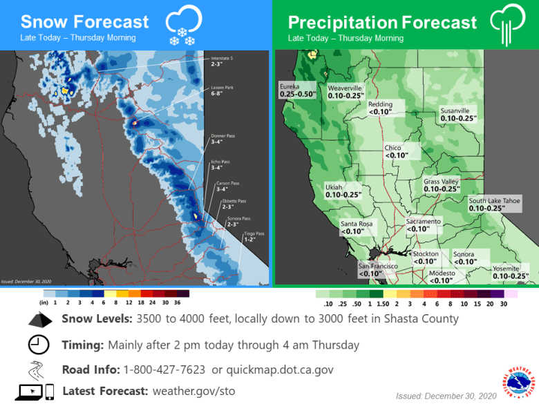
High pressure will remain with us through most of the day then a weak system will move through late in the afternoon through Thursday morning. The models continue to indicate a weak system Currently forecasting 1-3 inches of snow with local 4 inch amounts. Snow levels will lower to 2500 to 3000 ft over Shasta County to 3500 to 4000 feet elsewhere. Valley rain less than a tenth of an inch if any.
Behind the weak system high pressure will rebuild and we can expect dry weather through New Years Day. Only a small chance for the northwestern areas to receive some showers at this time. (Northern coastal range through Shasta County)
Through Saturday the models are indicating some possible isolated showers over the interior but for the most part expect mainly dry conditions.

Extended discussion (Sunday through Wednesday)
A weak but slightly more organized system will move through the area Saturday night and Sunday and bring the entire region a better chance of precipitation. Snow levels look to be in the 5000 to 6000 foot elevation range at this time.
Pattern continues to be active in the extended period as another system follows Sunday night into Monday and then followed by another system Tuesday into Wednesday.
Both GFS and European models indicate a possible impactful storms but not as strong as a day ago. They look more like your typical winter storms with decent precipitation, breezy to windy conditions and mountain snow.