March 17, 2017 – Dry weather today. Wet pattern returns late tonight through next week.
Discussion
Departing upper ridge will provide dry and warm weather today, although a few showers will be possible late in the afternoon over the northern Sacramento valley north of Red Bluff. Valley high temperatures will be in the mid to upper 70’s. These readings are 5 to 10 degrees above normal for this time of year.
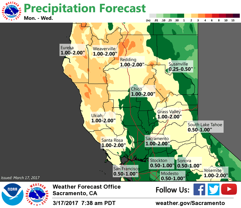
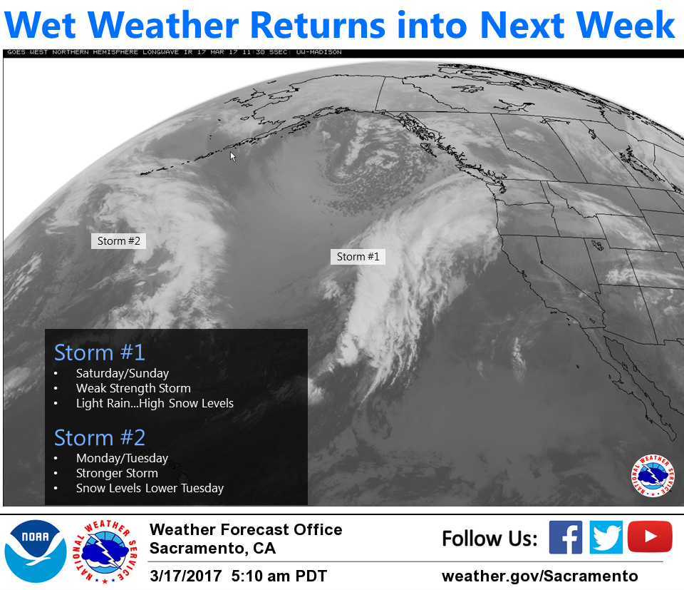
Low pressure trough will swing across NorCal tonight into Sunday. This system appears on the weak side, as main energy remains north of the area over the Pacific Northwest. Models continue to trend drier with this system and the 00z run of euro/gfs/nam have all come more in line with drier solution. The exception is over Shasta county where trend has actually been a bit wetter, as convergence focuses over this area. Current forecast maintains continuity with early forecasts, but amounts may need to be cut back if 12z run matches 00z. High snow levels above 7,500 feet will limit snowfall amounts.
Broad trough continues just of the coast Monday with southwest flow keeping showers chances over Northern California. Stronger impulse will approach the area Monday night with more significant precipitation possible.
Extended discussion (Tuesday through Friday)
Forecast models continue to advertise an upper level negatively tilted trough Tuesday that will bring rain and thunderstorm chances for the valley and snow for the mountains. Upper level forecast progs differ slightly between the Canadian, ECMWF, and GFS models as to the specifics regarding lift potential associated with the orientation of the incoming disturbance Tuesday, but there is general agreement to an unsettled pattern for the forecast area. Any storms that develop could produce gusty winds and small hail along with heavy downpours. The lower level jet does not look quite as strong as previous runs, but gusty Tuesday afternoon winds are still a probable outcome.
The longwave trough will continue to influence the weather on Wednesday with more rain and valley thunderstorm chances with snow for the Sierra. The heaviest snow is looking to be for mountain locations north of I-80 for elevations above 4000 feet. Stormy weather will continue Thursday as temperatures drop to 5 to 10 degrees below normal across northern California.