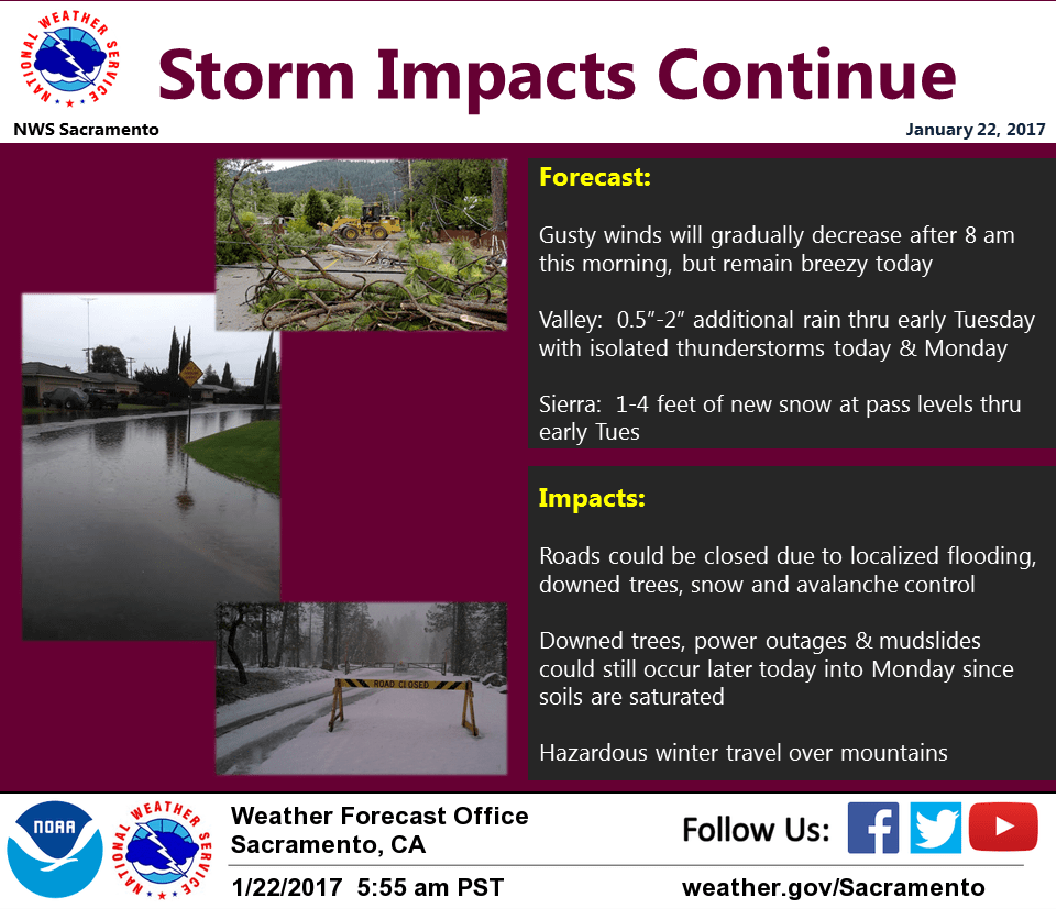
January 22, 2017 – Showers and isolated thunderstorms with mountain snow continue today and Monday. Drier weather Tuesday into the weekend except for a slight chance of some light mountain showers midweek.
Discussion
Frontal system pushing through southern portions of the forecast area this morning. Satellite imagery showing clearing behind the front. Wind speeds remained at higher end wind advisory criteria throughout the area overnight as expected, with KSCK the exception at 40 mph sustained for one observation. Wind speed has decreased with fropa and advisory expires at 10 am. Wind will remain somewhat breezy today, weakening by evening. Post frontal showers expected as vertically stacked system remains quasi-stationary off the Oregon coast. Models showing significant amount of CAPE developing over the Central Valley this afternoon while Bufkit profiles reveal strong 0-1KM and 0-6KM shear profiles. With clearing, daytime heating, and mid level cooling, instability increases today, especially in the afternoon. Thus likely to see some thunderstorms develop later today in the Central Valley. With 500 MB temps near -30 deg C potential for small hail exists with stronger storms. Also, given amount of shear, can’t rule out funnel clouds or brief touchdowns.
In the Northern and Coastal mountains, snow showers have diminished and will likely cancel the Winter Storm Warning for those areas this morning. Additional showers possible today and tonight, but any additional accumulations will be light. Snow levels forecast around 2500 to 3500 feet for those areas.
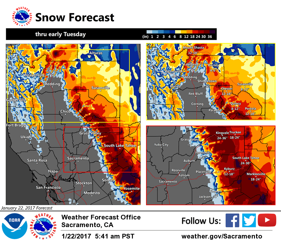
More widespread snow showers continue over the mountains of Western Plumas and west slopes of the Northern Sierra Nevada today into tonight where Winter storm warning remains in effect. Snow levels 3500 to 4500 feet today, lowering into the upper foothills tonight into Monday morning. Accumulations of a few inches possible in the upper portions of the NE foothills and Motherlode overnight.
Quasi-stationary stacked system progged to dig slowly off the West Coast Monday as it fills. Continued threat of showers and isolated thunderstorms Monday. Snow showers continue a possibility in the mountains but with lighter accumulations.
Drier northerly flow sets up on Tuesday as upper ridging approaches the West Coast and subsidence increases over Interior NorCal.
Extended discussion (Thursday through Sunday)
Models consistent for next Thursday in placing an upper level ridge over the eastern Pacific while dropping a week trough southward into the Great Basin. Can not rule out a slight threat of light showers over the northern mountains and southern Cascades on Thursday but any precipitation amount will be quite light and remain over the mountains. By Friday, upper ridge recenters over the west coast bringing dry conditions entire CWA with daytime highs several degrees above normal. Upper ridging remains over the west through the rest of the weekend for continued dry conditions and above normal temperatures. Light northerly winds through the period will likely keep valley fog limited mainly to south of Sacramento. Otherwise fair skies overnight will allow overnight lows to drop to a little below average.