March 15, 2017 – A quick moving disturbance will bring chances for rain to the north Sacramento Valley and northern mountains today through Thursday. Dry weather will return Friday before a wet pattern returns Saturday through next week.
Discussion (Today through Saturday)
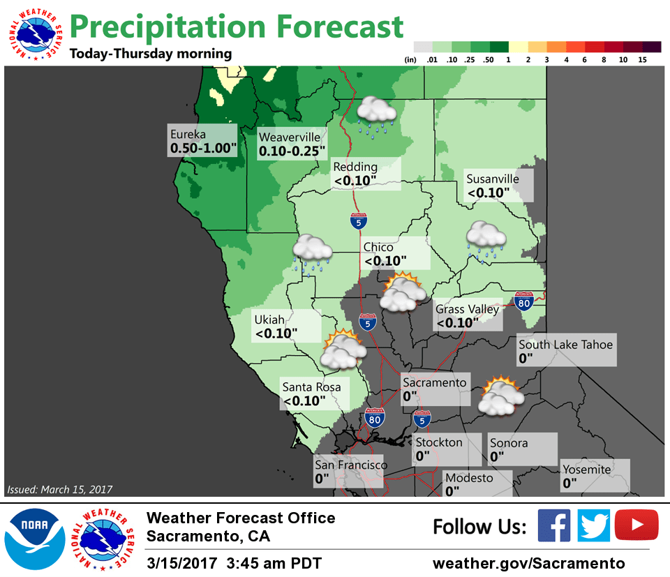
Model analysis and water vapor imagery showed a steady plume of moisture ahead of an approaching upper level trough of low pressure early this morning with increasing high level clouds. Radar and surface observations indicated dry conditions across northern California, although light rain showers were beginning to develop just off the coast.
Model forecasts are in good agreement to the progression and timing of the disturbance that will move through northern California today. There is high confidence that light rain showers will progress into the northern mountains and the northern Sacramento valley later this morning through this evening. Wind gusts for the ridges could reach 45 mph at times this afternoon as mid level jet stream moves through the northern portions of the forecast area. Rain will become more scattered Thursday morning before dry weather returns Friday as a shortwave ridge of high pressure brings a return to dry weather.
Another higher amplitude trough will approach the region Saturday with more rounds of precipitation chances for the Sacramento valley and the mountains. Confidence is high that rainfall will occur for the northern and coastal mountains and the northern Sacramento valley, with medium confidence that the Sierra and Sacramento valley will also see some light rain.
Extended discussion (Sunday through Wednesday)
A wetter pattern is shaping up for next week. A shortwave in broad southwest flow Sunday will deliver a chance of precipitation. A deepening upper low offshore will put NorCal within the divergent quadrant beginning Monday and continuing at least through Tuesday. Models are in pretty good agreement on timing through Tuesday with the GFS pushing the low through NorCal early Wednesday while the ECMWF delaying the low passage Wednesday night. Either way, even with the uncertainty, we kept Wednesday wet as well.
Snow levels will generally be around 6500 to 7500 feet Sunday, then lower to around 5000 feet by Wednesday.
Significant precip is possible late Monday into Wednesday with mountain travel impacted by heavy snow and strong wind. Periods of breezy to windy conditions possible during the extended period, especially with the system on Tuesday and Wednesday.