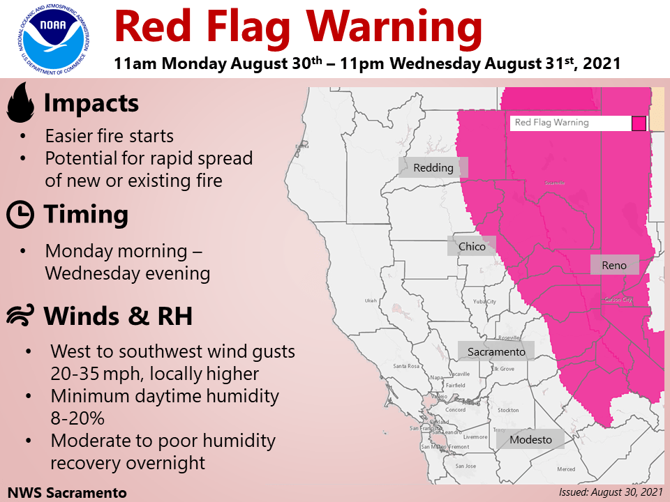
Continued hot and very dry today, then turning cooler through the remainder of the week. Gusty southwest winds will result in critical fire weather conditions over the northern Sierra and southern Cascades through mid-week. Red Flag Warning from 11 AM this morning to 11 PM Wednesday.
Discussion
Other than a bit of stratus nudging into far southwest Solano County, skies are clear across interior NorCal early this morning. Waver vapor imagery shows very dry air in the mid-levels over NorCal in the region between ridging to our south and the approaching trough to the north. Surface observations reflect this very dry air with current RH readings only in the teens and 20s percent over most of the northern Sierra and foothill ridges, and not surprisingly GOES-W shows very active burning continuing overnight on the Caldor Fire and southern portions of the Dixie Fire.
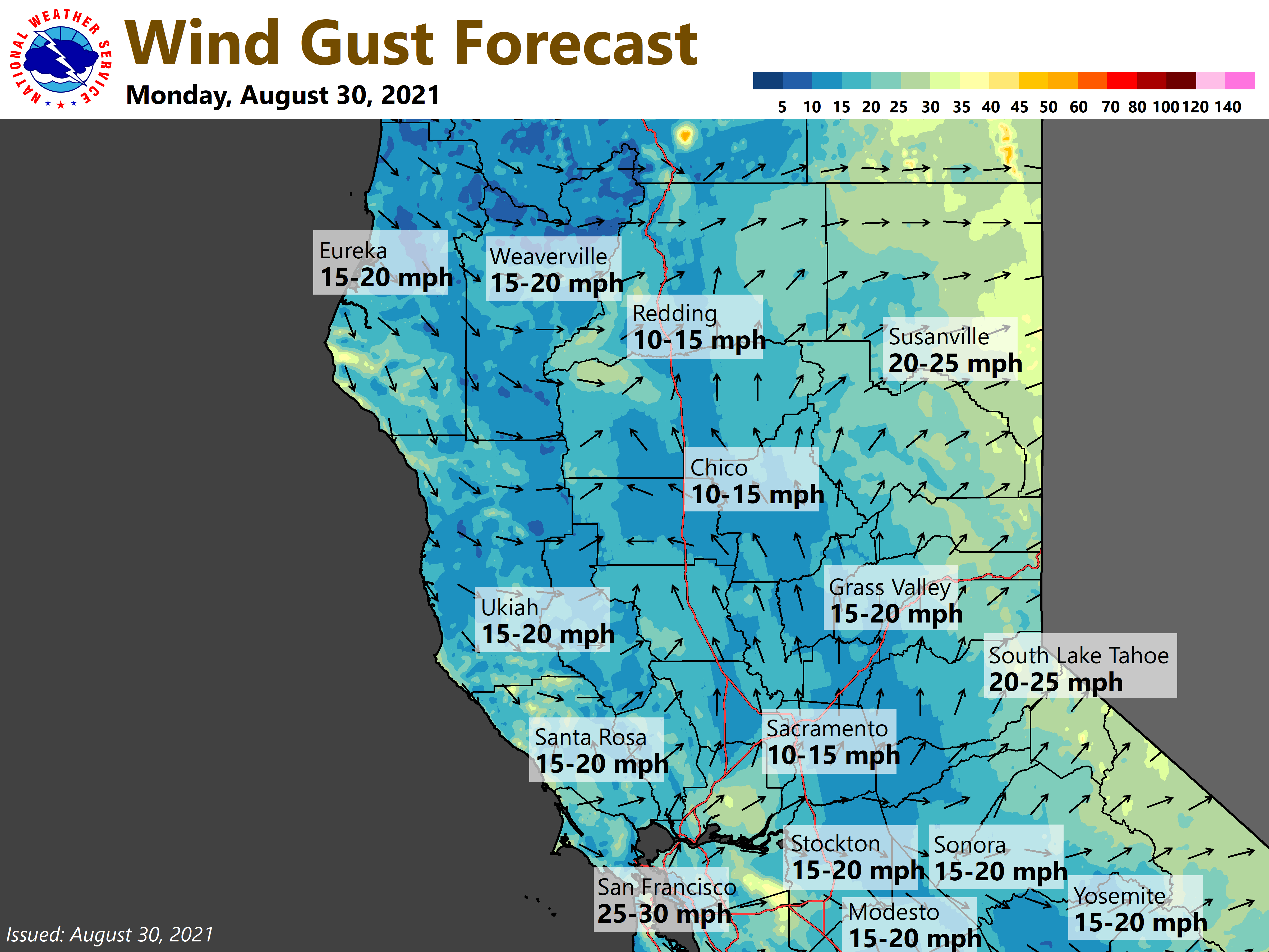
IR difference imagery showing stratus becoming more extensive along the NorCal coast. Profiler data indicate the marine layer is beginning to deepen slightly (up to 1-1.5k ft deep at Ft. Ord). Surface pressure gradients are beginning to transition to onshore, and a moderately strong Delta Breeze has returned to Travis AFB with gusts to around 30 mph. The increase in onshore flow is expected to bring some cooling to the Delta and southern Sacramento Valley today, but may exacerbate the ongoing wildfires as stronger southwest breezes return to the higher elevations this afternoon (Red Flag Warning begins at 11 AM).

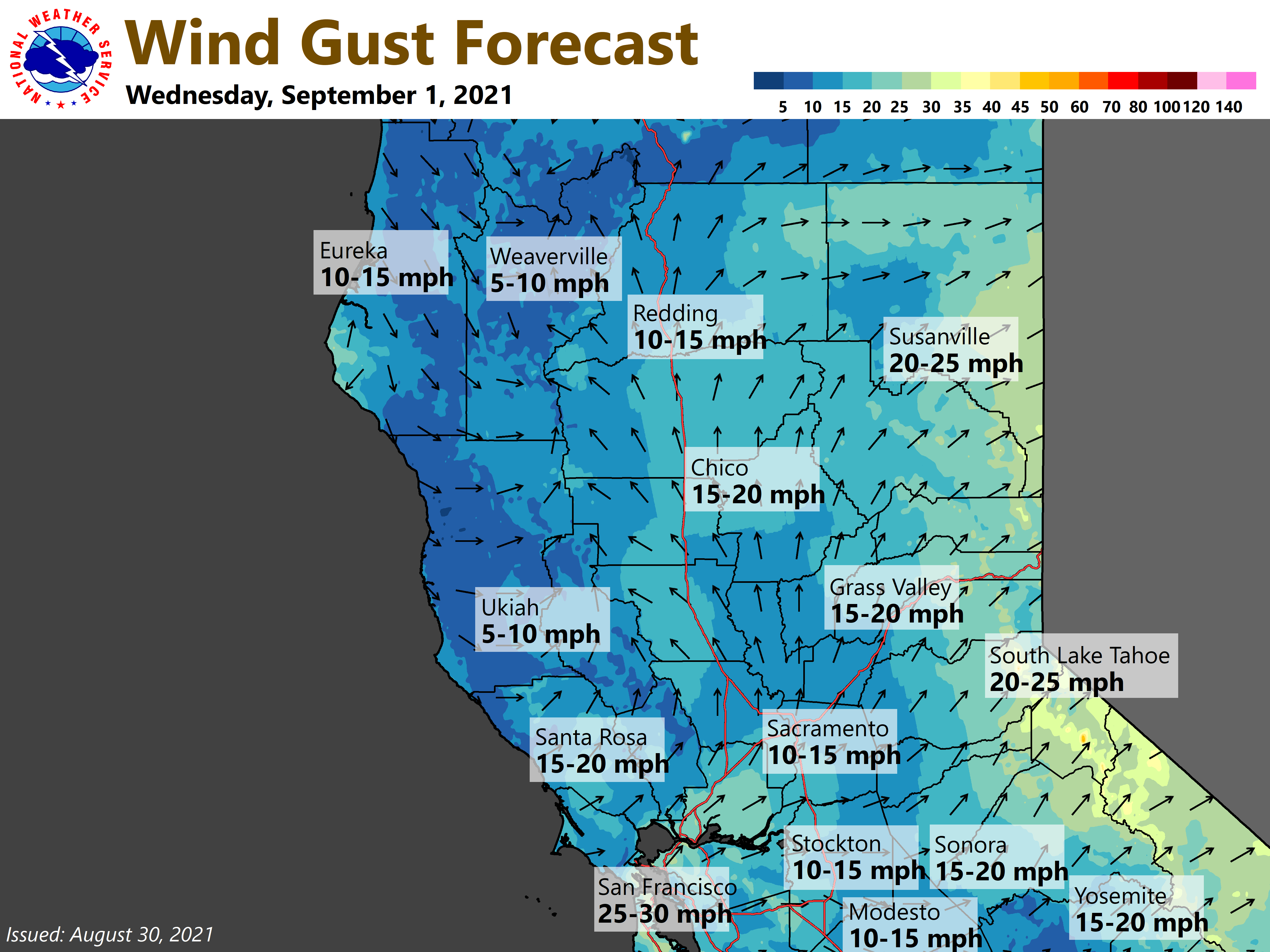
It’s still looking like the poor air quality will begin to ease today, then improve significantly across most of the region on Tuesday as the trough settles in and onshore flow persists pushing much of the smoke off to the east. On the other hand, an axis of stronger 850 and 700 mb winds is forecast to develop over the northern Sierra late tonight and Tuesday (as the trough moves in) which won’t be good news for the fires. Less breezy conditions are expected by Wednesday.
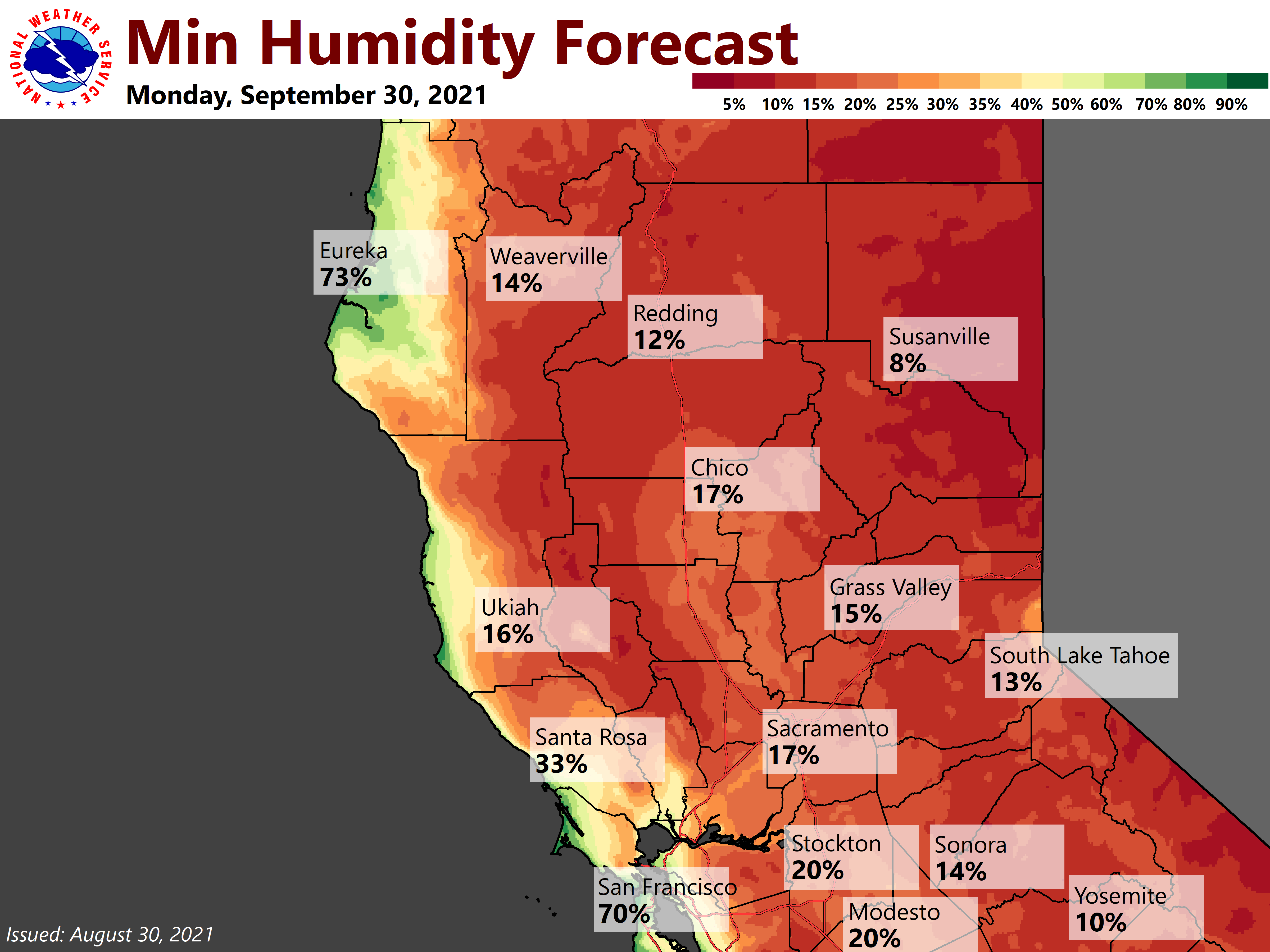
More significant cooling develops across the region Tuesday and continues through at least mid-week as temperatures lower to a little below average. Despite the cooling, humidity will remain low outside portions of the Central Valley influenced by the Delta Breeze.
Extended Discussion (Friday through Monday)
Troughing looks to continue over the west for the start of the extended period. This will keep cooler temperatures in place along with locally breezy onshore winds. The clusters show some divergence in ensembles late weekend into early next week but overall upper level ridging building in from the west is favored. This will bring a warming trend into early next week. No rain or thunderstorm chances expected.