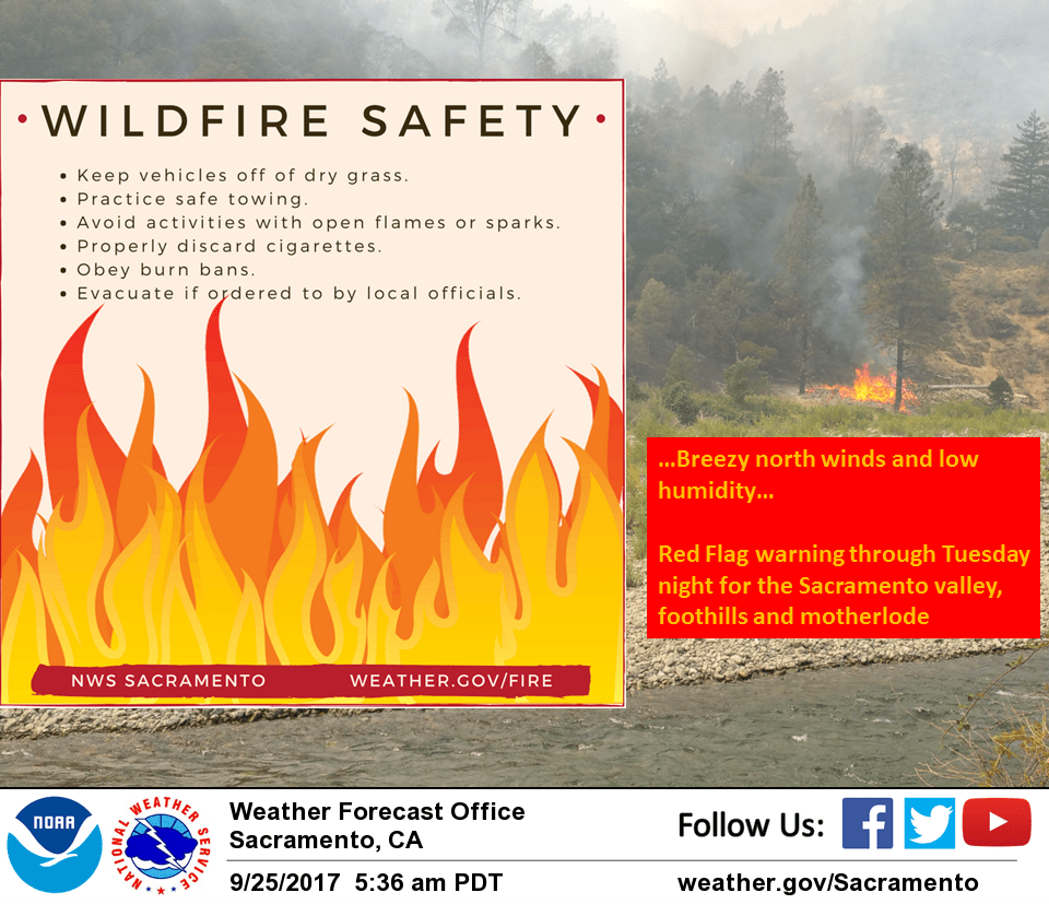
September 25, 2017 – Warmer through mid week with dry conditions continuing. Breezy north winds next few days for increased fire danger. Remaining warmer than normal through the end of the week with lighter winds. Red Flag Warning now in effect until 7 AM Wednesday for gusty winds and low humidity.
Gusty northerly or offshore winds over the northern and western Sacramento Valley and adjacent foothills will redevelop again this afternoon and tonight into portions of the Sierra Nevada, continuing through early Wednesday morning. The combination of offshore winds and dry airmass are expected to bring critical fire weather conditions.
Discussion
A strong upper level ridge of high pressure will bring continued fair skies and above normal temperatures through the short term period. The overall airmass is forecast to warm a few to several degrees today, Tuesday and a bit more Wednesday as the ridge amplifies and shifts inland. Combination of northerly flow aloft and northerly surface gradient will bring breezy north winds today especially over the northern portion of the CWA. As surface high pressure pushes into the Great Basin on Tuesday the easterly surface gradient tightens over the Sierra bringing increasing winds there. Winds and low daytime RH as well as poor overnight humidity recovery will bring increased fire danger through Tuesday night. Lighter winds are in store Wednesday as the upper ridge axis centers over the west coast and surface gradients relax. Little change in forecast expected for Thursday as upper level pattern remains mainly unchanged.
Extended discussion (Friday through Monday)
Eastern Pacific ridging will remain over the area with dry and warm weather continuing through the week. Daytime highs will remain above normal with low 90s across the Valley, Delta and into the lower foothills. By Friday, the ridge will slowly be displaced as a trough moves into the Pacific Northwest and this may bring slight cooling. The upper ridge will briefly rebuild and strengthen on Sunday, with Valley highs increasing into the mid 90s. Another Pacific trough is expected to bring a slight cool down early next week.