
June 8, 2019 – Temperatures will warm to well above normal over this weekend into next week. In addition to warmer weather, gusty northerly wind increases fire weather concerns across the Central Valley this weekend.
Discussion
After cooler and somewhat more seasonal temperatures over the past few days, the reprieve from the hot weather will come to end. This is due to the broad trough pushing eastwards. We’ve already started to the first of such changes as northerly winds have started to increase. These winds will increase throughout the day, and then peak later this afternoon/evening. Thus. the Wind Advisory remains in effect across much of the Sacramento Valley.
In addition to the gusty winds, hot and dry weather coupled with drying fuels (i.e., grassy surfaces) will be a concern. As a result the Red Flag Warning for the western Sacramento and San Joaquin Valleys below 1000 feet will remain effect through Sunday afternoon. Fuels above these elevations have not dried out as much yet given more recent precipitation. The most hazardous fire weather conditions will be on this afternoon/evening when the strongest winds and lowest relative humidities are expected.
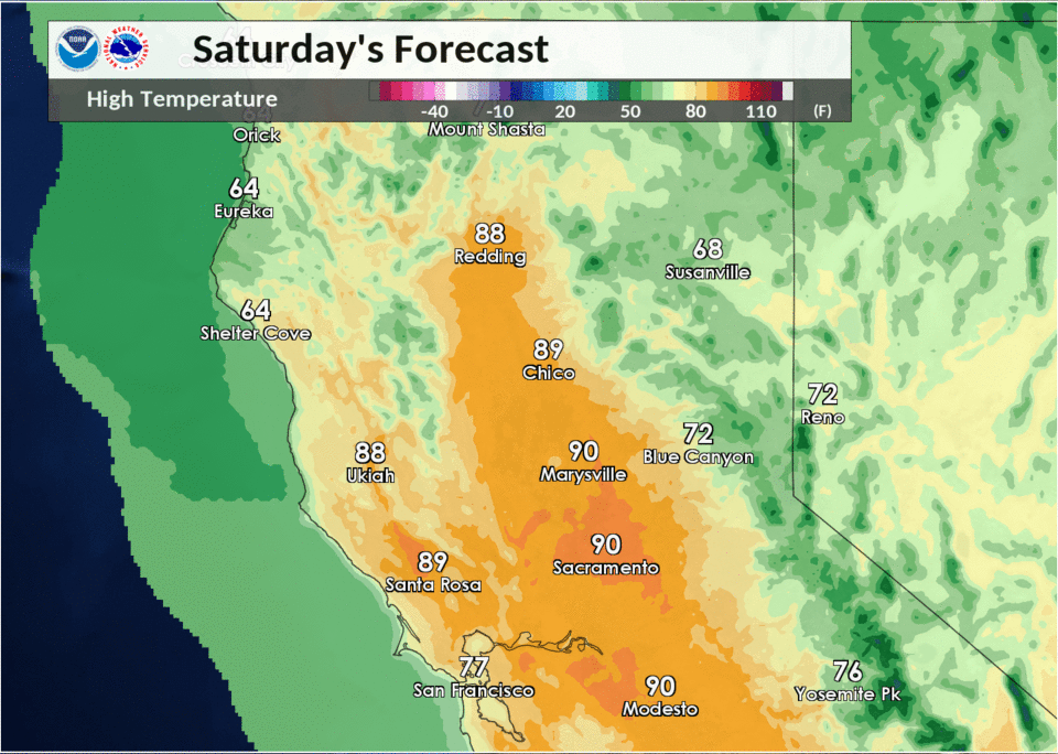
From Sunday into early next week, temperatures will increase considerably. Widespread mid 90s should spread over the entire Valley while numbers increase further on Monday given building heights over the West Coast. The forecast was actually raised a few degrees given the latest guidance remained unanimous readings hitting the triple digits. With high temperatures being forecast to reach the lower 100s, a few locations may near their daily records. Thus, groups whom are sensitive to excessive heat should stay alert to the latest temperature forecasts and heat-related products.
Extended Discussion (Wednesday through Saturday)

Extended forecast Wednesday starts out with a slight cooling trend as the upper ridge axis over the west coast shifts east of the coast line and a very weak trough edges closer to the coast. Even with the cooling, daytime highs will reach 10 to 15 degrees above normal. GFS paints some showers over Norcal Wednesday night while the ECMWF does not. Have opted to keep CWA dry for now going along with consensus models. A more onshore flow and cooler airmass continues the cooling trend on Thursday but daytime highs will remain several degrees above normal. Not much change is expected Friday and Saturday. GFS still wants to paint some showers over the northern CWA but consensus models still keep precipitation out of the forecast. Therefore, extended period forecast remains dry for the time being.