Periods of critical fire weather conditions through the evening. Mainly dry weather and near normal temperatures expected into next week. Breezy onshore winds at times through the weekend.

Discussion
Unseasonably strong upper low is near Eureka this morning and will track eastward through Shasta and then northeast into Modoc county through the day. Enhanced gradient southeast of the low will keep gusty winds going through the day especially upvalley and over ridgetops over the southern Cascade range and the Sierra, including major ongoing fires. Forcing and upward ascent out in front of the trough could also aid plume growth much like Wednesday. There will be some increase in humidity, as the trough passes through with lowering temperatures.
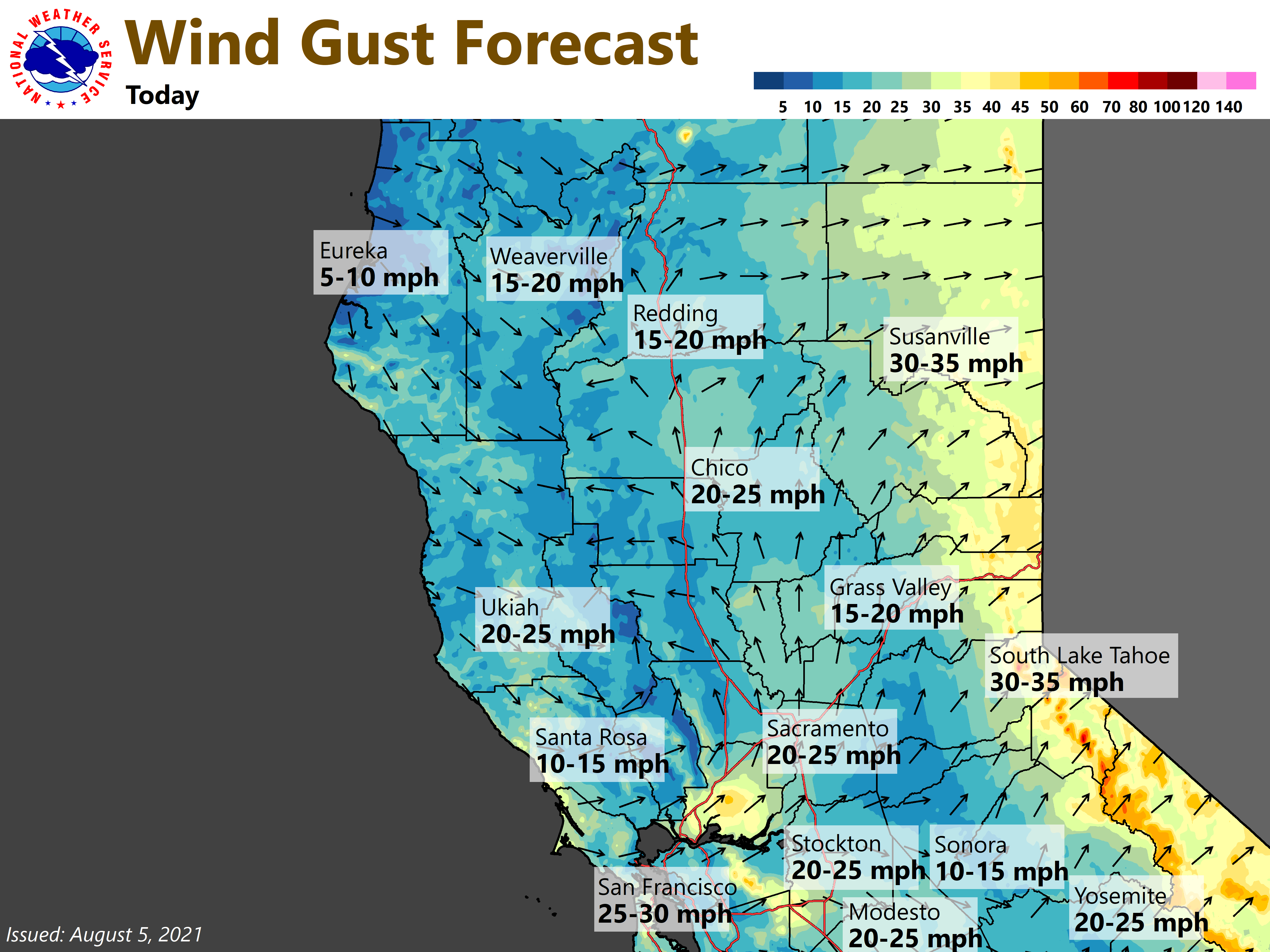
The combination of low humidity, gusty winds and extremely dry fuels will continue to bring critical fire weather conditions. A Red Flag Warning remains in effect for the northern and central Sacramento Valley, Coast Range, mountains of Shasta and western Plumas counties, the northeast foothills and the northern Sierra Nevada through the evening. Please practice fire safety.
Elsewhere, strong onshore flow will bring below normal temperatures generally from the mid 80’s to low 90’s at valley locations. Increased instability with a brief period of cooling aloft and steepening lapse rates near upper low passing through Shasta and Siskiyou counties may lead to a few isolated thunderstorms this afternoon over northern and western Shasta county.
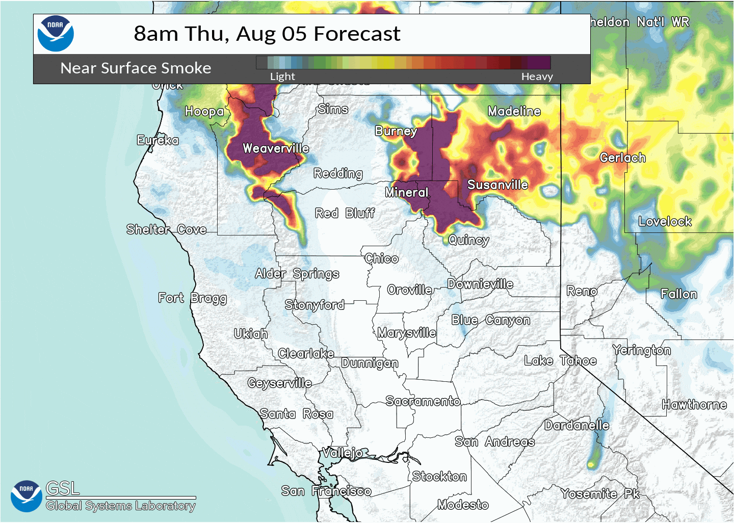
Upper low will shift northeast into Idaho Thursday night with trough extending south through Nevada. Winds will turn north downvalley through the night with downslope winds draining out of the mountains. This will likely bring potentially dense smoke into foothill locations and eventually filling much of the Sacramento Valley, especially Friday morning. North winds should not be long lasting, as at least weak onshore flow resumes Friday afternoon into Saturday and could provide some smoke improvement for Valley locations, but smoke is likely to remain over the foothills and mountains. Weak onshore flow pattern should continue into early next week, as trough passes through the Pacific Northwest, keeping temperatures near normal.
Extended Discussion (Monday through Thursday)
Weak upper troughing gradually gives way to upper ridging from the Desert SW through the extended forecast period. Dry weather prevails with a gradual warming trend. High temperatures forecast to be slightly below normal Monday, warming to around 5 degrees or so above normal by Thursday.