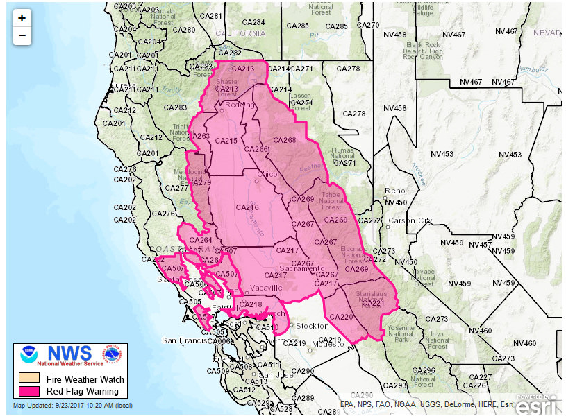
September 23, 2017 – Turning warmer and drier into next week with breezy north winds. Red Flag Warning in effect.
The National Weather Service in Sacramento has issued a Red Flag Warning, which is in effect from 2 PM this afternoon to 5 AM Tuesday. The Fire Weather Watch is no longer in effect.
* AFFECTED AREA: Fire weather zone 220.Fire weather zone 221.Fire weather zone 267.Fire weather zone 268.Fire weather zone 269.
* WIND: Northeast winds 10 to 20 mph with gusts 25 to 30 mph over exposed ridges and stronger through aligned canyons. Strongest winds expected during overnight and morning hours.
* HUMIDITY: Daytime humidity of 15 to 25 percent with the main concern being minimal humidity recovery overnight.
* IMPACTS: Any fires that develop will likely spread rapidly. Outdoor burning is not recommended.
Discussion
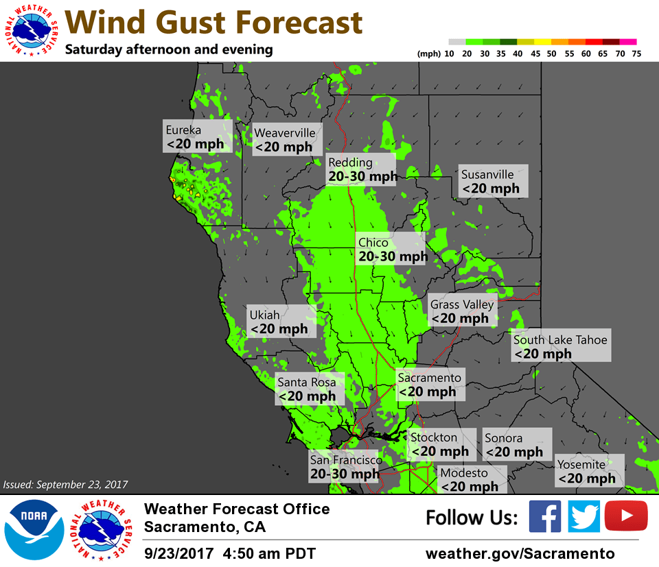
Upper low will shift east into Utah Today leaving NorCal in a much drier, but breezy north flow. This will cause temps to warm back to around 80 degrees Today and into the 80’s Sunday at valley locations. North wind gusts from 20 to 25 mph will be possible over the northern and central Sacramento valley from this afternoon through Monday. The warm-up will continue into Tuesday with readings from the upper 80’s to low 90’s for many locations as Pacific ridge builds eastward.
Extended discussion (Wednesday through Saturday)
Warm and dry weather dominates in the extended period as upper level ridging from the eastern Pacific continues to build over the area. An upper level low develops over the Great Basin and retrogrades over Southern California. This will act to limit warming over the region to some extent. Temperatures across interior NorCal will range from 5 to 10 degrees above seasonal normals through Friday. Valley highs will be in the low 90s through at least the end of the week. The foothill and mountain high temperatures will range from the 60s to the 80s. Northerly winds continue into Thursday, though not as strong as earlier in the week.