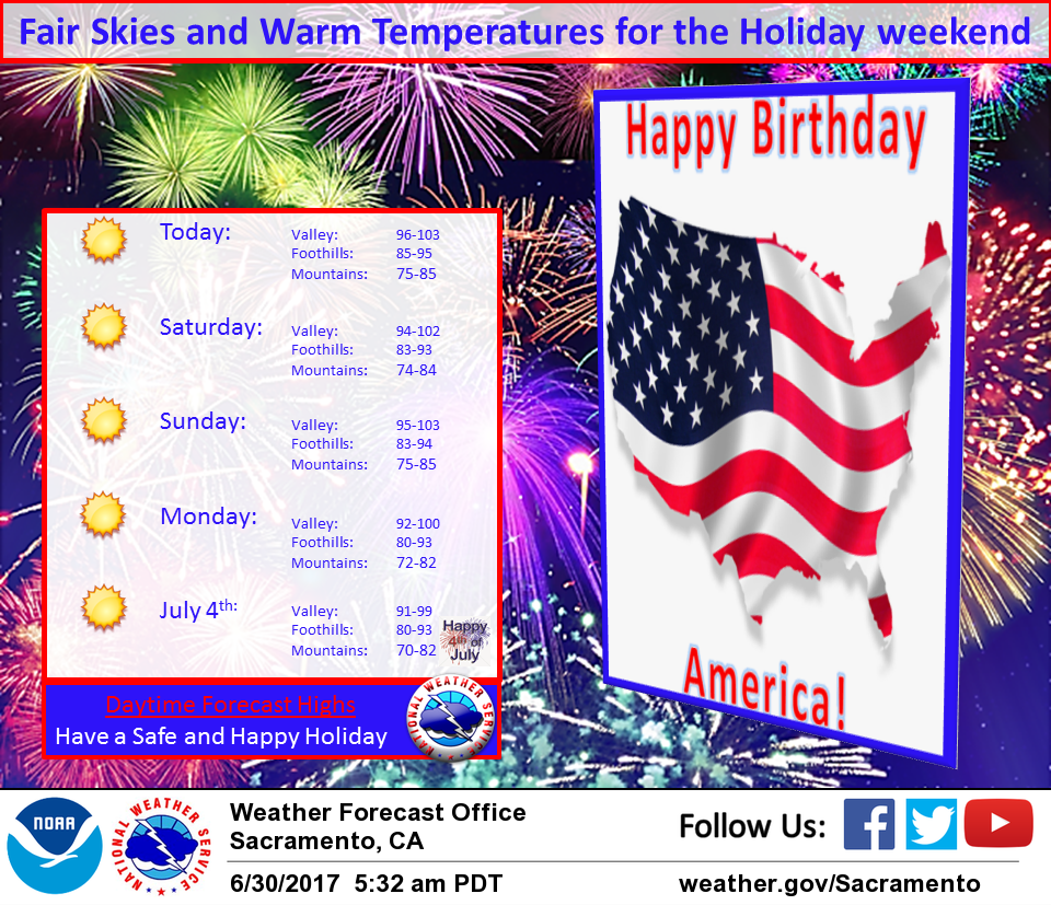
June 30, 2017 – Temperatures on the rise going into the weekend. Slightly cooler next week but slightly warmer than normal. Fair skies and dry conditions through at least the middle of next week.
Discussion
Upper ridge axis over the west coast will bring fair skies today. Only exception will be over western Solano county where some coastal stratus and a moderate delta breeze may bring some scattered low clouds this morning. Temperatures are running near 24 hours ago but airmass warming today should bring up daytime highs a degree or two over Thursday.
Weak upper trough moves through the Pacific northwest on Saturday. Overall impact will be minor with main effect being a slight cooling most areas and a continued moderate delta breeze. Upper ridge rebuilds quickly on Sunday bringing a slight warm up.
Highs on Sunday are expected to hit between 5 and 10 degrees above normal.
Upper ridge axis pushes inland on Monday as upper troughing begins to develop over the eastern Pacific. This will begin a cooling trend lasting into the middle of next week. Overall conditions remain stable through the short term so no mountain thunderstorms expected.
Extended discussion (Tuesday through Friday)
Upper level high pressure system will begin moving to the east Tuesday as a trough of low pressure strengthens off the coast. Upper level flow is expected to increase in amplitude as model forecasts agree to having the upper level high pressure stagnate over the middle of the CONUS for the rest of the week with upper trough remaining over the Pacific. Latest model runs have been highly variable and uncertainty is high for the pattern next week. Warm and dry conditions are expected to prevail through the end of next week, although a stray shower or thunderstorm for the mountains cannot be ruled out.