October 26, 2021 – Quieter weather building in. Light precipitation continues today north of I-80. Dry into the end of the week with slight shower chances Saturday in northern areas.

Discussion
Mid and high clouds are spreading south most of the region early this morning. Enough southerly flow is present across the northern Sacramento Valley to provide just enough lift to squeeze out some light rain across the mountains north of Redding. Elsewhere, IR difference imagery shows low clouds and some fog covering much of the northern Sierra west slopes. Current temperatures remain mostly on the mild side with 30s and 40s in the mountains, and upper 40s to mid 50s across the Central Valley.
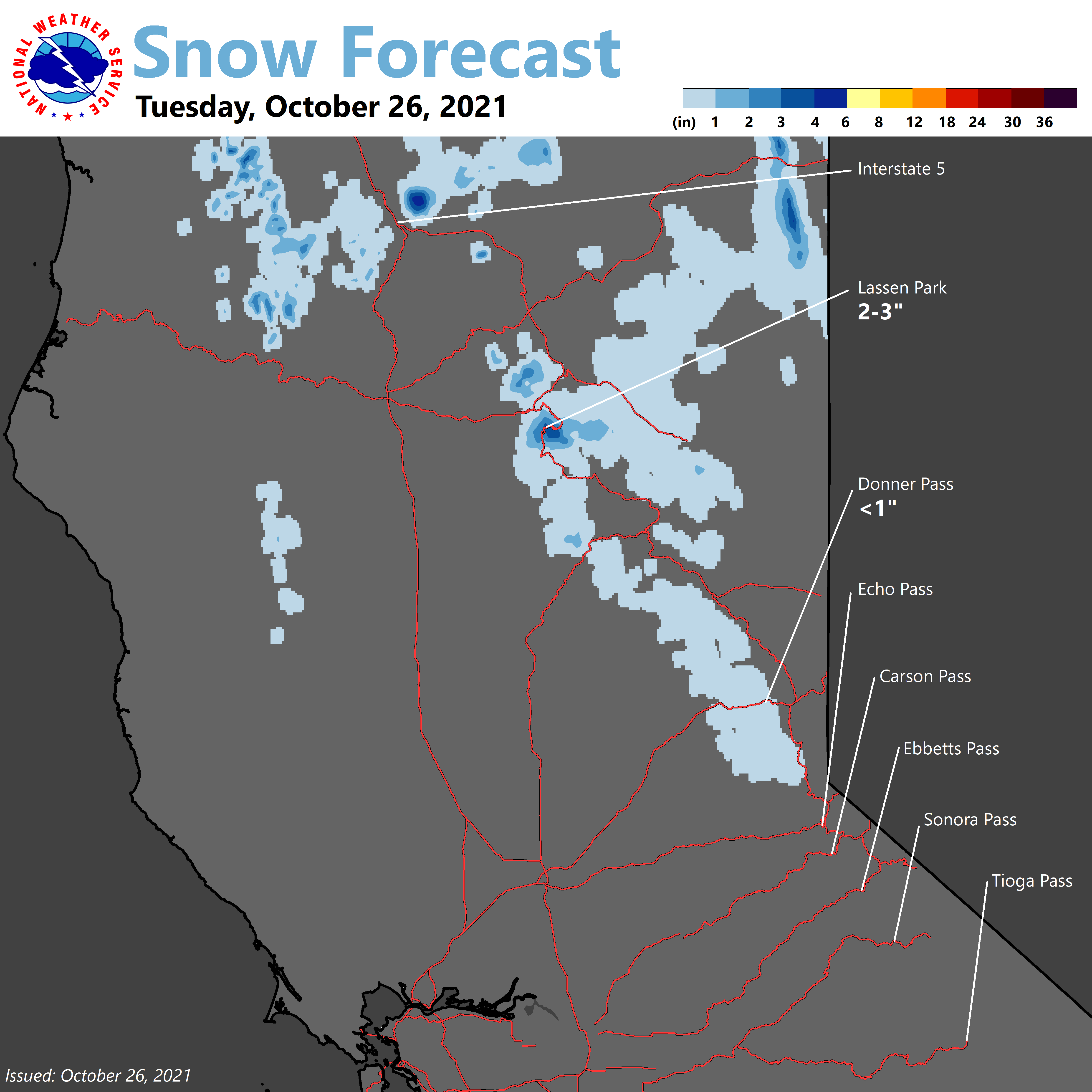
Ridging from the eastern Pacific will continue to edge into NorCal today which typically would be a dry pattern for us. However, another swath of deep moisture (TPW 1.25-1.5 inches) is moving over the ridge toward the region. Warm-advection and relatively weak orographic enhancement should be enough for some light QPF over the Coast Range, northern Sacramento Valley and northern mountains into early Wednesday. Snowfall accumulation of an inch or two will be possible over the higher peaks of the Coast Range, and near Mt Lassen this morning, before snow levels rise considerably. The remainder of the area will remain dry with partly to mostly cloudy skies.

Upper level ridge builds in on Wednesday bringing clearing skies and warming temperatures (closer to average). Other than perhaps some late night and early morning valley fog making an appearance, quiet weather with mild temperatures is expected through the end of the week.
Extended Discussion (Saturday through Tuesday)
Ensemble guidance is in good agreement a closing shortwave trough will pass over far northern California this weekend. Showers will be possible over the northern Sacramento Valley and surrounding terrain.
However, amounts are expected to be light with best chances for precip over the higher elevations of far northern California. Currently Redding has about a 15-20% chance for showers. Passing clouds will likely be the most noticeable widespread feature from this low pressure system.
Thereafter, upper-level ridging over the West will lead to a brief period of generally dry weather for Northern California. Early next week, precipitation could return to the region ahead of an approaching broad upper-level trough off the West Coast.