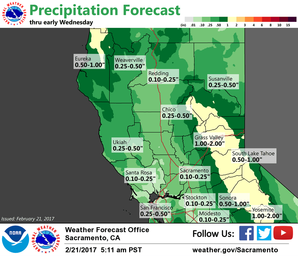
February 21, 2017 – Significant flooding concerns continue as runoff from the recent rain continues to work its way downstream adding stress to waterways. Showery weather with a few thunderstorms expected into mid-week, then another stronger storm potentially late in the weekend.
Discussion
Winds have continued to decrease overnight in the valley and have cancelled the wind advisory, but strong gusty southwesterly winds continue in the higher elevations of the northern Sierra Nevada and southern Cascade Range. Precipitation has turned more showery behind the front with even a few thunderstorms over northern Shasta County.
Convective precip will continue across the region with overall QPF expected to be considerably lighter, but flooding concerns will continue as runoff works its way downstream. Lowering snow levels to around 3000 to 4000 feet by tonight will also help reduce runoff.
Next upstream vort is evident on satellite imagery crossing 130W and will assist in leading to another upswing in shower and thunderstorm activity by midday. Upslope flow will continue moderate to heavy snow in the northern Sierra Nevada today with up to another foot or more of additional accumulation expected above 5500 feet before tapering off this evening.
Transition to northwesterly flow aloft Wednesday will allow much of the valley to dry out for the second half of the week with only a few showers remaining over the mountains.
Extended discussion (Saturday through Tuesday)
Stormy weather is possible this weekend, with the main issue being snow causing travel problems.
Extended models are now showing a cold upper trough from western Canada dropping down along the coast and phasing together with an upper low from the Gulf of Alaska. If this occurs, this would bring an extended wet period through the weekend. A secondary low is currently projected to continue this into Monday and possibly into Tuesday as well.
Unlike the current system, snow levels are expected to be quite low with these cold systems, around 2500-3000 feet. Accumulating snow could be a travel issue Saturday night through Monday night, potentially extending into the foothills. Uncertainty in the details remains high, as model runs have been changing quite a bit. Stay tuned to see how this system develops!