November 9, 2021 – Lingering showers today. Dry conditions with a warming trend the remainder of the week. Morning Valley fog possible mid-week onward.

Discussion
The heaviest band of rain has now pushed to the south of our area and we are just seeing light scattered showers. All of this is associated with a trough in the Gulf of Alaska and a short wave trough off the Coast of CA. We will see the short wave trough axis push over NorCal this morning into the very early afternoon.
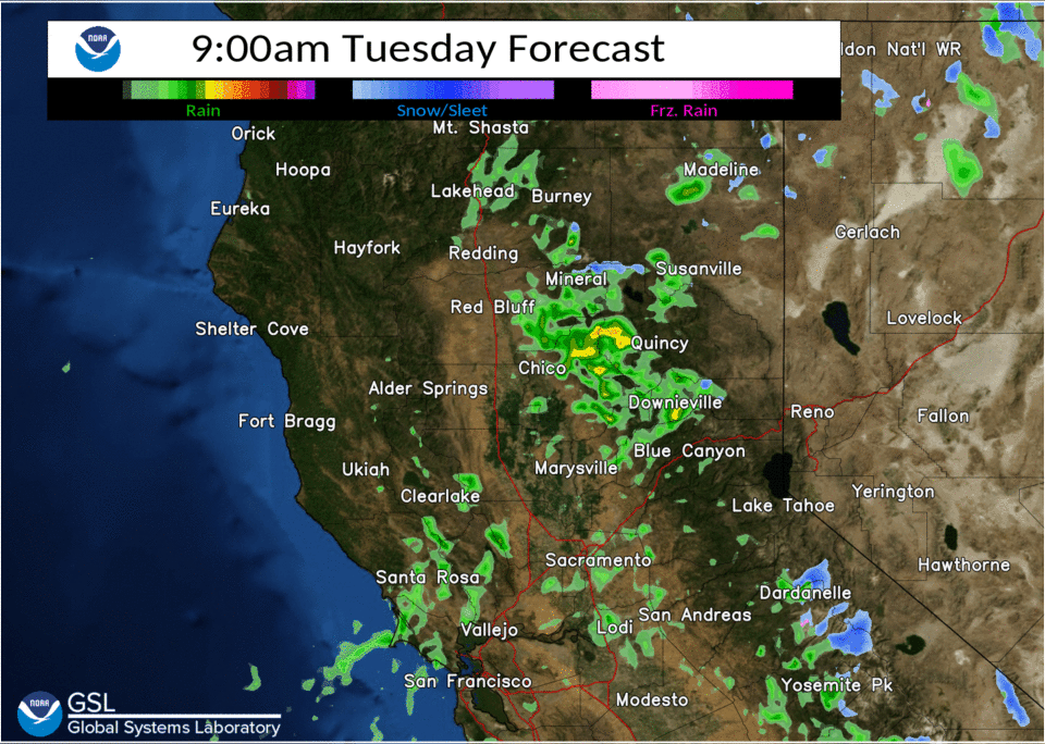
Light scattered showers will continue ahead of this trough passage with them most widespread over the Mountains. By the afternoon the majority of the showers will be gone for lower elevations but will continue in the Mountains through the afternoon.
Snow levels are right around 7000 feet and we still have surface temps near freezing at the passes with some light snow falling. Snow levels should rise above pass level by daybreak. Breezy southerly winds will gradually diminish during the morning into the afternoon.

Dry conditions set in by the overnight as upper level riding builds into the region. A few showers may re-develop over the Shasta County Mountains late in the overnight into Wednesday afternoon as they see weak warm air advection associated with a trough off to the NW. The better forcing will remain to their north and any showers that do develop will be very light.
Fog will be the bigger concern for Wednesday morning across the southern Sacramento Valley into the northern San Joaquin Valley. Some of the fog could be locally dense mainly in the northern San Joaquin Valley. Northern flow will develop Wednesday and that may be enough to limit some of the fog Thursday morning but we still could see some develop in eastern portions of the southern Sacramento and northern portions of the San Joaquin Valley.

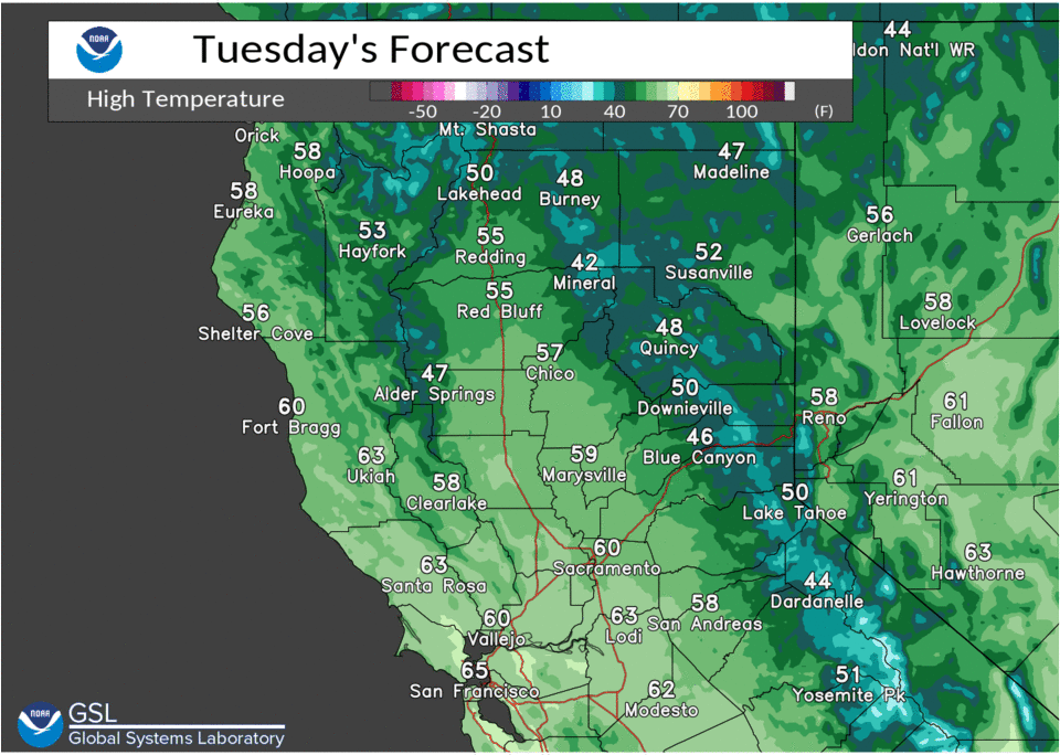
Cool temperature are going to remain in place for today with them running generally 5 to 12 below average. Highs will gradually warm as the ridge builds in with above average highs by Thursday.
Extended Discussion (Saturday through Tuesday)
Dry weather with near to slightly above normal high temperatures forecast over the weekend as upper level ridging moves through. Some morning valley fog may develop. Models differ with depth and progression of next Pacific storm early next week. NBM looks to lean towards wetter EC solution bringing a threat of generally light precipitation over northern third of the CWA Monday night into Tuesday.