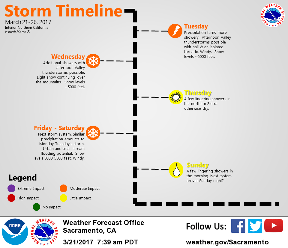
March 21, 2017 – A series of weather systems will bring cooler and more unsettled weather to the region this week. Chance of thunderstorms today with gusty winds and small hail.
Discussion
Upper trough centered off the West Coast with surface cold front approaching the NorCal coast early this morning. Plenty of showers continue across the region with breezy southerly winds and mild temperatures. Current temperatures are in the upper 30s and 40s in the mountains with 50s elsewhere.
Mild airmass lies across the region ahead of the front with radar profilers indicating the snow level is generally around 7-8K feet. Precipitation fell as snow earlier in the night over Donner Pass but has changed back to rain, so little to no travel impacts are expected until around midday when cooler air will begin to make it into the northern Sierra.
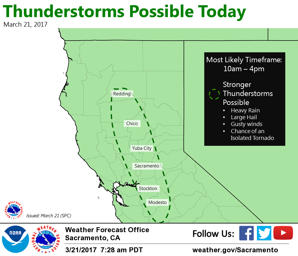
Primary weather concern for today will be extent and severity of deep convection expected to develop in the Central Valley during the midday hours as the short-wave (now inside 130W) moves onshore. Still lots of questions to whether we’ll see a whole lot of clearing this morning allowing for greater destabilization of the boundary layer.
High-res models continue to point toward the 18Z-22Z time-frame as most likely for thunderstorm development from Butte County southward. They also quickly evolve cells to the north of Sacramento into more linear orientation while maintaining more discrete cells across the northern San Joaquin Valley. Primary concern with stronger storms will be copius amounts of small hail along with gusty winds though a brief tornado or two cannot be ruled out, especially over the northern San Joaquin Valley where it looks like the best combo of instability and low-level shear will be present. We’ll continue to monitor.
Showery precip continues tonight and Wednesday as the upper trough moves overhead. Snow will continue in the mountains with snow levels lowering to 4-5K feet. There may be some travel impacts at times through the passes as around 3-6 inches of snowfall accumulation is expected for Donner Pass and Echo Summit.
Short-wave ridging briefly builds in for Thursday with a break in precipitation across most of the area and a bit of sunshine ahead of the next approaching system for the end of the week!
Extended discussion (Saturday through Tuesday)
Stormy pattern expected to continue next weekend as an upper trough slides across the region. Temperatures will be about 5 to 10 degrees below normal with Valley rain and snow for elevations above 3500 feet. An upper level ridge will build on Monday, which will bring a return of mostly dry weather for the valley and warming temperatures. Chances for rain are possible Monday for the higher terrain.