March 6, 2017 – Cool and unsettled weather continues early this week, then drier and milder weather returns mid-week.
Winter Storm Warning until 4 PM this afternoon for Clear Lake/Southern Lake County-Motherlode-West Slope Northern Sierra Nevada.
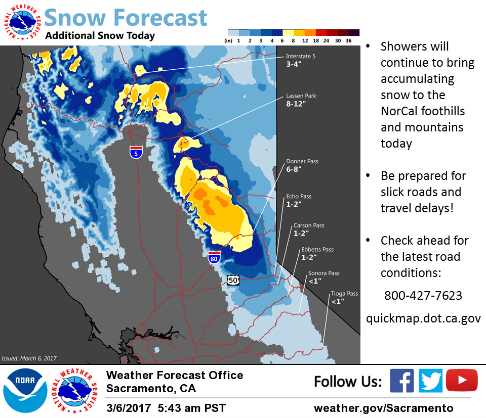
Discussion
Cool northwesterly flow continues across NorCal on the backside of the large upper trough moving across the West. Radar indicates numerous snow showers continuing across the northern Sierra Nevada while showers are more scattered elsewhere early this morning. Temperatures are cooler compared to 24 hours ago and generally range from the teens and 20s in the mountains to the mid 30s to lower 40s elsewhere.
Snow showers will continue this morning in the northern Sierra before tapering somewhat this afternoon as lapse rates decrease. Another foot or so of snowfall accumulation will be possible in some areas by this evening, and travel impacts will continue.
Shower chances will continue for the rest of region as well today and temperatures will remain well-below average with low snow levels (1000-2000 feet).
Ridging from the eastern Pacific will help to further taper showers by Tuesday with the best chances retreating to the northern mountains. Enough moisture forecast to continue flowing across the region through mid-week to keep a chance of showers across the far northern portion of the state, but the remainder of interior NorCal will dry out and see temperatures moderate back to around average for early March on Wednesday and Thursday.
Extended discussion (Friday through Monday)
A series of Atmospheric Rivers will pass through the Pacific Northwest late this week into the weekend. Forecast confidence isn’t high, but at this stage it looks like the bulk of the moisture will pass to our north, though periods of lighter precipitation will be possible through this timeframe. The GFS does bring a moderate storm system through the region early next week, but neither the ECMWF nor Canadian bring the wave this far south.
With the forecast trend lately pushing the storm track northward, we’ve warmed up our temperature forecast through the extended period as well.