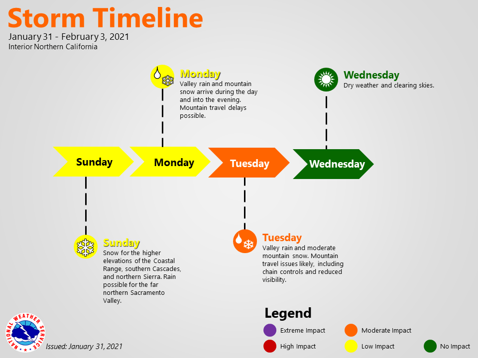
January 31, 2021 – Light to moderate showers possible today across the northern Sacramento Valley and northern mountains. A winter storm is forecast to impact NorCal late Monday into Tuesday night. Dry weather should return by Thursday and continue through the weekend with periods of increased north to east winds.
Discussion
Radar imagery this morning shows showers across northwest CA and the northern Bay Area. There remains a slight chance for an isolated shower in the southern Sacramento Valley area this morning; however, most showers tend to fall apart as they get close to the Valley.
Expect most areas to remain dry today with the exception being the the Coastal Range, southern Cascades, and far northern portion of the Sacramento Valley. Rain and mountain snow showers will be possible throughout the day for these areas, with chances dwindling for a bit as we head into Monday.
The question will be for how long as models have been delaying the arrival of the trough. Latest guidance has the trough sliding in late Monday to Monday night with widespread precip expected by Tuesday.
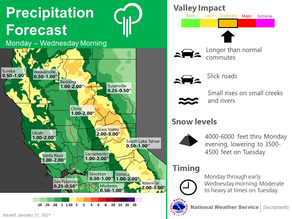
Confidence has lowered on the timing and placement of this trough as the latest ensemble and model guidance has the trough digging slightly farther to the south. Ended up adjusting the Winter Storm Watch again to reflect a start time of 8Z (midnight) Tue – 14Z (6am) Wed. QPF amounts are similar to yesterday afternoon’s package with Valley QPF around 0.5 to 1.25 inches with up to 1.5 to 2.5 inches in the foothills.
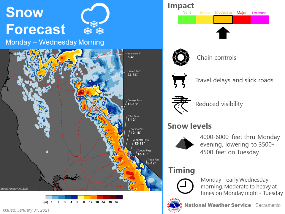
Forecasted snow amounts are still around 1 to 2 feet for elevations above 5500 to 6000 feet in the northern Sierra Nevada, but localized amounts up to 3 feet are only possible around Lassen NP.
Finally, breezy southerly winds are also possible with this storm, with gusts up to around 20 to 30 mph in the Valley, up to 40 to 50 mph in wind prone areas in the mountains.
Extended discussion (Thursday through Sunday)
GEFS and EC ensemble in agreement that NorCal will be downstream from an amplified ridge centered over the eastern Pacific late this week and next weekend.
The result will be a return to dry weather with mild daytime temperatures and cool nights. Locally breezy north to east winds will be possible at times.