May 13, 2021 – Slightly cooler today as onshore flow returns. Cooling trend continues into the weekend, but warmer temperatures are in store for Sunday. Scattered showers and thunderstorms are possible Friday into the weekend, mainly over the mountains as a low pressure system moves over the region.
Discussion
About 2 to 6 degrees of cooling at 09z-10z in our CWA, except in the far Nrn Sac Vly and mtns as a weak, subtle upper air feature approached the CA coast weakening the strong subsidence from yesterday. The Delta Breeze increased from 24 hrs ago with gusts over 30 mph through the Strait. This temp trend is expected to continue today with the greatest cooling in Solano Co where KSUU could be 10 degrees cooler than yesterday.
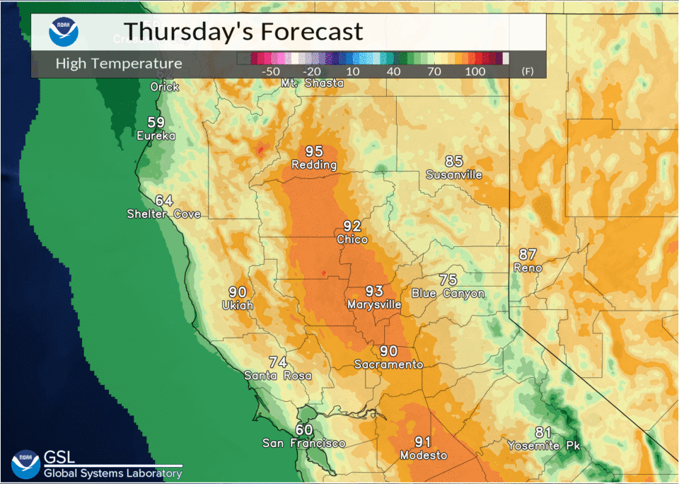
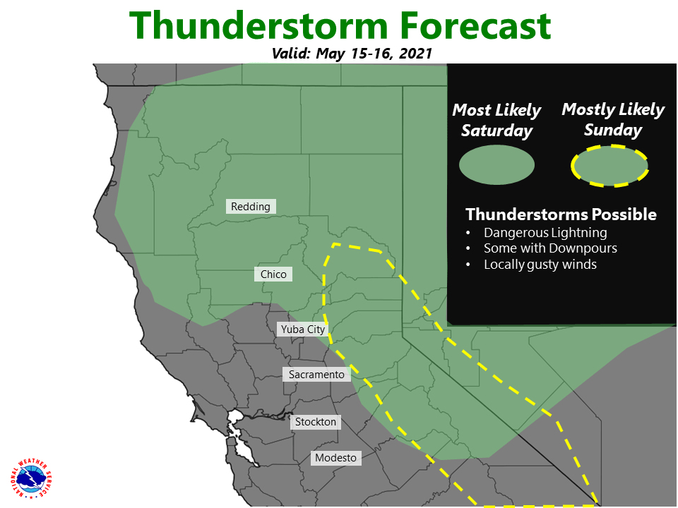
Additional cooling is forecast on Fri as a trof over the Pac NW affects the region. This trof eventually forms a closed low which tracks along the coast (GFS) or just inland (ECMWF) on Sat, bringing additional cooling and scattered showers/storms to our CWA before dropping into the srn half of CA on Sun. Warmer temps expected on Sun as the low drops south of our area.
Moisture profiles and instability progs indicate the best chance of convection on Fri/Fri nite will be over the Trinity mtns/coastal mtns (mostly Shasta Co) with the approaching trof, and then more widespread over the Sierra and possibly foothills Sat/Sat night, then mainly over the Sierra south of the I-80 corridor on Sun as the closed low drops south of our area. Looks as if the CONSRAW PoPs may have a better handle on the coverage and probability of precip than many of the other PoP guidance products.
A narrow band of 1+ inch precipitable water values is forecast to be drawn into the circulation of the closed low Sat/Sat night with the mean of the NCEP QPF SREF plumes for the various mtn sites indicating about a third to a half inch, suggesting the potential of some “wet” showers/storms. This is in conjunction with the moisture profiles indicating substantially deeper moisture later in the weekend which also lessens the downdraft potential.

Extended discussion (Monday through Thursday)
A cool closed upper low is projected to move across SoCal Sunday. Ensembles suggest some uncertainty in the exact track of the core of the low, which could affect where potential wrap around showers and isolated thunderstorms develop on Sunday. Current forecast projects best confidence for Sunday afternoon over the Sierra Nevada from around Downieville southward. Models also differ with the progression rate of low.
Some isolated showers and thunderstorms are possible over Alpine County and far eastern Tuolumne County Monday afternoon before the system entirely exits the region. Dry weather is then expected except for a slight chance over norther Shasta County, where ensembles hint at a weak system brushing by to the north.
High temperatures continue to trend down Sunday into Tuesday, remaining near to slightly above normal, then begin a slight trend upward again Wednesday.