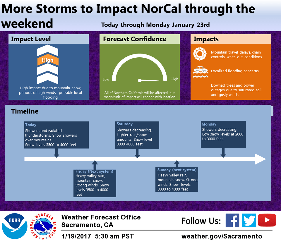
January 19, 2017 – A series of winter storms will move through NorCal through Monday. Mountain travel impacts are likely due to snow and winds. Moderate to heavy rain at the lower elevations with windy conditions.
Discussion
Upper trough moving through NorCal this morning producing numerous showers. Most intense showers now occurring from the Sacramento area northeastward into the foothills with isolated thunderstorms. Some of these thunderstorms may have become briefly severe.
Showers will continue today with the most instability over the valley from about Marysville southward and have included a threat of thunderstorms here today.
Snow levels remain fairly low at around 3500 feet over Shasta County to about 4000 feet northern Sierra so have kept snow advisory for coast range, Shasta mountains and Sierra Cascade range today.
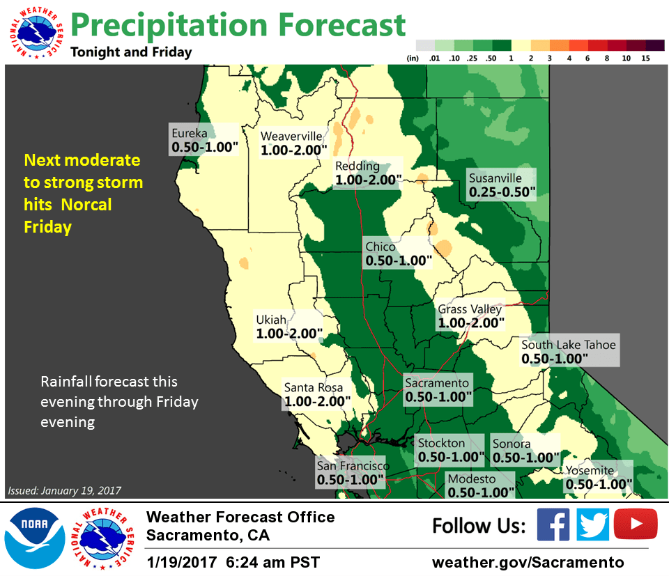
Next Pacific frontal system still poised to move into NorCal Friday morning. Moderate amounts of precipitation are expected with this system and with relatively low snow levels predicted, combined with expected gusty winds have kept winter weather advisory over the coast range and Shasta mountains and bumped up advisory to a warning over the Sierra Cascade range. Strongest winds appear to occur around mid day Friday and may top advisory criteria in the central valley.
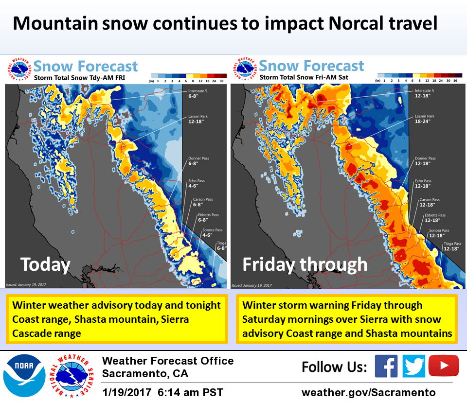
Shower activity continues on Saturday under a fairly flat ridge with enough snowfall over the Sierra to continue the winter storm warning there. Should see a brief decrease in showers Saturday afternoon but next system already moving onto the coast Saturday night.
Snowfall rates will begin picking up again late Saturday night with one to two feet of new snow likely over the Sierra Sunday. This system will bring another round of heavy precip and wind through the day Sunday. At this time the tightest wind gradients appear will occur around mid day so expect strongest winds then.
Extended discussion (Monday through Thursday)
Transition to amplified upper air pattern forecast for next week expected to give a break in precipitation to the region beginning Tuesday. Until then, lingering upper trough will continue showers across the region on Monday with accumulating snowfall likely across the foothills and higher terrain.