May 31, 2017 – A weak system will move through the interior today to bring light amounts of rain and cooler temperatures. Dry and warmer for the remainder of the week. Isolated showers and thunderstorms over the northern mountains Sunday followed by gusty northerly winds early next week in the valley.
Discussion (Today through Friday)
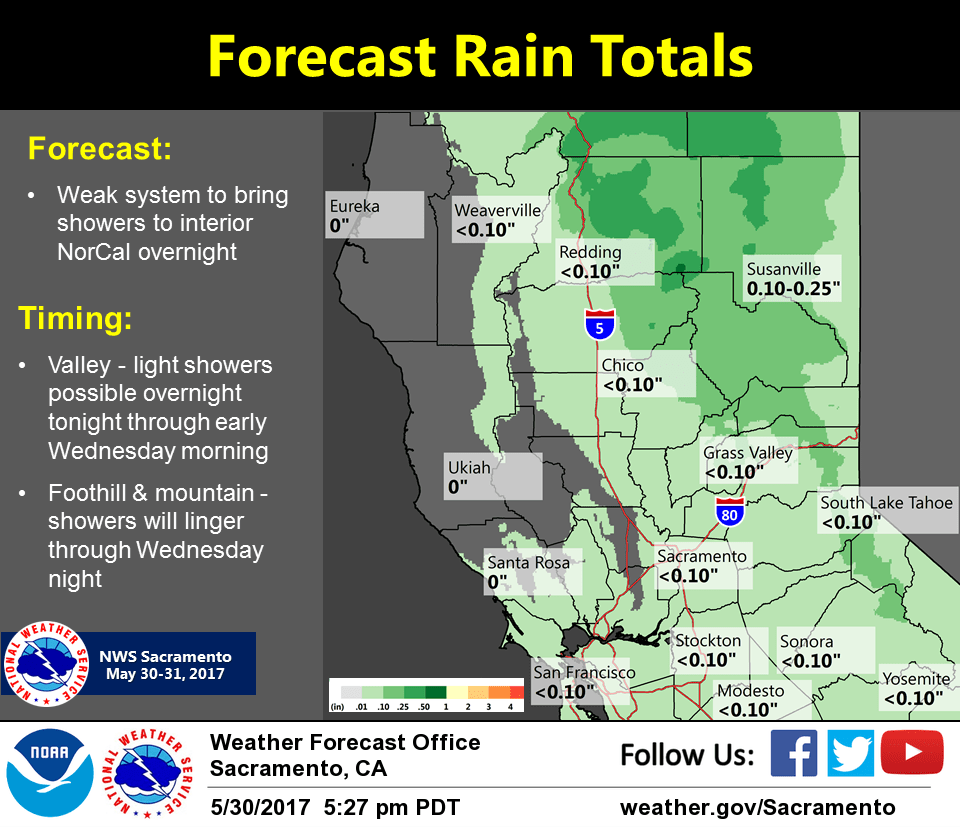
A weak trough is moving through the interior mainly this morning. Light amounts of rain are expected for the valley with accumulating amounts less than a tenth of an inch for most areas with some local amounts between a quarter to a half an inch over the northern Sacramento valley and mountains. Some showers may linger this afternoon in the foothills and mountains before ending. Cooling for all areas will continue today with today being the coolest day of the week.
Thursday and Friday the region will be under a dry zonal flow pattern and temperatures will warm back to normal or slightly above normal for the interior. A trough will develop along the west coast on Saturday and the interior will remain dry with little change in temperatures.
Extended discussion (Sunday through Wednesday)
A weak shortwave moves through Sunday and may bring some showers or isolated thunderstorms to the northern mountains. The low will move over the Great Basin Sunday night through Tuesday before moving east. Gusty northerly winds may develop over the valley during this time period. Temperatures will become a little above normal for this time of year but remain pleasant. By Wednesday the flow pattern reverses as weak ridging develops over the region.