January 9, 2017 – A relative break today as precipitation turns more showery and snow levels lower. The next storm begins to affect the region tonight with increasing wind and precipitation into mid-week. A prolonged period of heavy snow is expected in the northern Sierra.
Flood Watch through Tuesday afternoon, High Wind Watch from Tuesday afternoon through Tuesday evening.
Discussion
Break for most of the valley now as the finale of this latest round moved across the northern San Joaquin Valley into the southern Motherlode early this morning with a line of heavy showers and embedded thunderstorms. Small rivers and streams continue to run high with flooding in some areas as runoff works its way through the system. A variety of flood warnings and watches remain in effect.
In the northern Sierra, there is no break. Precipitation is not as heavy and is more showery, and snow levels have come back down below the pass levels. Upslope flow will be enough for 5-10 inches of accumulation today with travel impacts becoming more likely across the trans-Sierra passes as the day progresses. Winter storm warning remains in effect.
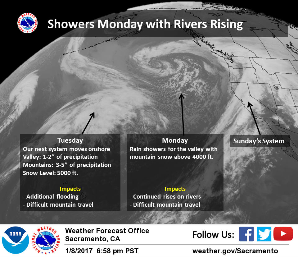
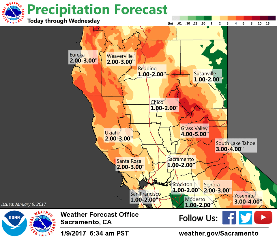
Precip will be on the upswing across NorCal again by tonight, especially over the foothills and mountains while the Sacramento Valley may be shadowed. Wind and precip will increase across the entire region Tuesday and Tuesday night as the next deep moisture plume interacts with a frontal system moving in. At this point, levels on small rivers and streams will likely trend upward again.
Additional QPF of an inch or two can be expected in the Valley with 4-8 inches in the foothills and mountains by early Thursday. Several feet of snowfall accumulation will be possible down to around 4500 feet elevation with 5 feet or more possible along the northern Sierra Crest.
It’s also looking like there will be potential for some strong winds across the region later Tuesday afternoon through Tuesday evening as a deep surface low (below 990 mbs) moves into SW Oregon. Depending on the track and depth of the surface low, strong to very strong southerly winds will be possible through the Sacramento Valley Tuesday evening with the potential for more widespread tree damage and power outages. Given some uncertainty, have opted for a high wind watch at this time.
Precip turns more showery again later Tuesday night and Wednesday with much of the area forecast to begin drying out again by later Thursday.
Extended discussion (Friday through Monday)
Models trending toward a drier wx pattern on Fri as the closed upper low drops Swd across Socal and into the Desert SW. Cyclonic flow around the low will bank up clouds on the E side of the Sierra Crest and some clouds and snow showers could spill over the crest and into our CWA mainly in the morning, and mainly S of the 80/50 corridor. Otherwise, partial clearing on Fri could result in some patchy dense morning fog with light Nly low level flow in the Valley.
For next weekend and into next Mon, the models differ on the amplitude (strength) of a positively-tilted ridge moving into the Wrn states. Generally, the GFS shows less amplitude and spreads the precip farther S than the ECMWF and into portions of our CWA on Sat and again on Mon. Have continued PoPs for those two days due to these positively-tilted ridges being susceptible to WAA precip.
Although there will be cold overnite mins early in the period especially in the colder Sierra basins, a warming trend is expected as the ridge axis shifts inland.