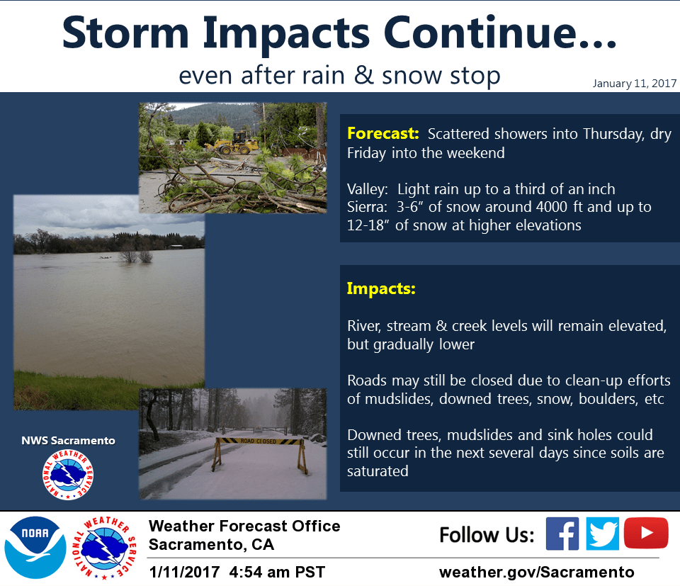
January 11, 2017 – Severe Pacific storm beginning to wind down across the region, however showers and a few thunderstorms will continue into Thursday with additional flood concerns and mountain snow. Drier weather expected Friday into the weekend.
Blizzard Warning until noon today for West Slope Northern Sierra Nevada.
Discussion
Plenty of river and stream flooding continues across interior NorCal early this morning along with snow in the mountains. Precipitation has become more showery overnight and winds have decreased as the frontal zone and deeper moisture has shifted south into the southern half of the state.
Snow will continue across the northern Sierra today, but will not be as heavy as Tuesday. Strong southwesterly winds are expected to decrease by this afternoon and weather conditions over the mountains will improve a bit. Another 12-18 inches of snowfall will be possible by Thursday.
At the lower elevations, scattered showers along with a few thunderstorms will continue today.
The next wave which is presently out near 40N/140W will move into the region late tonight and Thursday bringing another round of showers, mainly to areas along and south of I-80.
Drier weather is expected across the region Friday into the weekend as ridging from the eastern Pacific extends into NorCal.
Extended discussion (Sunday through Wednesday)
Fair dry conditions expected Sunday under upper level ridging and dry northerly flow. Night and morning patchy fog will be possible in the lighter wind valley areas from about Sacramento southward.
Daytime highs Sunday should come in around normal. Dry weather continues into Monday under upper ridge but some high cloud cover may begin to spill over it and over Norcal ahead of the next Pacific frontal system. This system is forecast by extended models to move into Norcal next Tuesday bringing a threat of precipitation to the northern portion of the forecast area.
Current projections bring main frontal band into the north state on Wednesday with at least a chance of precipitation over the entire CWA. This system is still a week out but current projections indicate that this will be a moderately strong system with breezy winds and fairly high snow levels.