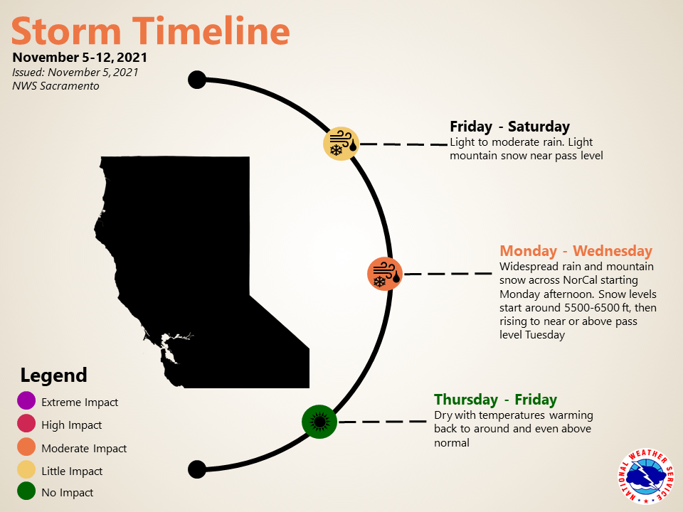
November 5, 2021 – Patchy fog this morning in the valley otherwise mostly dry across the area through most of the day before another weather system brings rain and high elevation snow showers. A wetter weather system is forecast early next week, bringing widespread rain and mountain snow.
Discussion
Clear skies and light winds will allow for some patchy fog to develop from around Marysville south this morning otherwise an approaching weak disturbance will be increasing clouds during the day helping to cool temperatures. Clouds will be thicker over the north where the greatest cooling is expected.
Two weak disturbances will move through the area each bringing minimal amounts of rain or high elevation snow to parts of the region. The first late today and tonight followed by a second one Saturday and Saturday night.
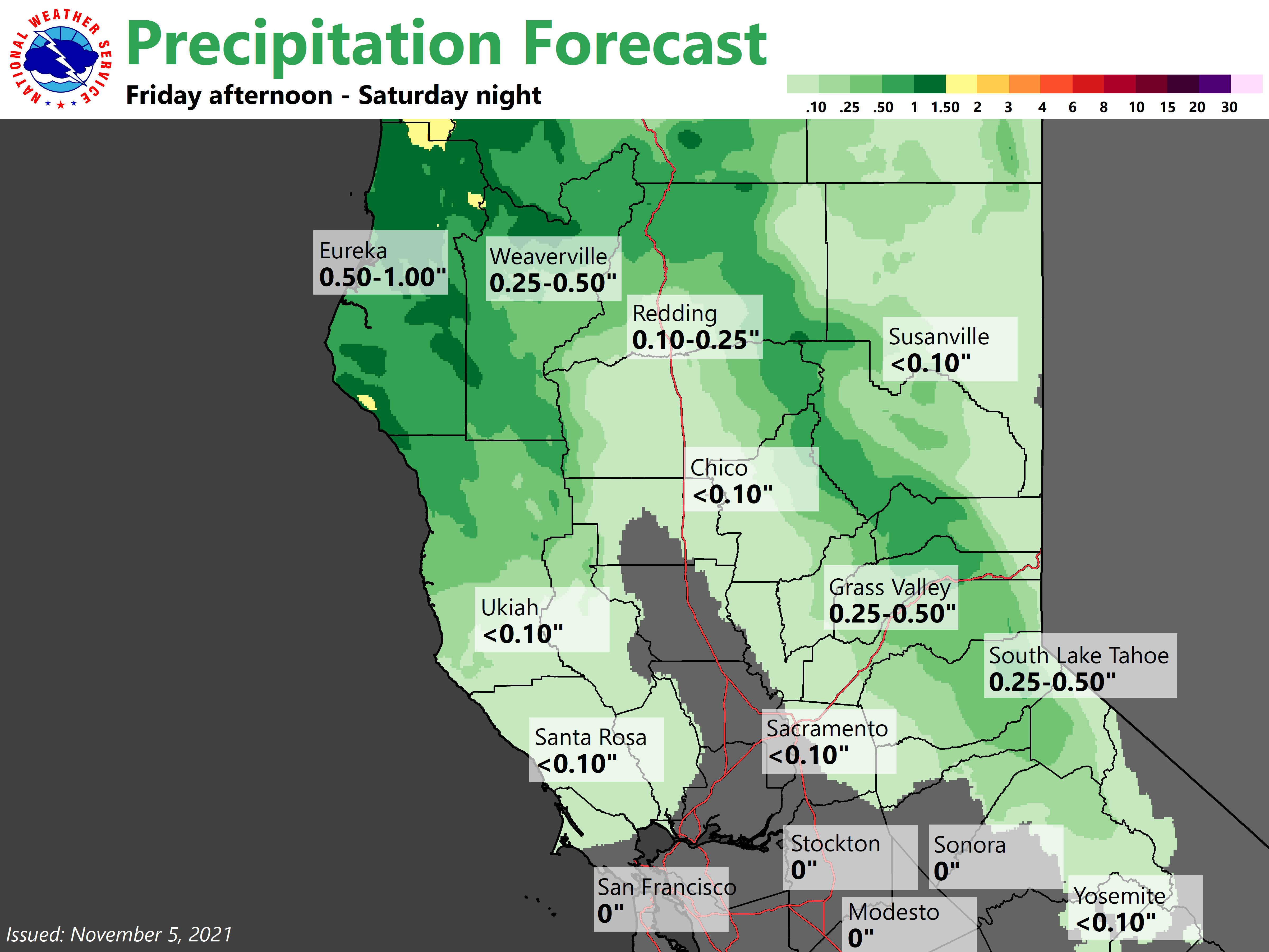
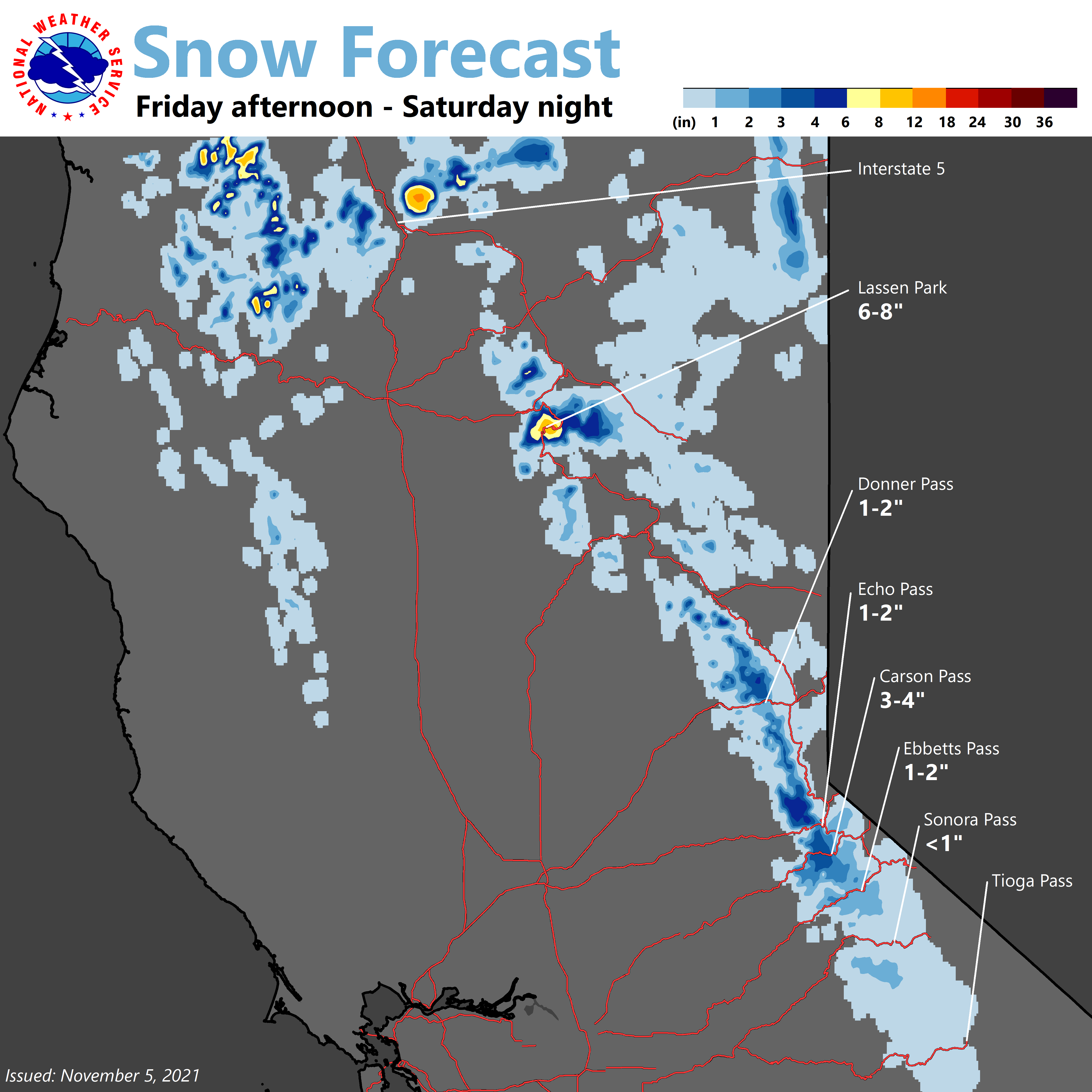
Snow levels will continue to be high but may lower to around pass levels along I-80 to bring minimal amounts of snowfall (less than an inch). Any valley precipitation looks to remain north of the Sacramento region but may bring some mountain showers much further south to Tuolumne county Saturday night.
Zonal flow over the Pacific and a dry through over California will set up for Sunday into Monday. Maybe a couple of isolated high elevation mountain showers but otherwise dry during this time period. Monday afternoon and Monday night is when the next decent system will spread over the region.
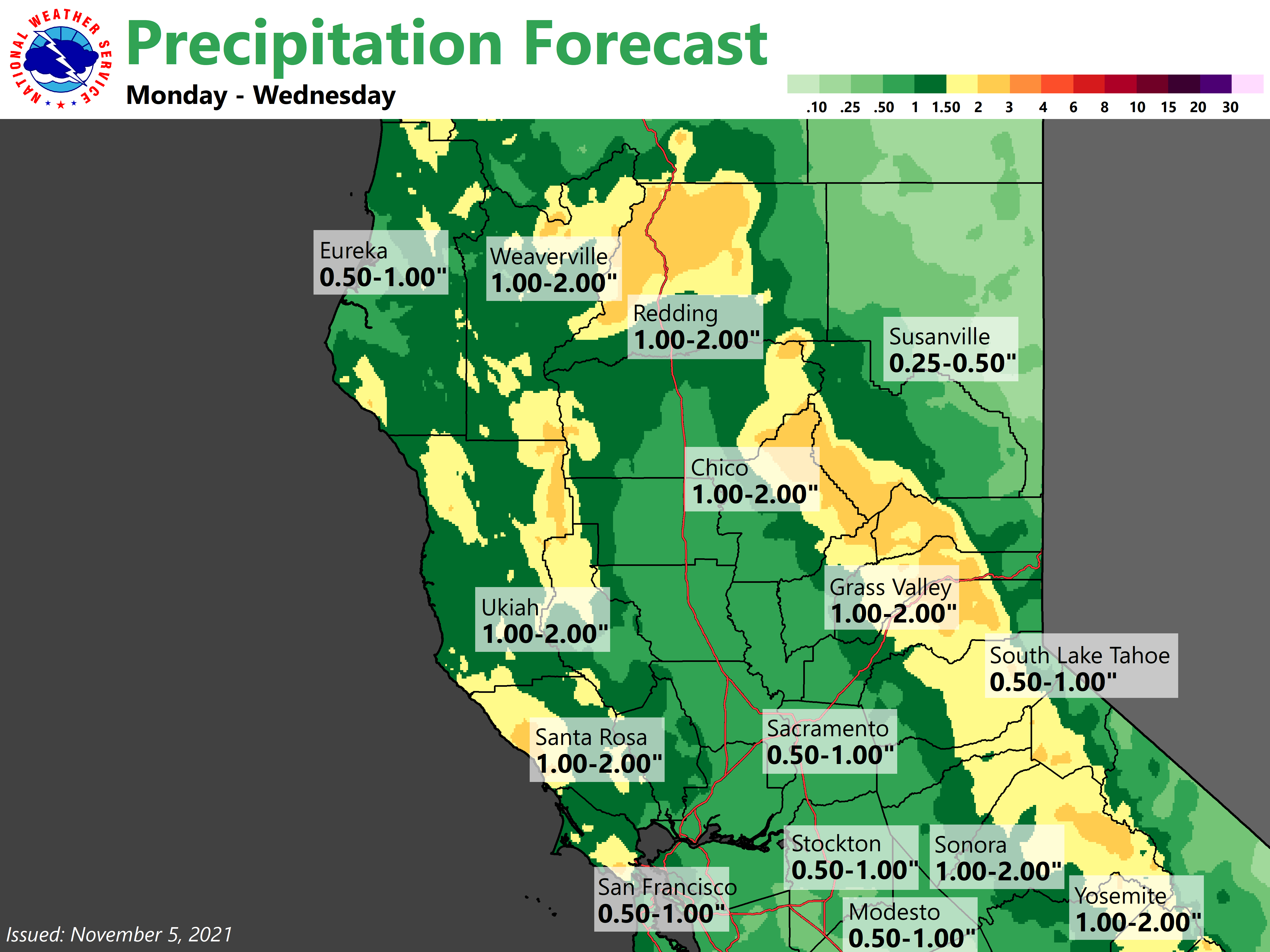
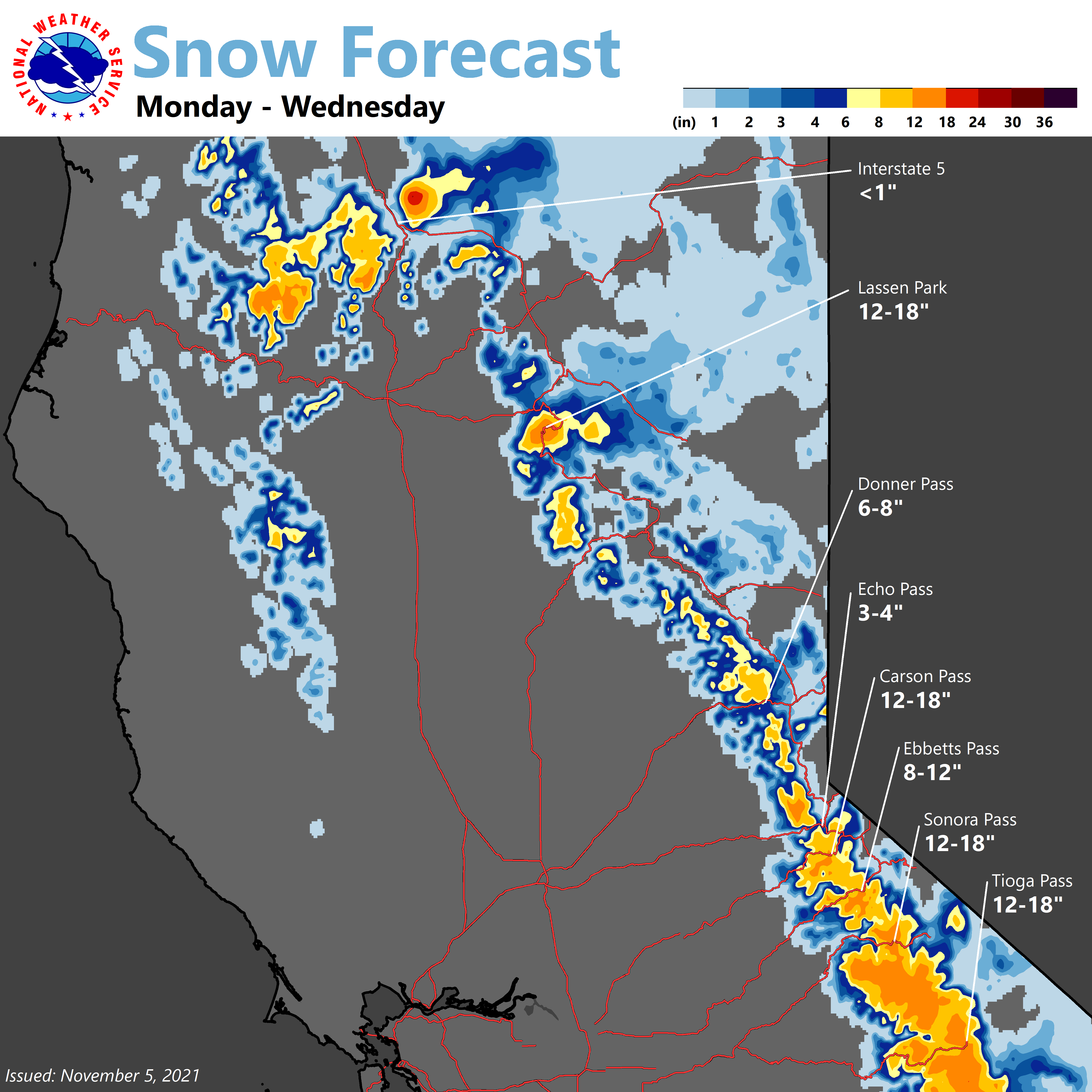
Models today look much wetter than yesterday’s model runs. Snowfall looks like it will create some mountain travel issues mainly starting Monday night at this time. Breezy to windy conditions look possible Monday afternoon and Monday night.
Extended Discussion (Tuesday through Friday)
The trough will remain over the region into Wednesday and rain and mountain snow for the foothills and mountains have a good chance of continuing into Wednesday. Models are mixed late Tuesday and Wednesday with amounts of precipitation over the region.
Valley will likely see periods of dry conditions late Tuesday and Wednesday but shower chances will continue. Thursday a ridge will be building over the region and continue for Friday bringing dry conditions and warmer temperatures.