May 26, 2021 – Dry weather with temperatures near or above average through the week. Hot conditions will develop early next week.
Discussion
A few high clouds are moving into the region from northwest California, but overall good lunar eclipse viewing conditions with mostly clear skies early this morning. Current temperatures are running up to 10 degrees cooler compared to 24 hours ago and range from the 30s in the mountain valleys, to the mid 50s to mid 60s across the Central Valley.
Dry weather with minor ups and downs in temperature expected through the remainder of the week as transient short-wave ridges and troughs pass through the area.
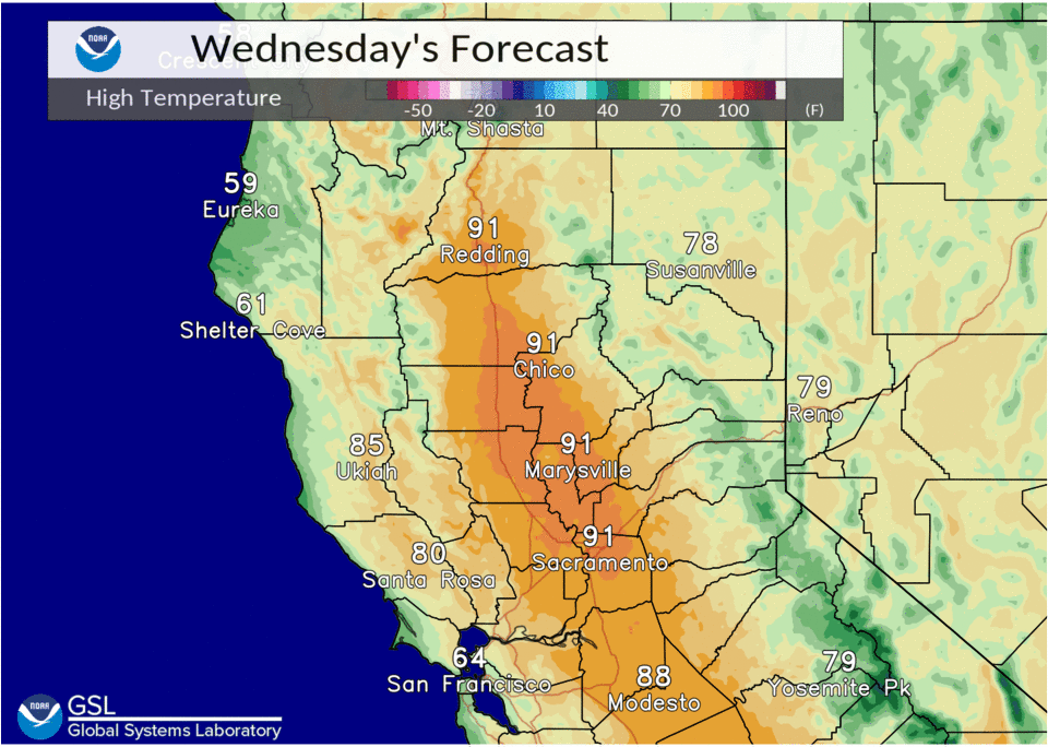
Slightly warmer temperatures are expected today as highs climb into the lower 90s across the Central Valley. Another minor cool down is expected Thursday as a trough passes to the north through the PacNW.
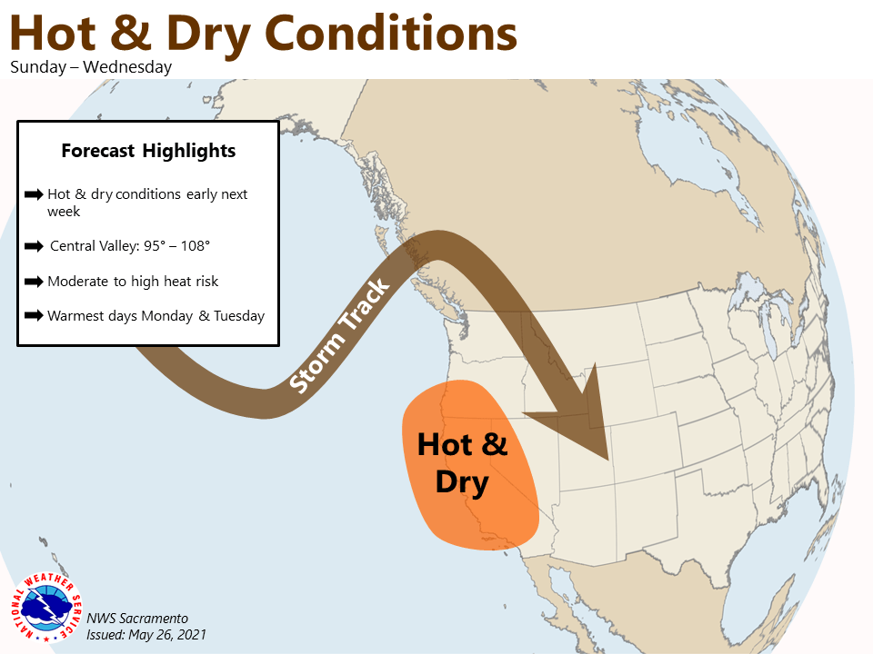
Major warmup holds off until early next week (see extended discussion for details).
Extended discussion (Sunday through Wednesday)
Models have trended weaker and more progressive with the short wave trough progged to move through CA over the weekend. Forecast now looks dry for deep moist convection potential over our portion of the Sierra Nevada.

Anomalous strong EPAC upper ridging progged into the CWA early next week. This will result in significant AMS warming with triple digit heat forecast in portions of the Central Valley. Ridge axis shifts inland over the area Tuesday which has the potential for some record heat for this time of year. Ensemble solutions differ with how progressive the ridge will be which results in forecast uncertainty at this time with how long the heat wave will persist next week.