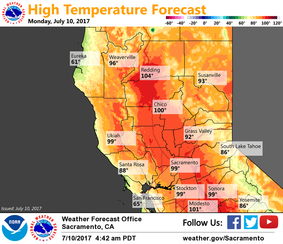
July 10, 2017 – Not quite as hot through mid-week then hotter again beginning late in the week.
Discussion
Clear skies across interior NorCal early this morning. Temperatures are a little cooler across most of the area compared to 24 hours ago and generally range from the mid 40s to mid 50s in the mountain valleys to the 60s to mid 70s elsewhere.
Hot and dry weather continues this week, but it is not expected to be as hot as late last week and over the weekend. A weak upper trough is forecast to linger through mid-week providing a little synoptic cooling and allowing the Delta Breeze to return and provide some relief to portions of the valley – satellite imagery is already showing stratus attempting to fill-in along the coast.
Thunderstorm chances are expected to remain south of Lake Tahoe in the Sierra through mid-week as monsoonal moisture will find it difficult to make it further north than central California.
Extended discussion (Friday through Monday)
The strong upper level Four-Corners ridge expands westward in the extended with a return of the triple digit heat that will likely put much of interior NorCal into the moderate heat risk category with a sprinkling of high risk. Afternoon temperatures will be around 10 degrees above normal while the overnight lows will be 5 to 8 degrees above normal.