Isolated mountain thunderstorms near the Sierra Crest and east of the Crest each afternoon and evening into the weekend. Otherwise quiet and warm.

Discussion
Overall we are not going to see much in the way of a change in the weather pattern for today. A deep marine layer has pushed inland over the Bay area this morning and the main question this morning is if some of that will push east into the Sacramento Valley.
Currently the main thing holding it back is the depth of the marine layer, currently around 2000 feet. Usually need it to be at least 2500 feet to push into the Valley. If we see it deepen to around 2500 feet by daybreak some patchy stratus can be expected into the Sacramento Valley mainly along the east side of the Valley but may expand slightly to the NNW. Any status that develops will dissipate by the mid morning.
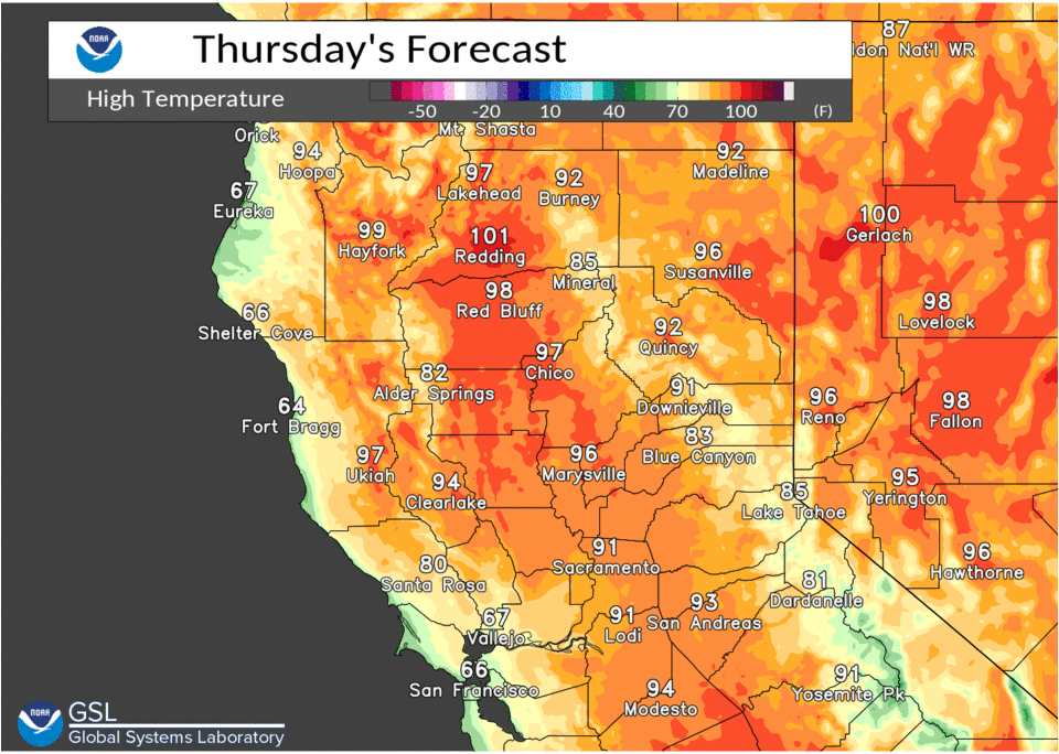
With the onshore flow, strong flow through the Delta and lower heights due to a trough in the PacNW we will see daytime highs a few degrees cooler today compared to yesterday. As we head into the weekend flow over the PacNW will become more zonal allowing the desert SW ridge to build back into NorCal. This will bring warming temperatures over the weekend but warming will be limited in the Delta influenced regions as onshore flow will continue.
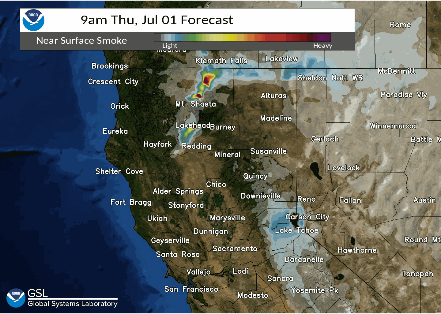
Afternoon and evening convection will be the other concern for the short term. The desert SW high has pushed moisture north into the region and that has been bringing afternoon and evening thunderstorms to the mountains, that is going to continue for today and at least through Saturday. Synoptic forcing will be limited and thunderstorms will mainly be driven by topography. The best chances for storms will be in areas of uncapped CAPE which today should be limited to mainly the Sierra crest and east from about I-80 south.

The thunderstorm threat will expand north some on Friday but once again limited to mainly the Sierra crest and east. Upper level flow will be weak and with PWATS in the 0.50-1.0″ range, heavy rain can be expected with any thunderstorms along with maybe some small hail.
As we head into Sunday the upper level ridge will begin to push back to the east and flow will become a bit more westerly, this will limit the CAPE and moisture and thunderstorm chances are looking low.
Extended discussion (Monday through Thursday)
Ensembles and clusters favor a broad upper level ridge over much of the Western United States early next week with southwesterly flow aloft. Some varying solutions depicted in the clusters with respect to an approaching trough to the Pacific Northwest in the Tuesday-Wednesday timeframe, generally favored more in the American ensembles than the European and Canadian. Very limited precipitation chances in the extended with any shower/thunderstorm potential limited to the Sierra crest and points east. Expect temperatures to be generally near normal in/around the Delta, and upwards of 5 to 10 degrees above normal for locations outside the Delta’s influence.