August 19, 2016 – Mainly dry conditions with warm temperatures slowly cooling to near normal by early next week. Isolated Sierra thunderstorms through early next week.
Discussion
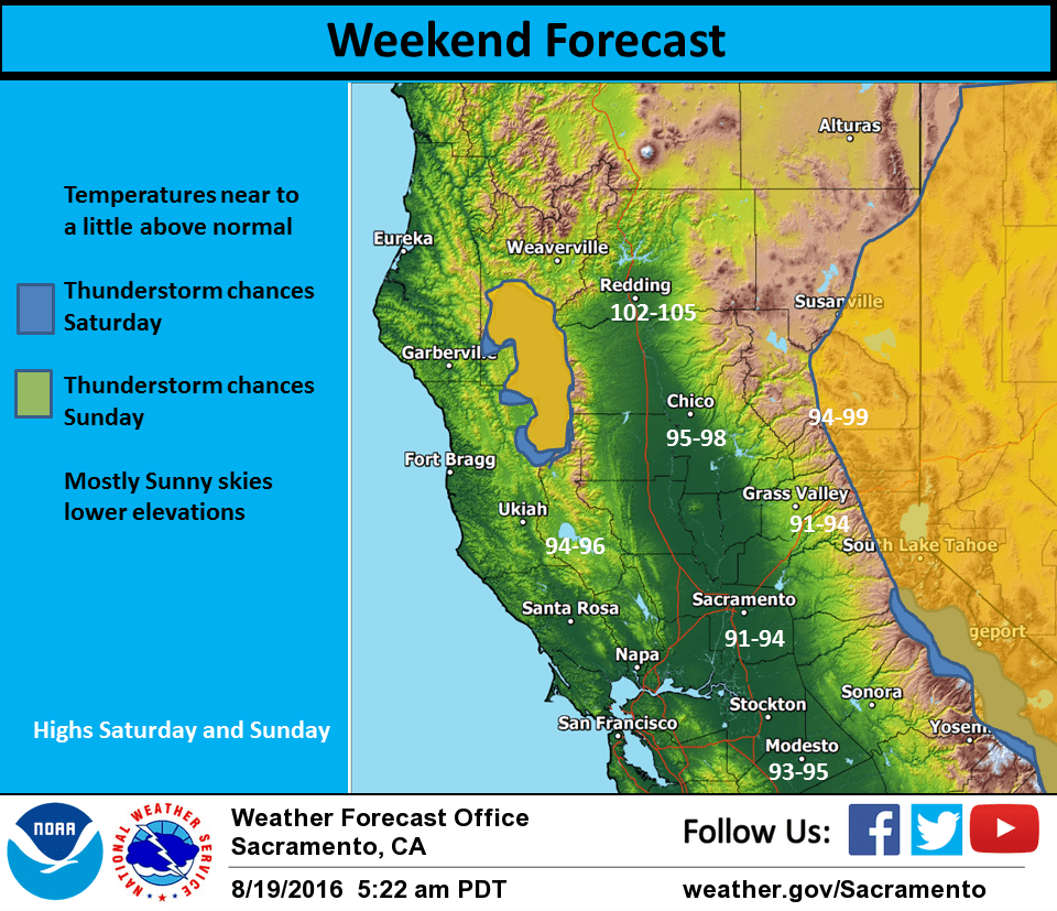
Northern California currently under upper level northeast flow between high pressure over the Pacific Northwest and a low pressure system off the Socal coast. Temperatures today should come in similar to Thursdays under a similar airmass. A shift of the upper low slightly farther south today should shift Sierra thunderstorm activity a bit south as well.
As a result, any afternoon Sierra showers or thunderstorms should remain south of interstate 80. Only minor changes in the overall weather pattern are expected Saturday. A few afternoon thunderstorms will be possible south of Tahoe again with most places seeing a slight cooling although daytime highs will remain slightly above normal.
A weak upper level trough is forecast to approach the Pacific Northwest coast on Sunday. Onshore flow and a continued moderate Delta breeze will bring down daytime highs a bit more topping out just above normal for mid August. The afternoon thunderstorm threat will again shift northward but an upper west flow will likely keep any thunderstorms near the crest. Temperatures cool a bit more on Monday as the upper trough passes to the north with enough instability for Sierra crest thunderstorms.
Extended discussion (Tuesday through Friday)
Broad upper troughing lingers over the Great Basin while weak ridging develops over the west coast. Any thunderstorm activity associated with the trough should stay out of our forecast area, east of the Sierra crest Tuesday. Daytime highs will remain near to slightly above normal during the extended forecast. Expect a very subtle warming trend for interior NorCal from Tuesday through Thursday with dry conditions.