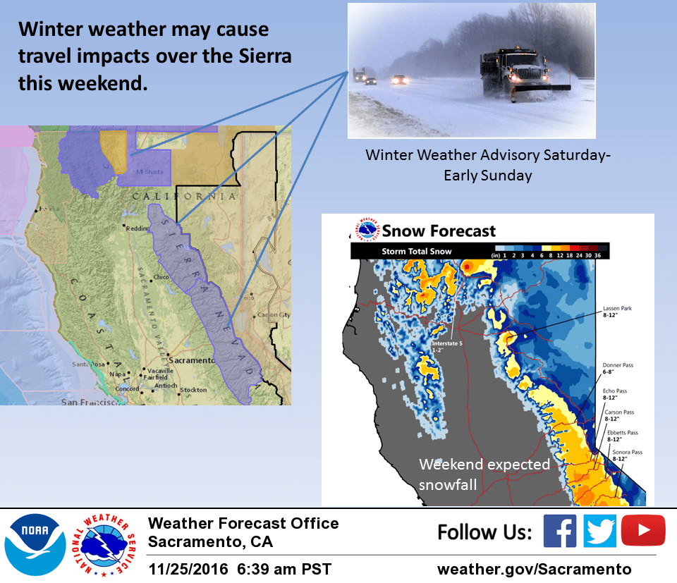
November 25, 2016 – Precipitation begins today for the northern valley and mountains and will spread to the southern valley and Sierra on Saturday. Heavy snow will be possible over the higher elevations of the Sierra Cascade crest Saturday into Sunday and will likely impact some holiday weekend travel. Showers are expected Monday with a break in precipitation most areas on Tuesday.
Discussion
A Pacific frontal band now moving into the northwest corner of the state is bringing light precipitation there this morning. This precipitation will move southward during the day and likely bring light precipitation as far south as the northern or central Sacramento valley. This frontal band is now predicted to stall out over the northwest corner of the state in advance of a Pacific trough forecast to approach the coast tonight and early Saturday. Precipitation today should remain fairly light except western Shasta county which could accumulate some moderate rain or higher elevation snowfall.
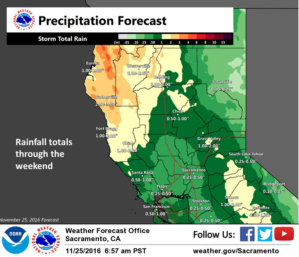
The offshore trough will push into Northern California early Saturday but is forecast to split as it does so. Models are now in fairly good agreement in pivoting the southern portion of the trough through Norcal during the day Saturday.
The heaviest precipitation is predicted to occur over the Sierra Cascade range and with snow levels around 4000 feet will likely have travel impacts on holiday weekend travel. Have therefore issued a snow advisory for Saturday over the Sierra Cascade range. The northern portion of the Pacific trough is forecast to dig into the Great Basin on Sunday keeping precipitation going over the Sierra Cascade range through Sunday morning. As this portion of the trough digs into the Great Basin, northwest flow aloft will bring a decrease in precipitation Sunday afternoon. This break will be short lived however before another disturbance dropping out of the Gulf of Alaska brings another round of light precipitation on Monday. Daytime temperatures throughout the short term period are expected to remain a few to several degrees below normal.
Extended discussion (Tuesday through Friday)
Upper ridge builds on Tuesday resulting in north-northeasterly winds, dry conditions and near normal temperatures across interior NorCal. The ECMWF and GFS models show an upper trough moving into the Pacific Northwest next Wednesday. Precipitation will mainly be over the mountains with a slight chance possible in portions of the valley. By Thursday, the models disagree on the synoptic pattern over NorCal. The ECMWF has the storm lingering in our region while the GFS pushes the storm more eastward with high pressure along the west coast. Have kept mostly dry conditions for Thursday into Friday except for some slight chances over portions of the mountains. Temperatures will remain near to a few degrees below normal through next Thursday.