February 27, 2017 – Showers linger into early Tuesday, then extended period of dry weather starts by the middle of the week.
Discussion
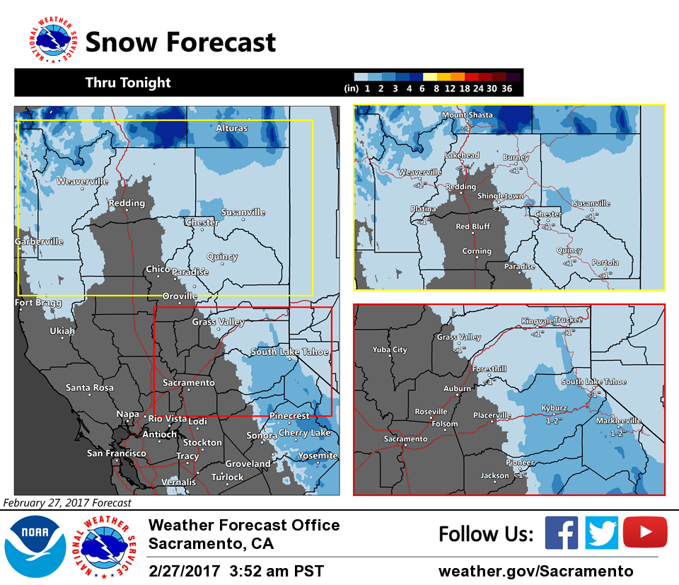
Satellite imagery depicts cold upper trof moving across NorCal early this morning. Scattered showers continue across the southeastern half of the forecast area with the most numerous showers occurring over the northern Sierra to the south of I-80. Temperatures are a little milder across much of the region early this morning compared to 24 hours ago and generally range from the teens and 20s in the mountains to the mid 30s to mid 40s elsewhere.
Wave approaching Vancouver Island early this morning will drop south into NorCal this afternoon and evening and will continue a chance for scattered showers across the northern mountains and northern Sierra Nevada into tonight (and a perhaps a few showers across the northern Sacramento Valley).
High pressure from the eastern Pacific will move across the region later Tuesday and continue through mid-week. This will lead to a return of dry weather along with milder daytime temperatures. Overnight lows will remain rather chilly in the valley with patchy early morning frost.
Extended discussion (Friday through Monday)
A flat ridge of high pressure will continue to bring dry weather across interior Northern California through Friday. The ridge weakens a bit next weekend, with both the GFS and Canadian models hinting at a weak to moderate storm system moving through the region. The ECMWF maintains a stronger ridge, keeping precipitation to our north. With low confidence, our forecast is a blend of these solutions.
Temperatures throughout the extended period are expected to be within a few degrees of normal.