October 10, 2016 – Cooling trend this week. Two storm systems will impact the region late this week.
Discussion
A weak troughing pattern has developed over Northern California, as a storm system passes through the Pacific Northwest and a closed upper low approaching off the coast. Partly cloudy skies prevail across the region, and temperatures are generally running warmer than they were 24 hours ago.
Fair weather will continue through Thursday across much of the forecast area, as a series of dry shortwave troughs pass through California Tuesday and Wednesday. A gradual cooling trend will result. High temperatures will be in the lower to mid 80s across the Valley today, with 60s to 70s over the mountains. By Thursday, high temperatures will be in the upper 60s to lower 70s across the Valley, and 50s to 60s over the mountains. Precipitation may begin to spread across northern CA on Thursday, with the bulk of the moisture expected Friday into the weekend.
Extended discussion (Friday through Monday)
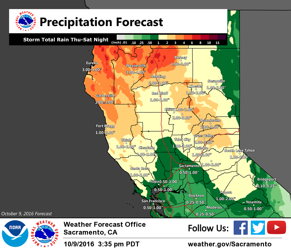
Moist Pacific frontal system pushes into Interior NorCal Friday producing widespread precipitation. Precip turns showery Friday night into Saturday behind fropa. Secondary frontal system follows Saturday night into Sunday. Moist Pacific plume continues precip into Monday. Models differences increase early next week but main theme is decreasing precip threat late Monday into Tuesday.
High temperatures through the extended expected to be 10 to 20 degrees below normal. Periods of breezy to windy conditions Friday into Monday as systems move through. Snow levels will be generally above 8000 feet through the weekend, lowering Monday as precip is decreasing.