February 6, 2017 – Series of Pacific storms will bring periods of moderate to heavy rain and mountain snow with strong wind to Interior Northern California this week.
Flood Watch from this evening through Wednesday afternoon, Winter Storm Warning until 4 PM PST Tuesday for the higher elevations and a Wind Advisory until noon for the Central Valley, Foothills and Sierra Nevada.
Discussion
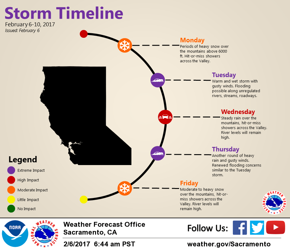
Storm #1 is beginning to decrease early this morning as precipitation has turned showery across the lower elevations with rain and high-elevation snow continuing across the northern Sierra. Caltrans traffic cameras continue to show heavy snow along I-80 over Donner Pass. Winds have been trending lower the past several hours as pressure gradients relax a bit, and this morning’s wind advisory has been dropped for areas south of Yuba City.
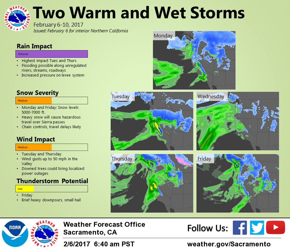
Storm #2 moves in later today and this evening with increasingly strong lift and deeper moisture generating moderate to heavy precipitation. Precip forecast to become more focused along and south the I-80 corridor by Tuesday morning. QPF amounts of 1.5-2.5 inches will be possible in the Central Valley while amounts of 4-8 inches will be possible in the foothills and west slopes of the northern Sierra by Tuesday evening. Flood watch has been issued to address potential for flooding of rivers and streams draining the west slopes, and for flood prone areas of the valley.
Heavy snow and strong winds will continue in the northern Sierra, but snow levels will steadily rise on Tuesday and are forecast to be above the pass levels by Tuesday afternoon.
In addition to the heavy precipitation, winds will increase again later this evening as continue into midday Tuesday. Surface pressure gradient forecast to reach 17 mbs from Fresno to Redding early Tuesday and gusts of around 50 mph will be possible in the valley and foothills.
Warm-advection likely to continue lighter precip across the region Wednesday, then storm #3 is forecast to bring an increase in rain again on Thursday.
Extended discussion (Friday through Monday)
The second storm this week is expected to arrive on Thursday. This system will bring another round of high precipitation rates, particularly over the mountains. With snow levels initially forecast to be over 8000 feet, a high amount of runoff will also be expected with this storm. One saving grace is that this system is currently forecast to move through the region a bit quicker than the Tuesday storm. That being said, flooding concerns will continue through this storm as water levels will already be running high.
Snow levels will be dropping on Friday as the cold front passes through. Expect snow levels to drop down to 5000 ft or possibly lower, with heavy snow expected above those levels.
Drier weather will begin on Saturday and continue through the weekend as high pressure builds across the region.