Excessive Heat Warning continues for portions of the Valley and foothills today. Slight cooling trend then expected through mid-week with a slight chance for thunderstorms in the far northern mountains/coastal range Tuesday and Wednesday. Elsewhere, dry weather expected with above normal temperatures returning Friday into next weekend.

Discussion
Noticeable cooling is seen near areas around the Delta (including locations near Sacramento and Stockton) early this morning compared to yesterday. The Excessive Heat Warning was dropped last night for these areas as a low pressure system off the coast of California continues to bring onshore flow and cooler temperatures to these locations.

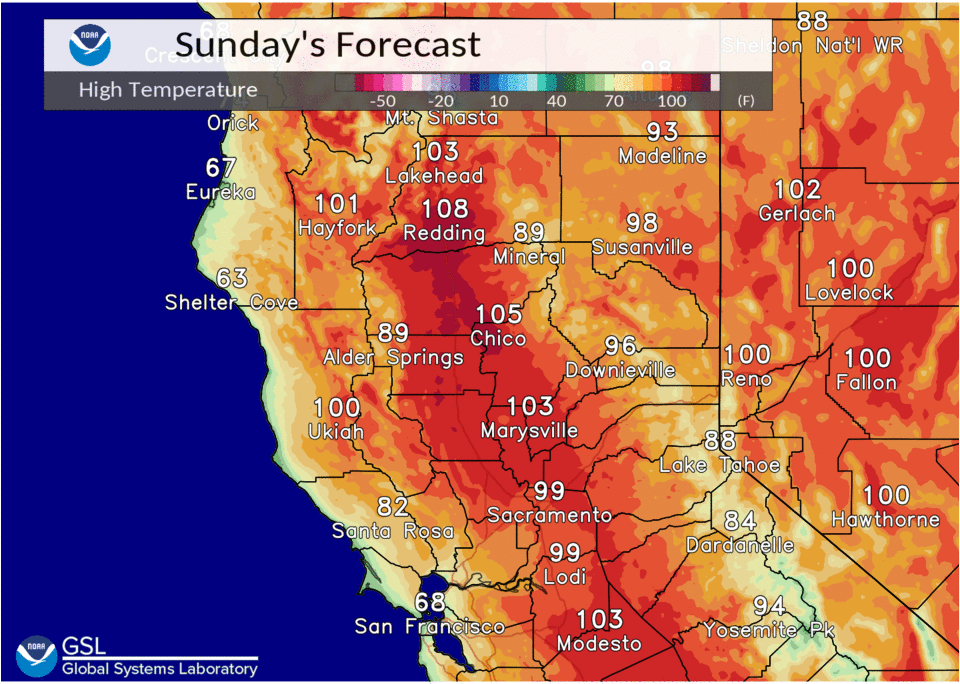
Elsewhere, another hot day is expected with temperatures in some Valley and foothill locations back up into the 105-110 range. Along with these hot temperatures, extremely dry conditions continue with some slightly breezy onshore winds expected this afternoon and evening, most notably in the northern Sacramento Valley, bringing continued elevated fire weather concerns.

The Excessive Heat Warning for much of interior NorCal continues through 8pm tonight.
A slight cooling trend and continued onshore flow is seen Monday into mid-week as the upper level low remains off the coast.

By Wednesday, expect average to slightly below average temperatures. There could be some isolated storms along the coastal range or northern mountains Tuesday and Wednesday evening, but the better chances look to be west and north of our CWA.
Extended discussion (Thursday through Sunday)
Ensembles and clusters continue to show a weak closed low off the coast later this week. Weather impacts expected to remain further to the west vicinity the low.
Temperatures will be climbing to well above average again by next weekend with highs potentially topping out in the 105-110 degree range across the northern half of the Sacramento Valley. Heat impacts will be possible.