October 16, 2017 – Dry weather with less breezy conditions thru mid-week. Rain returns late in the week with possible high mountain snow.
Discussion
Clear skies across the region under high pressure. Current temperatures are pretty similar to 24 hours ago as surface pressure gradients continue to gradually relax. Humidities are a little higher as dew points recover slightly.
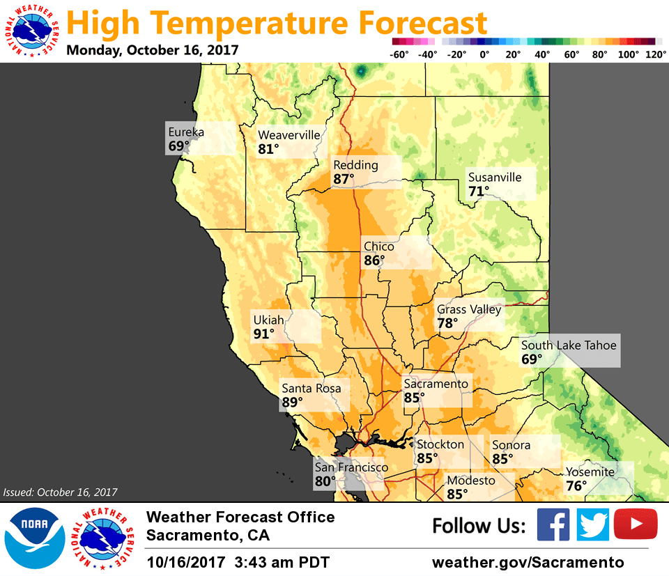
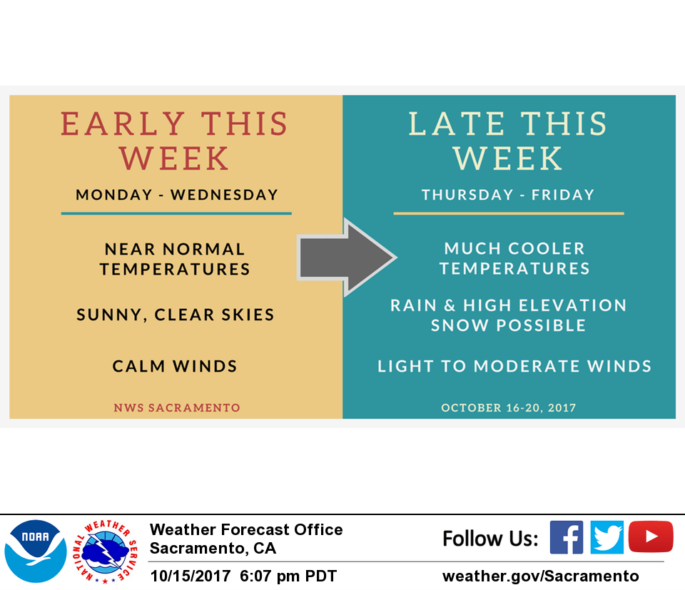
Dry weather with mild days and cool nights will continue through mid-week under high pressure. Valley high temperatures will be in the lower to mid 80s.
Latest model trends for the late-week system are to slow it down, and QPF is considerably lighter and focused mainly to the north of I-80 as deeper subtropical moisture is now not forecast to phase with the northern stream trough. Wetter mountain areas may see as much as an inch of rain while the valley will generally see less than a quarter inch.
Extended discussion (Friday through Monday)
Much needed rain and some light amounts of high elevation snow will continue on Friday for interior NorCal.
Trough pushes east and weakens Friday night into Saturday morning making way for drier and warmer weather over the weekend. Daytime highs in the valley will go from the 60s on Friday into the upper 70s and low 80s by Sunday.
For foothills and mountains, Friday highs will range 40s to low 60s becoming 60s to mid 70s on Sunday.