August 8, 2017 – Showers and thunderstorms are possible over the next several days mainly over the mountain. Temperatures remain close to average.
Discussion
Clear skies across the region early this morning as clouds associated with yesterday’s shower and thunderstorm activity has dissipated. The marine layer is between 1500-2000 feet and a healthy Delta Breeze continues. Current temperatures are within a few degrees compared to 24 hours ago.
Little change thru mid-week as upper level low lingers near the NorCal coast. Moisture wrapping around the low will continue the daily chances for afternoon and evening showers and thunderstorms, mainly across the mountains.
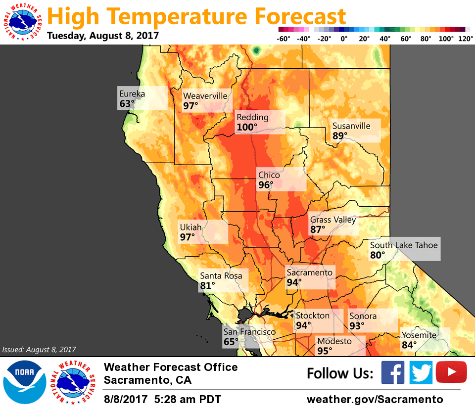
Temperatures will warm slightly the next couple of days remaining close to average. Overnight lows should remain rather nice for this time of year as steady flow remains through the Delta.
Low starts to move back inland on Thursday which may shift chances for convection to the north of the area. Still could see a bit of activity near Mt Lassen and portions of the Coast Range.
Extended discussion (Saturday through Tuesday)
Models continue to show an upper low moving into the west coast in the extended forecast. The trough extending from this upper low will impact NorCal into early next week. Moisture is expected to stay north of our CWA so have kept the forecast dry. Daytime highs will remain close to seasonal. High temperatures will range from 90 to 101 in the valley with 70s to 80s over higher terrain. Coolest temperatures and cloudier skies expected Monday as a cold front moves inland.