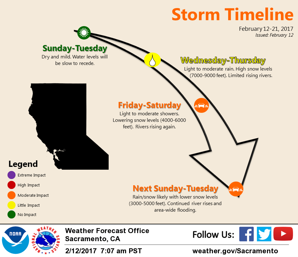
February 12, 2017 – Drier weather continues through Tuesday. Yet another round of wet weather arrives Wednesday with several rounds continuing through next weekend.
Discussion (Today through Wednesday Night)
A much needed break from the rain will continue through Tuesday. High pressure over the region will allow Valley temperatures to warm into the 60s each day through Tuesday and into the 40s and 50s across the mountains.
Nevertheless, high water issues will remain a problem for some areas, so the flood warning continues into Monday. Hillsides remain water logged and will take several days to dry out and become more stable, just in time for more rain.
High clouds will spread over the region in varying amounts the next few days. Some patches of fog may develop the next couple of mornings in the Southern Sacramento and Northern San Joaquin Valleys and maybe locally dense near water ways.
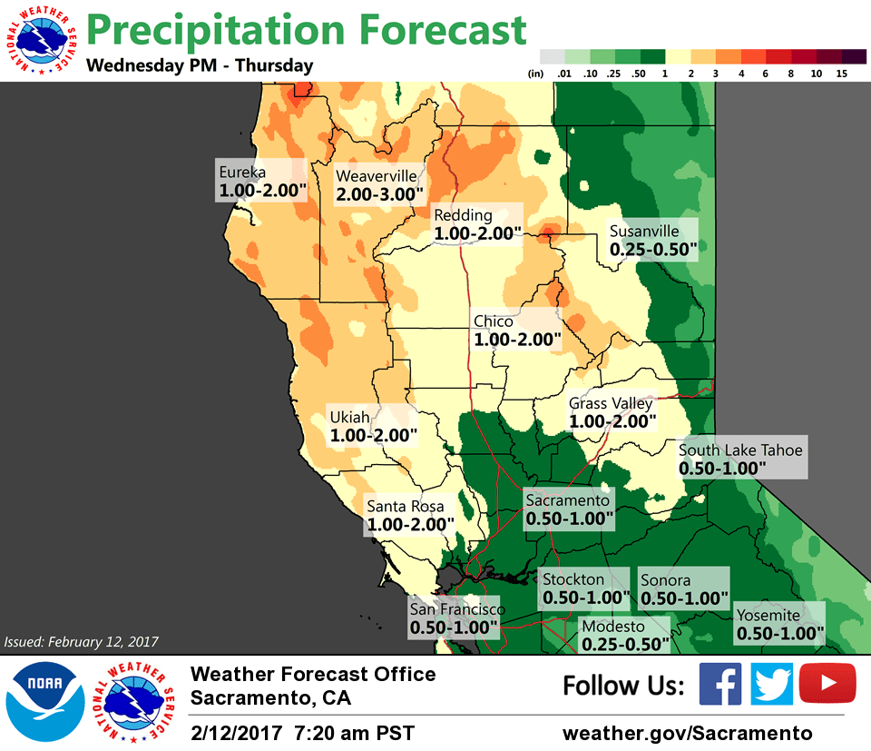
A warm frontal moves into parts of Northern California late Tuesday night and Wednesday. Precipitation amounts with the warm front will be light and snow levels will start out high between 8000 and 9000 ft. The cold frontal part of the system may begin to spread inland late Wednesday night.
Extended discussion (Thursday through Sunday)
Models remain consistent advertising a return to wet weather for NorCal later this week. Initial frontal system expected to spread precipitation across the area Thursday with snow levels 7-8K ft. Showers will be possible Friday into Saturday with lower snow levels (4-6K ft) as the brunt of the following system is forecast to move into SoCal.
Potential for stronger systems next Sunday- Monday with favorable pattern (WSW flow) for heavy orographic precip and deeper moisture entrainment. Details of timing and QPF will be adjusted as the event approaches.