October 19, 2017 – Increasing clouds and cooler temperatures today. Rain chances along with high mountain snow and gusty winds this evening and Friday. This will be followed by a warming trend early next week with above normal temperatures through the week. Winter Weather Advisory from 11 PM this evening to 11 AM Friday for West Slope Northern Sierra Nevada.
Discussion
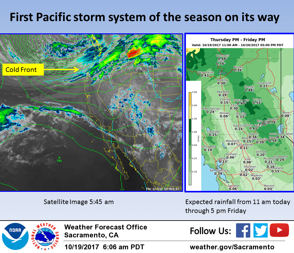
Pacific frontal system now moving into the Pacific Northwest will be moving into northwest California this afternoon. Increasing cloud cover and increased onshore flow along with airmass cooling will bring 10 degrees or more of cooling today. By this afternoon the coastal range will see a chance of light rain. Southwest flow aloft and orographics will bring a slight threat of showers over the northern Sierra and southern Cascades. Main frontal band moves through during the nighttime hours tonight will bring a good chance of rain to most of the cwa with snow at the higher elevations. Expected rainfall amounts in the valley range fairly light at about 1/10th to 3/10ths of an inch. Orographics over the Sierra could squeeze out over an inch of precipitation.
Tightest surface pressure gradient will be this evening. Could see winds at wind advisory criteria especially over the Sierra Cascade range but the stronger winds will likely be relatively short lived. Front shifts east of the CWA by Friday morning with shower threat ending most locations. Upper troughing will continue to feed cool air into the region so highs on Friday will range from 10 to 15 degrees below normal.
Upper ridging begins to build over the eastern Pacific Friday afternoon with continued ridging on Saturday. Disturbances slipping over this ridge will bring a threat of showers to the northern zones through Saturday.
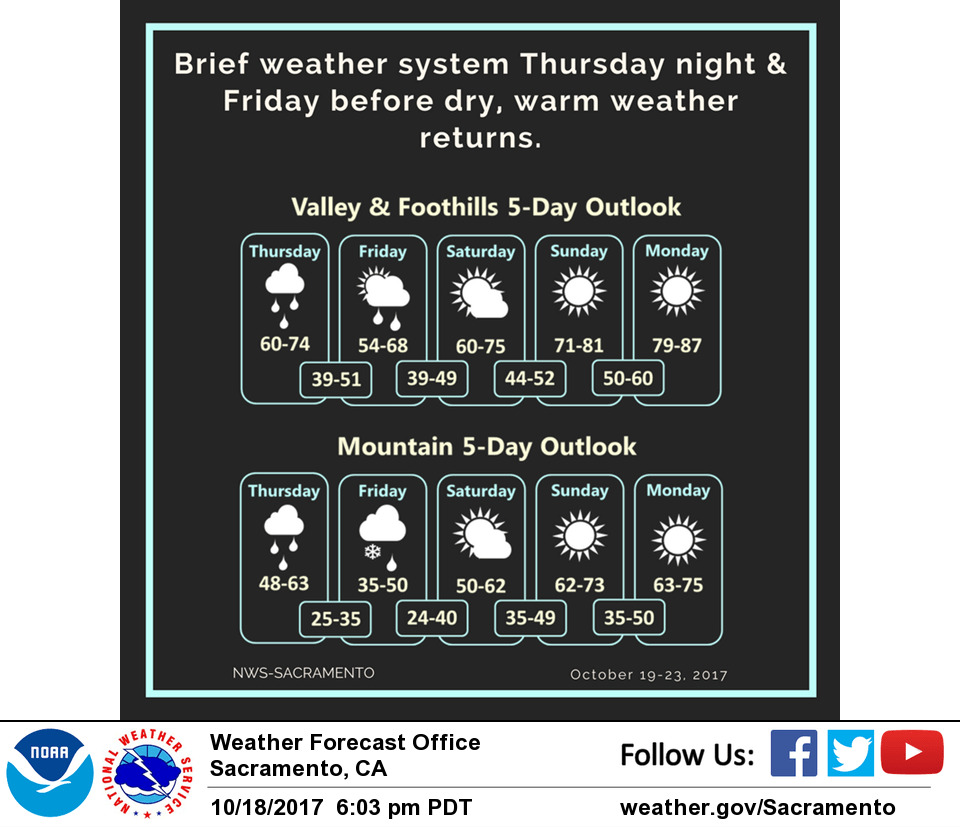
Clearer skies and warming airmass will bring daytime highs up to close to normal for this time of year by Sunday afternoon. This warming trend will continue going in to next week.
Extended discussion (Monday through Thursday)
Upper level ridge persists next week maintaining a dry and warm pattern for our CWA. Daytime highs will range 6-14 degrees above normal during the extended forecast period. Valley highs will stay in the low to mid 80s while mountain highs range 60s and 70s.