May 18, 2017 – Dry with a warming trend forecast for the next several days. NorCal’s first triple digit heat possible early next week. A chance of Sierra showers next week.
Discussion
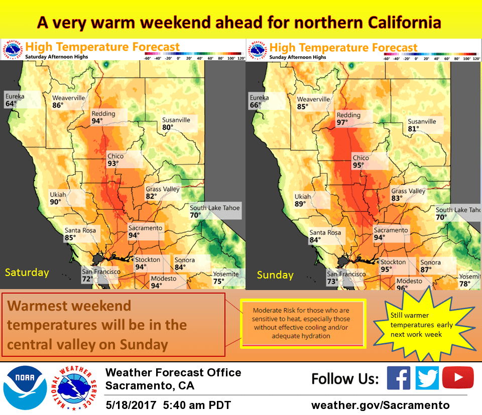
High pressure building over the west coast will be the predominant weather feature over the next several days. Most of northern California will see fair skies although some high clouds will spill over the ridge as it builds today. Daytime highs will see a significant climb today moving to above normal by several degrees. Upper ridge axis centers over the coast on Friday for still more warming bringing highs up to about 10 degrees above normal.
A shortwave through riding through the Pacific Northwest and into the Great Basin will level off high temperatures a bit Saturday although highs may still creep up just a bit. GFS digs this shortwave westward into a weak low over NorCal Sunday afternoon and evening. The resulting instability could bring isolated thunderstorms over the Sierra Cascade crest during the afternoon and evening hours. ECMWF and GEM do agree with this solution however keeping a strong ridge of high pressure over the west coast.
For now, will keep slight chances of isolated thunderstorms in forecast for portions of the crest but confidence is not high due to model inconsistencies. Either way, airmass warming will bring a bit more warming for the second half of the weekend.
Extended discussion (Monday through Thursday)
High pressure will continue to bring mainly hot and dry weather across the region early next week. Triple-digit heat is projected across the northern portions of the Sacramento Valley Monday and Tuesday. An upper low spinning well off the California coast should bring a bit of onshore flow and cooling to Delta Breeze- influenced locations. The ridge should weaken slightly toward the middle of next week.
There may be enough instability and moisture in the high Sierra for a chance of a few afternoon/evening showers and thunderstorms near and south of Lake Tahoe through the extended period.